12 m away
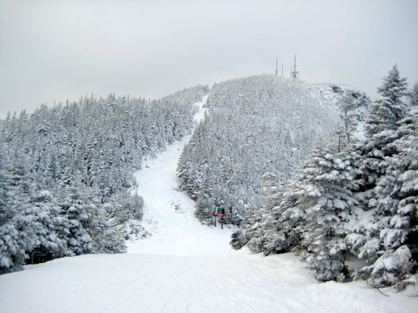
Old Nosedive

The remnants of a classic New England ski trail.
Moderate Freeride Skiing
- Distance
- 436 m
- Ascent
- 0 m
- Descent
- 115 m
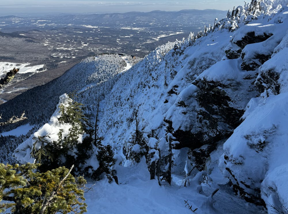
A an exposed, hanging chute that is quite technical.
Freeride Skiing Severe

The Booger gets its name due to the fact that it descends from The Nose, a false summit of Mansfield. The best way to approach is by hiking up Old Nosedive, where the ski trail ends there is a narrow path that continues to the top. Finding the entrance isn’t easy but it can be easily scoped from the top of the Four Runner Quad. The Booger begins with a tight drop through a constriction. Ski the upper pannel, and mind your sluff, as this section hangs above a large cliff. Continue to work your way right, following a very sliver of snow through the trees to a narrow chute. This can be negotiated with a straightline or a few hop turns. The chute ends on the Auto Road, you can take this back to Nosedive or ski some steep woods on the Kitchen Wall.
Severe
Steep skiing at 38-45 degrees. This requires very good technique and the risk of falling has serious consequences.

In case of a fall, death is highly likely.

Away from help but easily accessed.
12 m away
The remnants of a classic New England ski trail.
Moderate Freeride Skiing
110 m away

A fun little freeride zone in the shadow of The Nose.
Difficult Freeride Skiing
315 m away

Steep chutes with trees and cliffs, accessed by a sidestepping traverse.
Difficult Freeride Skiing
449 m away

One of the oldest ski trails in the USA and a great run for advanced skiers.
Moderate Freeride Skiing
564 m away

The most relentless inbounds line at Stowe
Severe Freeride Skiing
577 m away

A Stowe Classic, Goat Glades is the popular glade to skiers left of Goat.
Moderate Freeride Skiing
647 m away
Very similar to Pipeline, with a different access point. Perfect for skiers looking for something tight and steep.
Difficult Freeride Skiing
937 m away

An expert glade with an interesting history.
Moderate Freeride Skiing
951 m away

Popular woods between Upper National/Liftline and Starr
Difficult Freeride Skiing
1 km away

A long traverse, under a massive icefall leads to some fun low angle glades
Moderate Freeride Skiing
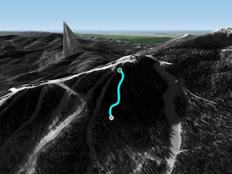
12 routes · Freeride Skiing