12 m away
The Booger
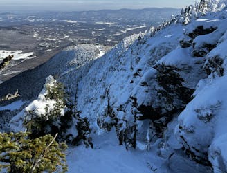
A an exposed, hanging chute that is quite technical.
Severe Freeride Skiing
- Distance
- 226 m
- Ascent
- 7 m
- Descent
- 99 m
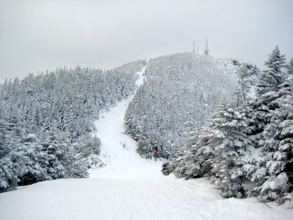
The remnants of a classic New England ski trail.
Freeride Skiing Moderate

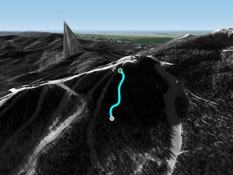
The town of Stowe Vermont is very rich with ski history. Some of the first ski trails in the USA were cut on the wooded slopes of Mount Mansfield. Among those is The Nosedive. Unlike The Bruce, which was lost to the area boundary, The Nosedive is still enjoyed by many skiers each year. But the final portion of this historic trail lies just out of reach of the Four Runner Quad, on the summit of The Nose. Old Nosedive has become a bit overgrown with little spruces here and there. In the early season, these are real obstacles, but by mid February most of them are buried. The best way to access it is to hike up from the bottom. The hike usually only takes 10 minutes. Eventually the ski trail ends and narrows to the width of a hiking trail. Those approaching The Nose should continue up this trail. For those looking to ski Old Nosedive, this is where you put your skis on. The trail is tight and fast with no sign of letting up until you pop out on Nosedive. This is characteristic of old New England trails, those who have skied The Bruce know this. The top section has several convex rolls before reaching a consistent pitch. The trail hooks a slight left before popping out on Nosedive. Old Nosedive is a great way to experience a piece of ski history without traveling too far out of bounds.
Moderate
Slopes become slightly steeper at around 25-30 degrees.

As well as the slope itself, there are some obstacles (such as rock outcrops) which could aggravate injury.

Close to help in case of emergency.
12 m away
A an exposed, hanging chute that is quite technical.
Severe Freeride Skiing
122 m away

A fun little freeride zone in the shadow of The Nose.
Difficult Freeride Skiing
320 m away

Steep chutes with trees and cliffs, accessed by a sidestepping traverse.
Difficult Freeride Skiing
448 m away

One of the oldest ski trails in the USA and a great run for advanced skiers.
Moderate Freeride Skiing
565 m away

The most relentless inbounds line at Stowe
Severe Freeride Skiing
583 m away

A Stowe Classic, Goat Glades is the popular glade to skiers left of Goat.
Moderate Freeride Skiing
649 m away
Very similar to Pipeline, with a different access point. Perfect for skiers looking for something tight and steep.
Difficult Freeride Skiing
941 m away

An expert glade with an interesting history.
Moderate Freeride Skiing
952 m away

Popular woods between Upper National/Liftline and Starr
Difficult Freeride Skiing
1 km away

A long traverse, under a massive icefall leads to some fun low angle glades
Moderate Freeride Skiing
12 routes · Freeride Skiing