3 m away
Three Ridges Wilderness Loop
A gut-wrenching—yet rewarding—loop through the Three Ridges Wilderness.
Severe Hiking
- Distance
- 22 km
- Ascent
- 1.3 km
- Descent
- 1.3 km
A shorter segment lined with excellent day hiking and overnight opportunities.
Hiking Difficult

The southern terminus for this segment is VA-56, often referred to as Crabtree Falls Highway. Due to its location less than an hour from Charlottesville, plus its proximity to other major highways and the Blue Ridge Parkway, the latter half of this segment is extremely popular for day hiking.
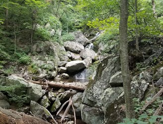
To begin this segment, cross the bridge over Tye River and begin the climb with a series of switchbacks. Once you reach the intersection with the Mau-Har Trail, keep right on the Appalachian Trail. After a short descent, you'll continue climbing to Chimney Rock and the summit of Three Ridges.
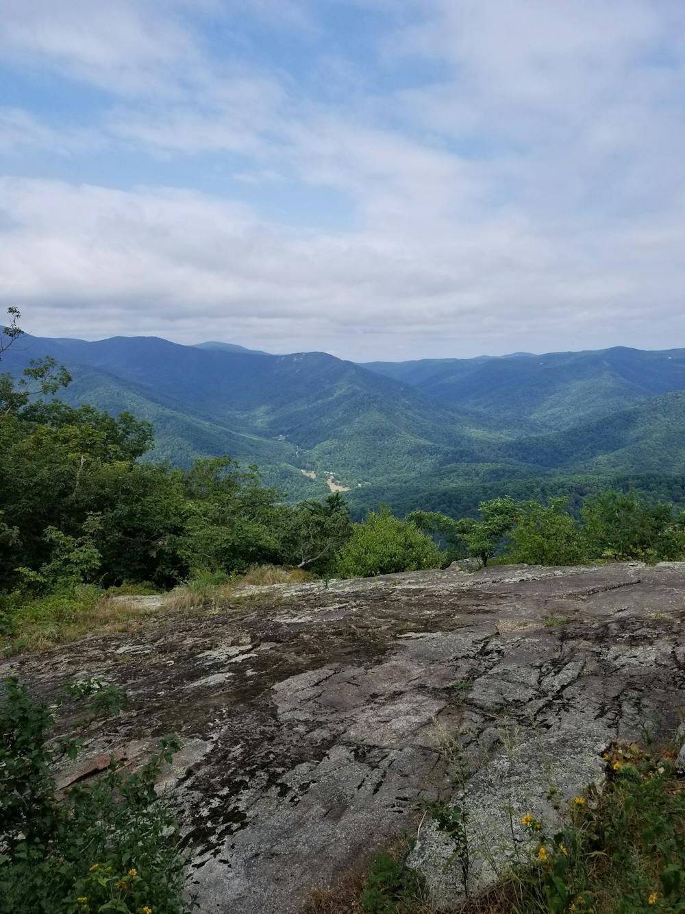
A few quiet and solemn overlooks line the way as you finish out the 3,000-foot climb between Tye River and the summit of Three Ridges. After descending from the summit, you'll reach the Maupin Field Shelter at the northern junction of the Mau-Har Trail—a route often used to create a loop. In addition to the shelter, the surrounding wilderness area provides plenty of overnight camping opportunities.
Crossing the small parking area along Beech Grove Road, the trail follows the Blue Ridge Parkway Corridor until the Wintergreen Resort. In this area, you'll cross over the unique and picturesque rock formations of Cedar Cliffs and Dripping Rock, both easily accessible from the road. Know that camping in this area is limited in order to prevent erosion or other damage.
Soon to follow, a spur trail leads towards the Humpback Rocks Picnic Area. If day hiking, this area serves as an excellent staging area or place to have lunch afterward.
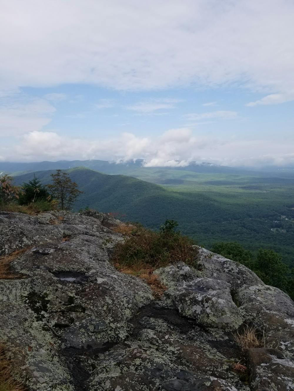
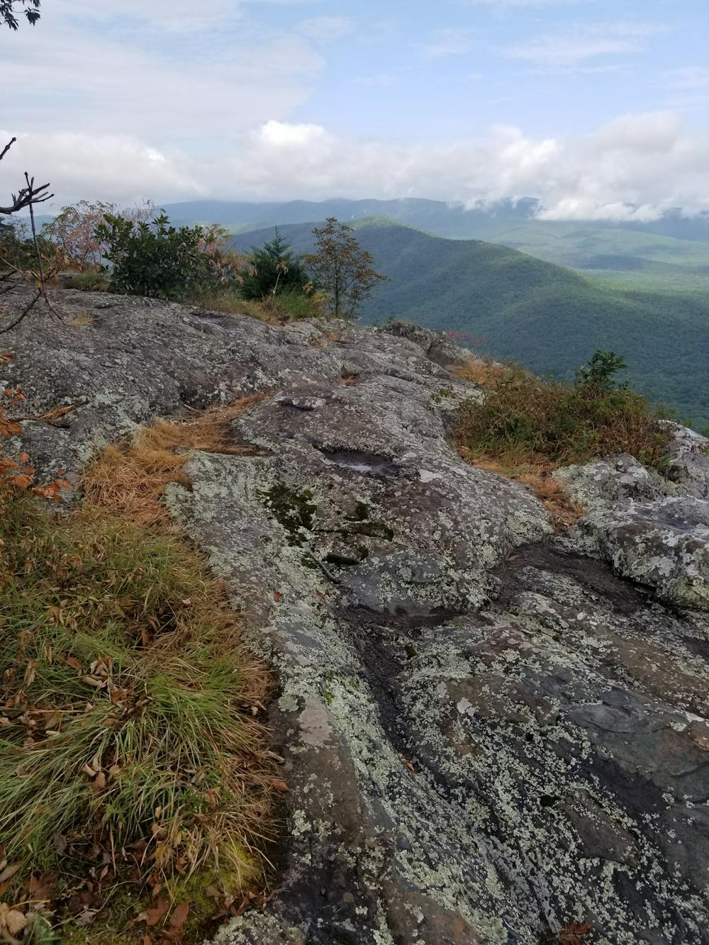
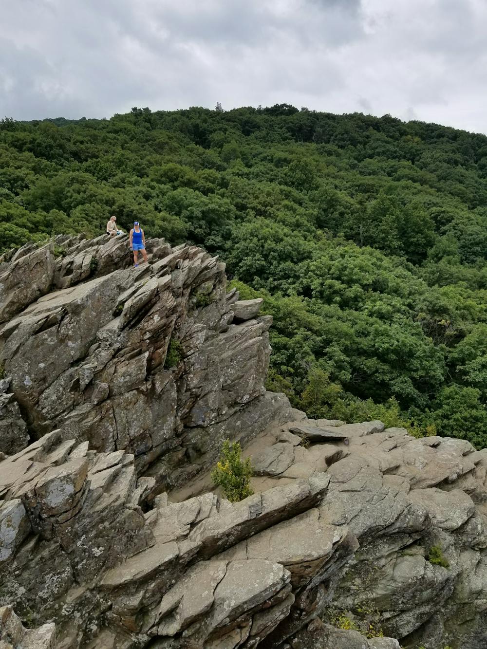
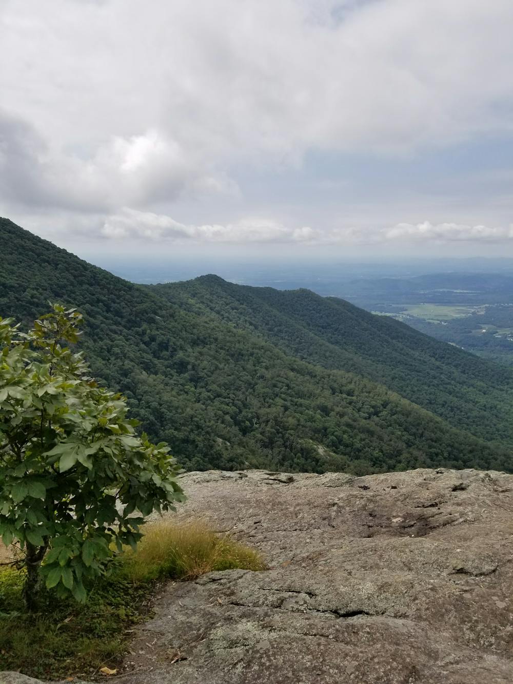
Ahead on the trail, you'll cross over Humpback Mountain and the iconic Humpback Rock, a pinnacle emerging from an enormous granite formation below. A quick spur trail leads to the overlook, and can become quite popular in the spring and fall. Atop, you'll be welcomed with epic views to the west.
Finishing the segment, continue north through countless switchbacks as the trail makes its way to Rockfish Gap at Interstate 64.
Difficult
Hiking trails where obstacles such as rocks or roots are prevalent. Some obstacles can require care to step over or around. At times, the trail can be worn and eroded. The grade of the trail is generally quite steep, and can often lead to strenuous hiking.

The trail contains some obstacles such as outcroppings and rock which could cause injury.
Away from help but easily accessed.
3 m away
A gut-wrenching—yet rewarding—loop through the Three Ridges Wilderness.
Severe Hiking

58 routes · Hiking