3 m away
Appalachian Trail: VA-56 to Rockfish Gap
A shorter segment lined with excellent day hiking and overnight opportunities.
Difficult Hiking
- Distance
- 45 km
- Ascent
- 2.2 km
- Descent
- 1.9 km
A gut-wrenching—yet rewarding—loop through the Three Ridges Wilderness.
Hiking Severe
Just shy of 13 miles, this loop is perfect as both a day hike or an overnight trip. For an experienced trail runner, this would also be an epic route—though the pitch of the trail makes it a hike in many places.

Located less than an hour from Charlottesville, this loop quickly sends you up into remote backcountry that is only visited by experienced hikers looking for a challenge. During the spring months, expect to see a handful of thru-hikers along the Appalachian Trail portion of this segment.
A small parking area lies along VA-56, sometimes referred to as Crabtree Falls Highway. A small footbridge crosses Tye River and also serves as a great place to cool down on a hot summer day.
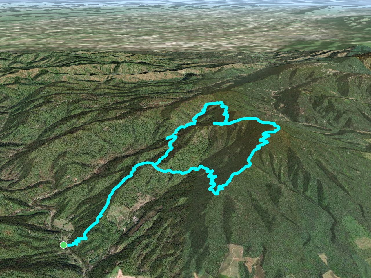
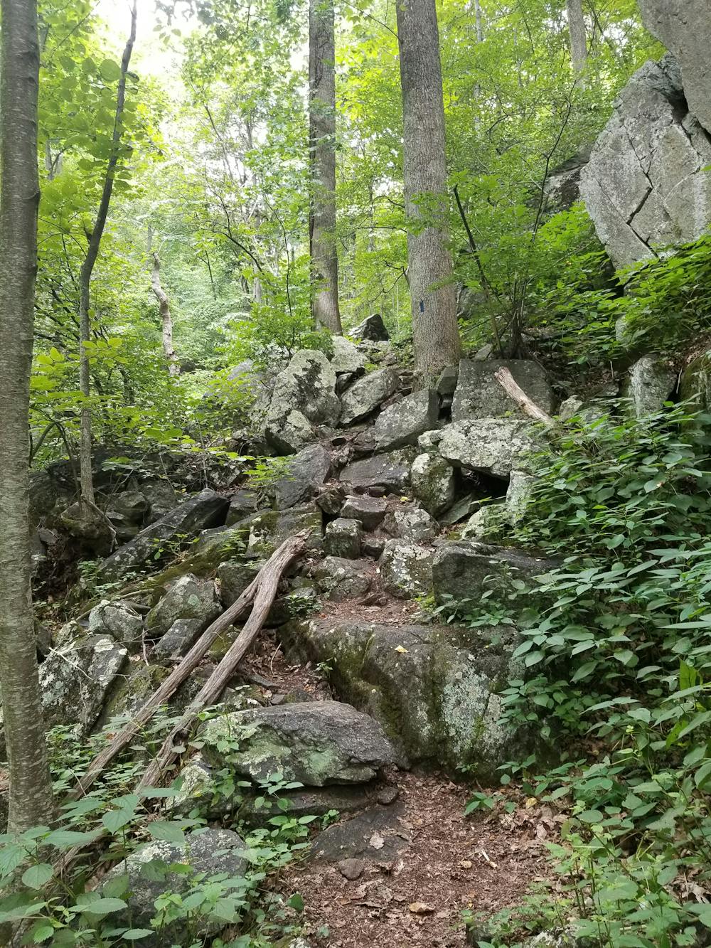
A series of steep switchbacks forms the path to the intersection with Mau-Har Trail. From here, you could complete the loop in either direction, though counter-clockwise is chosen by most.
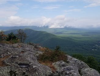
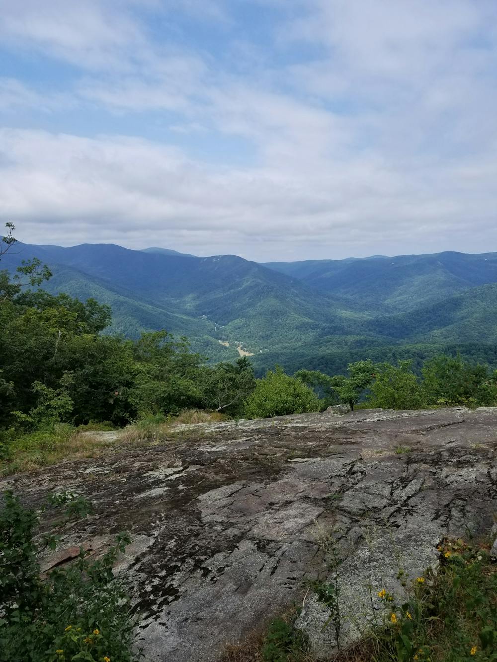
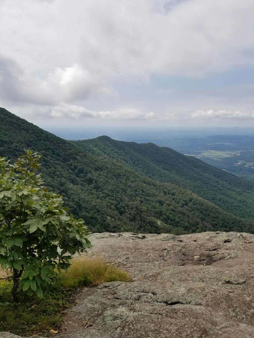
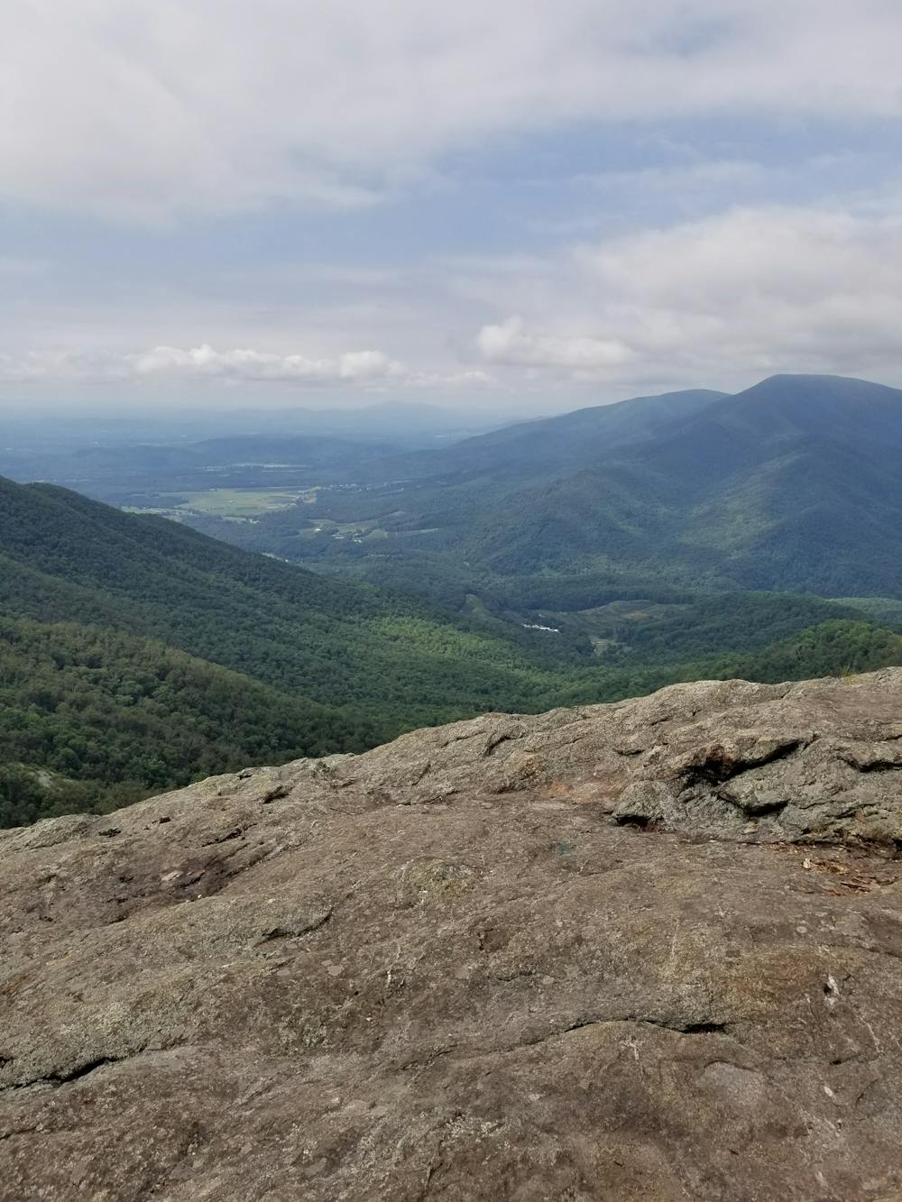
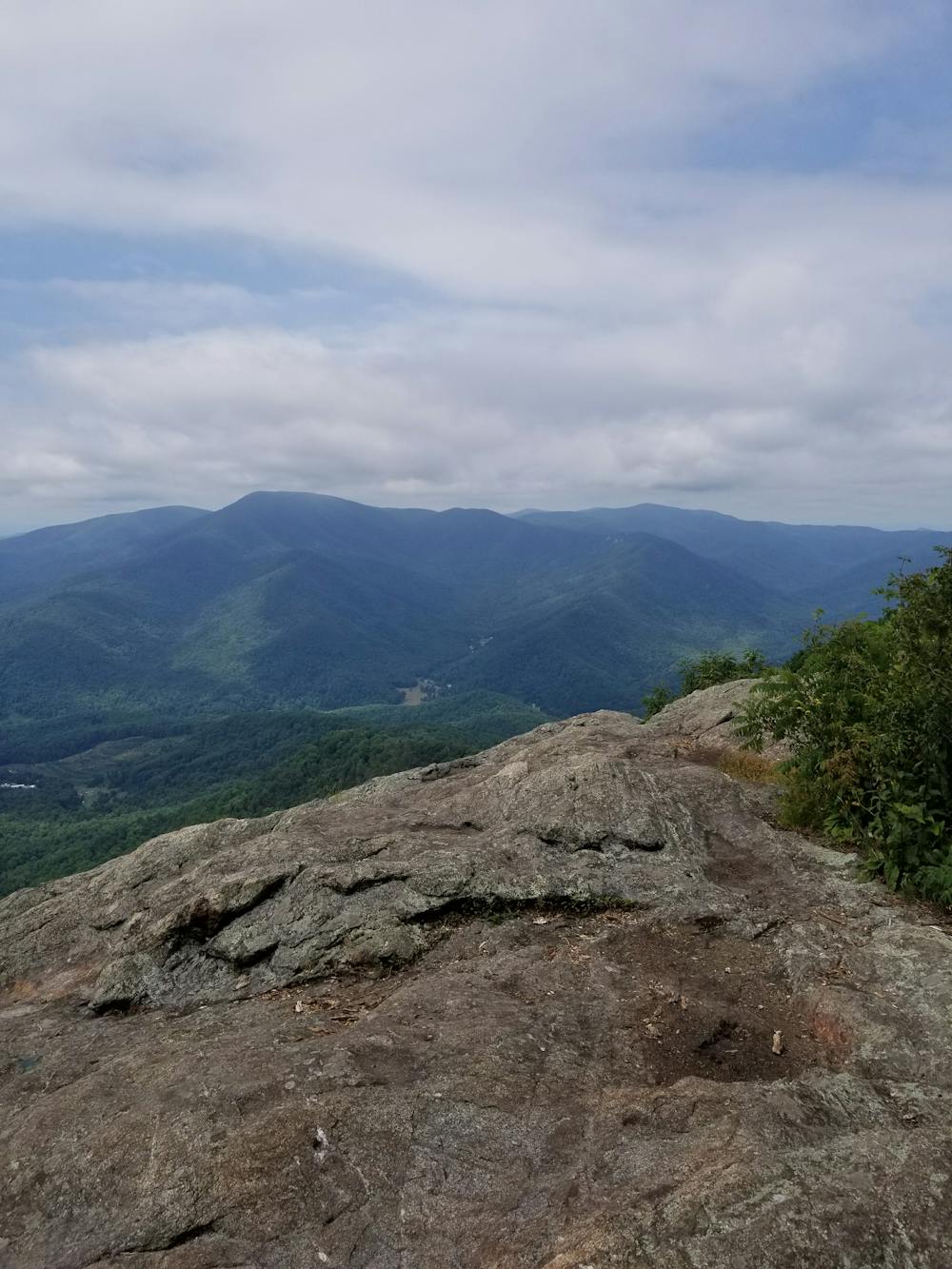
Keeping right, the trail crosses a drainage as it continues climbing. After reaching a ridge, the trail roughly follows its spine as it climbs over Chimney Rock and onto Three Ridges. This segment of the trail is incredibly steep and will have your legs begging for a break as you finish the almost 3,000-foot climb at the summit of Three Ridges. All along this stretch, you'll be rewarded with countless vistas that will take your breath away—should you have any to spare. After a long and steady descent to Maupin Field Shelter, you'll reach the intersection with the Mau-Har Trail. The shelter and surrounding camping opportunities serve as an excellent spot to spend the night.
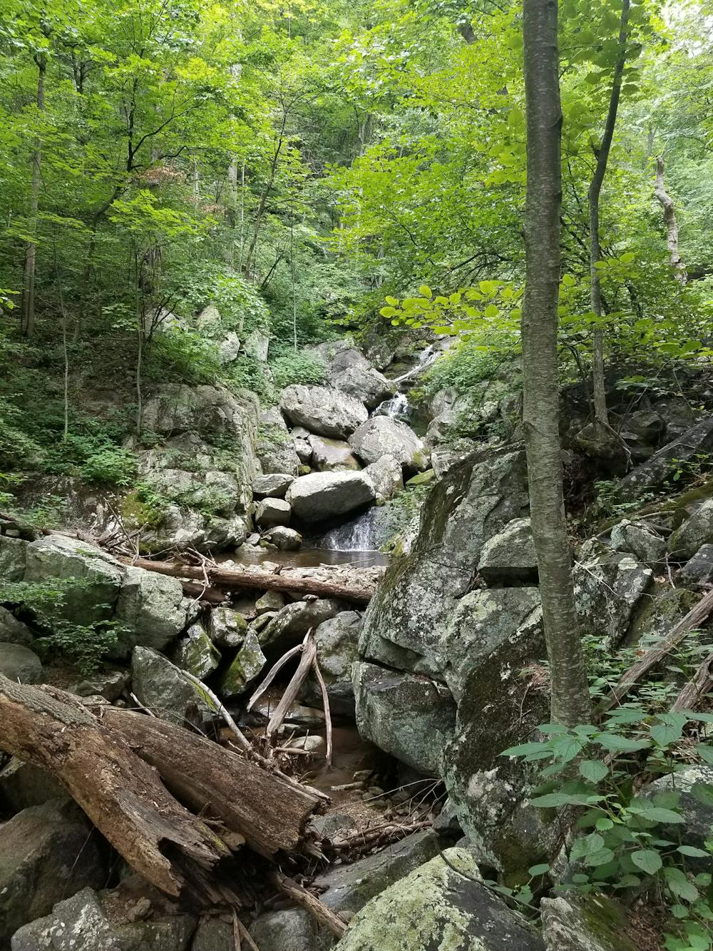
Behind the camping area, follow the Mau-Har Trail as it follows a series of springs that ultimately form Campbell Creek. Steepening in spots, the trail parallels the drainage as it begins to form picturesque waterfalls and cascades that ultimately drain into the Tye River.
Though mostly downhill, a few steep and punchy climbs lie ahead, as the Mau-Har Trail merges back with the Appalachian Trail and descends back to the road.
Severe
Hiking challenging trails where simple scrambling, with the occasional use of the hands, is a distinct possibility. The trails are often filled with all manner of obstacles both small and large, and the hills are very steep. Obstacles and challenges are often unexpected and can be unpredictable.

The trail contains some obstacles such as outcroppings and rock which could cause injury.
Away from help but easily accessed.
3 m away
A shorter segment lined with excellent day hiking and overnight opportunities.
Difficult Hiking

58 routes · Hiking