2.8 km away
Appalachian Trail: Thorton Gap to Tucker Lane
This section of the Appalachian Trail crosses over Hogback Mountain, the Marshalls, and then heads through Trumbo Hollow.
Difficult Hiking
- Distance
- 56 km
- Ascent
- 2.1 km
- Descent
- 2.5 km
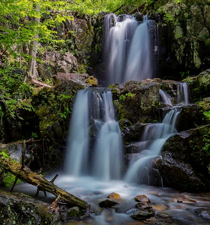
A beginner-friendly overnight loop with a beautiful waterfall and small cave.
Hiking Moderate

This is an excellent one-night circuit with a small cave and waterfall. It could also be hiked in a single day, with the waterfall as the perfect lunch destination. Several rock surfaces overlook the waterfall below, allowing you to relax with a view.
Whether you're camping overnight or day hiking, this loop is never too challenging and perfect for those new to backpacking. Many consider it kid-friendly, and dogs are also allowed.
As an overnight trip, look for a campsite along White Rocks Trail near the spur trail to Hazel Falls/Cave. You may be able to find a site somewhere along Hazel Mountain or Hazel River Trails, but the NPS makes no note any specific areas.
The trailhead is the Meadow Spring Area, milepost 34 on Skyline Drive. It's just a few minutes south from Thornton Gap and on the other side of Mary's Rock Tunnel, the only tunnel on the scenic 105-mile roadway.
During the spring or after heavy rain, consider an out-and-back to the waterfall and cave, rather than returning via Hazel River Trail. When the water is high, crossing the river can be dangerous. If you get there and decide to turn around, you'll face an even longer climb back out.
Sources: https://www.nps.gov/shen/planyourvisit/upload/SHENBCTrip-WhiteRocksB125-508.pdf https://virginiatrailguide.com/2013/05/01/hazel-falls/
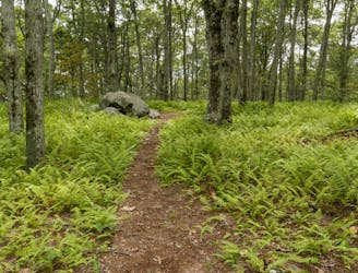
Moderate
Hiking along trails with some uneven terrain and small hills. Small rocks and roots may be present.

The trail contains some obstacles such as outcroppings and rock which could cause injury.
Away from help but easily accessed.
2.8 km away
This section of the Appalachian Trail crosses over Hogback Mountain, the Marshalls, and then heads through Trumbo Hollow.
Difficult Hiking
5.8 km away
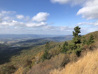
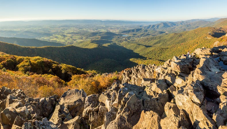
A short hike with epic views atop the northernmost 4,000' peak in the Blue Ridge Mountains.
Difficult Hiking
7.8 km away
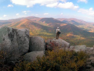
A epic and mesmerizing hike — "One of Shenandoah's premier experiences."
Difficult Hiking

58 routes · Hiking
6 routes · Hiking
10 routes · Hiking

10 routes · Hiking

63 routes · Alpine Climbing · Hiking