9 km away
Carvin's Cove Lower Trails
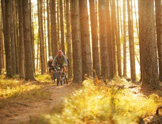
A superb selection of Carvin Cove's flowiest trails.
Moderate Mountain Biking
- Distance
- 23 km
- Ascent
- 405 m
- Descent
- 404 m
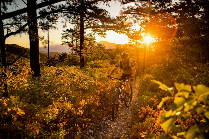
A true black diamond backcountry challenge awaits on the exposed bedrock spine of North Mountain.
Mountain Biking Severe

"The rocky ridgeline of North Mountain has earned the distinction of being labeled 'Dragon's Back' and the trails on North Mountain are outstanding for mountain biking," writes VisitRoanokeVA.com. The name "Dragon's Back" arises from the spine of rock that follows the ridge top, and which the trail traverses. Exposed bedrock, rock gardens, and rolling baby head rocks make the North Mountain Trail a true backcountry black diamond challenge.
While there are several ways to access the ridge top, the best is to form a loop with two of the trails running up and down the mountainside. Those trails in and of themselves form fantastic old school singletrack descents... but whichever trail you choose to climb will pose a steep challenge, with some likely hike-a-bike sections.
While this trail isn't located that far from the town of Roanoke, when you begin pedaling out into the far reaches of George Washington and Jefferson National Forests, you'll quickly be plunged into the wilds of the Blue Ridge Mountains. Even driving to the trailhead that this ride is mapped from will require fording rocky mountain streams in your vehicle—meaning you may choose to access this route from a more convenient location if you're driving a low clearance vehicle.
The moral of the story: like with most mountain bike rides, be prepared for anything. But even more so when riding the Dragon's Back. Be prepared for chunky gnar, bike mechanical issues, and possibly being stranded in the middle of absolutely nowhere if something goes wrong.
Severe
Widely variable, narrow trail tread with steeper grades and unavoidable obstacles of 15in/38cm tall or less. Obstacles may include unavoidable bridges 24in/61cm wide or less, large rocks, gravel, difficult root sections, and more. Ideal for advanced-level riders.

The trail contains some obstacles such as outcroppings and rock which could cause injury.

In the high mountains or remote conditions, all individuals must be completely autonomous in every situation.
9 km away
A superb selection of Carvin Cove's flowiest trails.
Moderate Mountain Biking
9 km away

A popular loop that accesses the upper mountain at Carvin's Cove.
Severe Mountain Biking
5 routes · Mountain Biking