2 m away
Hi-Dee-Ho Loop

A popular loop that accesses the upper mountain at Carvin's Cove.
Severe Mountain Biking
- Distance
- 12 km
- Ascent
- 413 m
- Descent
- 413 m
A superb selection of Carvin Cove's flowiest trails.
Mountain Biking Moderate

The Carvin's Cove trail system is the undisputed mountain biking hotspot in the Roanoke region. The entire trail network is situated on land owned by the city of Roanoke. At 12,000 acres in size, "it is the second largest municipal park in the United States (behind South Mountain Park in Phoenix, Arizona)," according to an article on Singletracks.com.
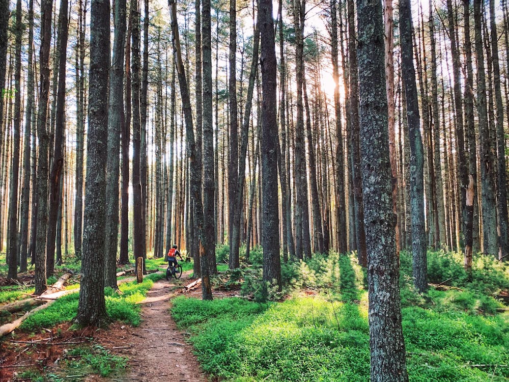
Carvin's Cove offers 40 miles of singletrack and has "another 40 in the works," according to RootsRated.com. The trails are split into roughly two halves: the high trails that run up and down the mountain, and the lower trails near the base.
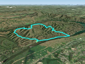
Mapped here is a big figure-8-style ride on the lower trails... but of course, even the route mapped here could be shortened.
The lower trails are much less technical than the steeper trails up high, making for a great stepping stone for beginner and early intermediate riders. Trails like Four Gorge were constructed with IMBA-approved trail building techniques, providing rolling climbs and descents, and well-benched singletrack.
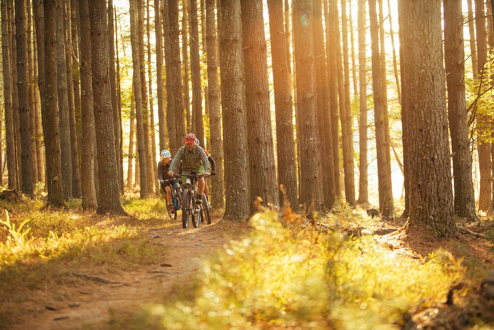
The Enchanted Forest is a rare gem of a trail. "This flat singletrack runs through a stand of old growth pine trees," according to Singletracks.com. "Evergreens aren’t very common in this region, so riding through the deep trees on the quiet of the pine straw is a rare treat for the locals."
Sources: https://www.singletracks.com/blog/mtb-trails/trail-tuesday-carvins-cove-roanoke-virginia/ https://rootsrated.com/stories/is-roanoke-the-best-up-and-coming-mtb-destination-in-the-southeast
Moderate
Mostly stable trail tread with some variability, with unavoidable obstacles 8in/20cm tall or less. Other obstacles such as rock gullies and steep sections may exist. Ideal for lower intermediate riders.

The trail contains some obstacles such as outcroppings and rock which could cause injury.
Away from help but easily accessed.
2 m away
A popular loop that accesses the upper mountain at Carvin's Cove.
Severe Mountain Biking
3.3 km away
The rowdiest, most technical descent at Carvin's Cove.
Severe Mountain Biking
9 km away

A true black diamond backcountry challenge awaits on the exposed bedrock spine of North Mountain.
Severe Mountain Biking
5 routes · Mountain Biking