2 km away
Pinnacle Peak
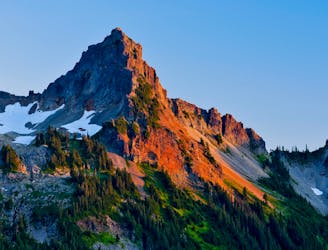
A steep hike and scramble to the summit of Pinnacle Peak.
Moderate Alpine Climbing
- Distance
- 4.6 km
- Ascent
- 500 m
- Descent
- 499 m
Classic route to Washington's highest summit
Alpine Climbing Moderate

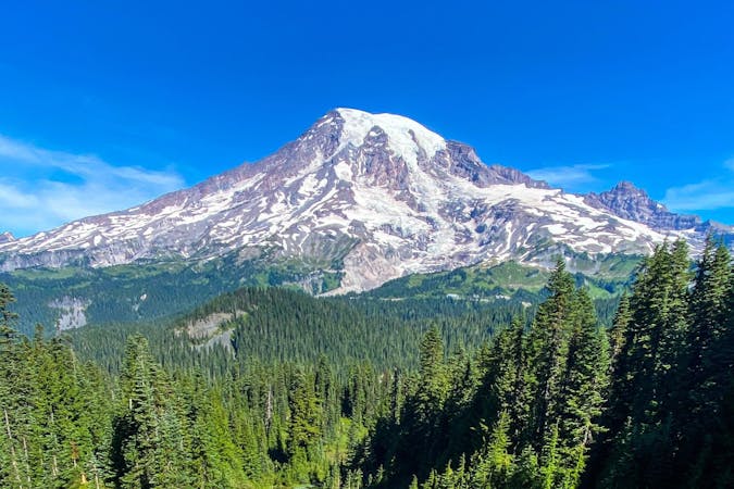
The tallest mountain in Washington state, and one of the most glaciated peaks in the Cascade range, Mount Rainier dominates the western Washington skyline, dwarfing any surrounding mountains with its splendor.

Naturally, this makes it a popular climbing destination, with thousands of climbers attempting to reach its summit. Roughly half of those attempts are successfully, with the remainder turned back by weather or fatigue.
There are many routes up Mount Rainier, but the most popular is the Disappointment Cleaver route (commonly abbreviated DC) that is set and maintained by various guide companies.
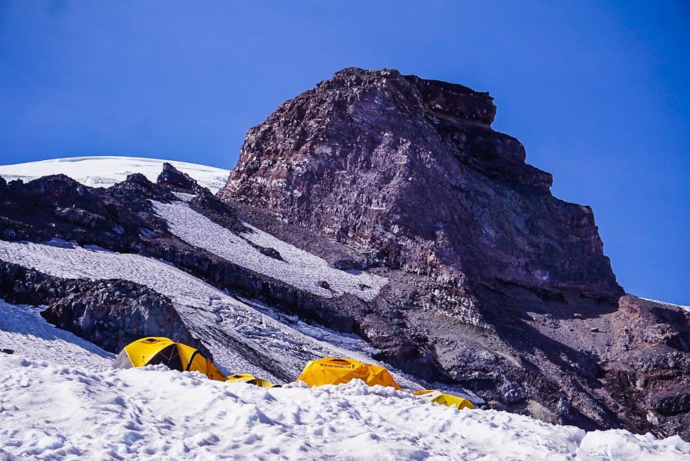
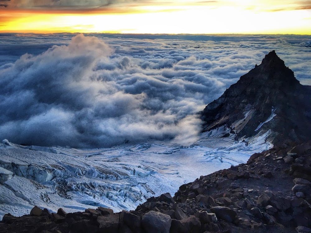
From the aptly named Paradise meadows, the route climbs onto the Muir snowfield before reaching Camp Muir at 10,100 feet. There are facilities here, and it marks the point where the route transitions from a simple snow scramble to glacier climbing. Beyond Camp Muir, a climbing permit is required year-round.
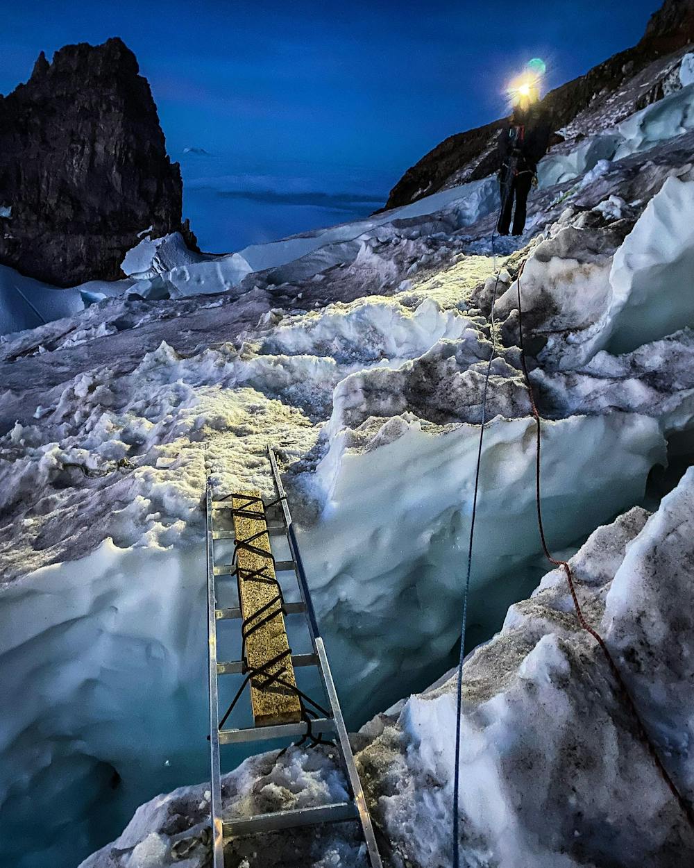
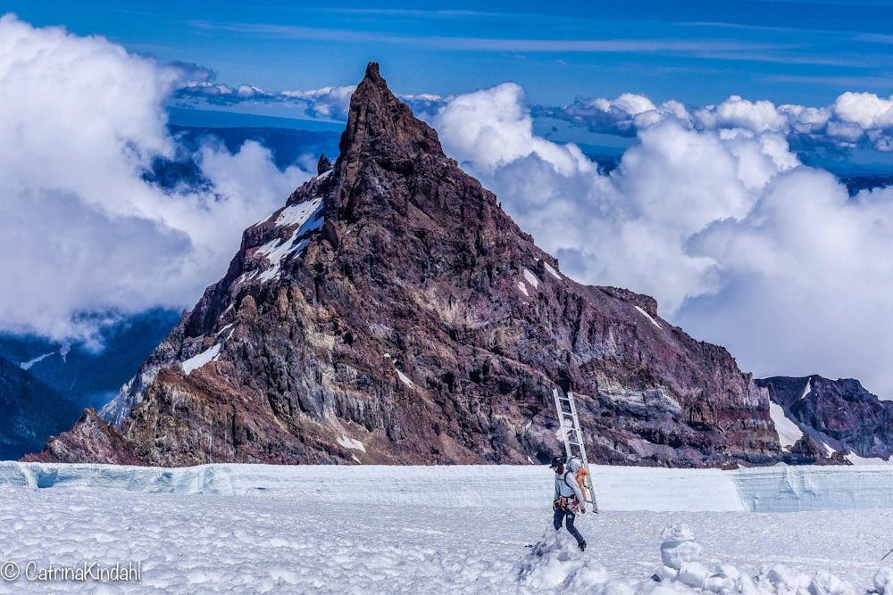
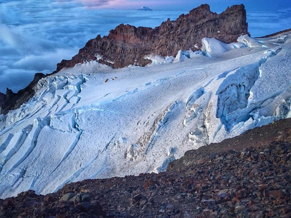
From Camp Muir, most parties start around midnight and begin the journey across the Cowlitz glacier and up the dirt and pumice of Cathedral Gap to reach the edge of the Ingraham Glacier and the Ingraham Flats camp.
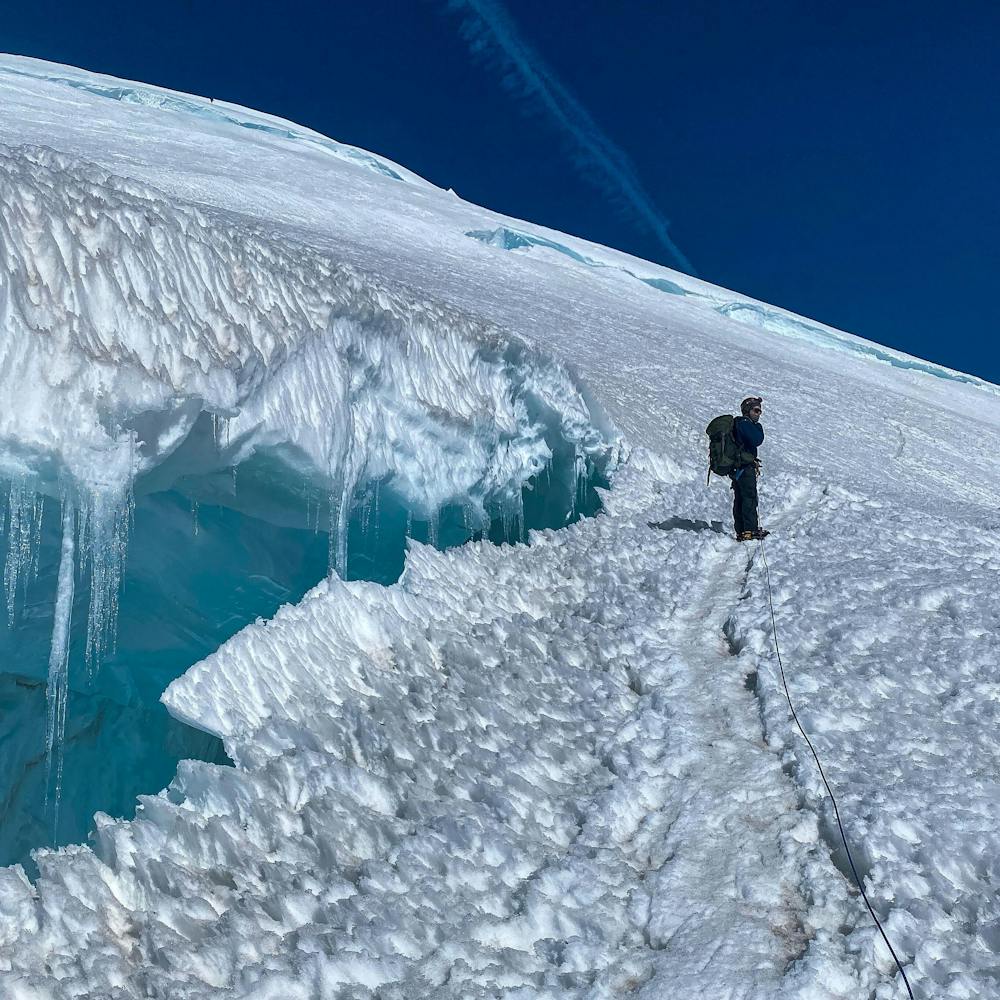
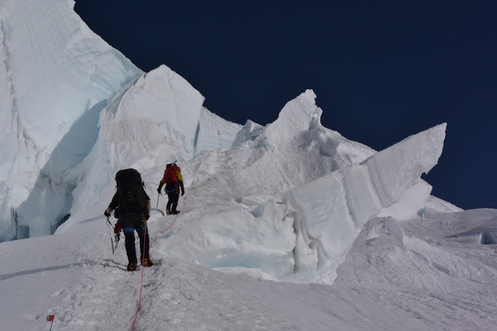
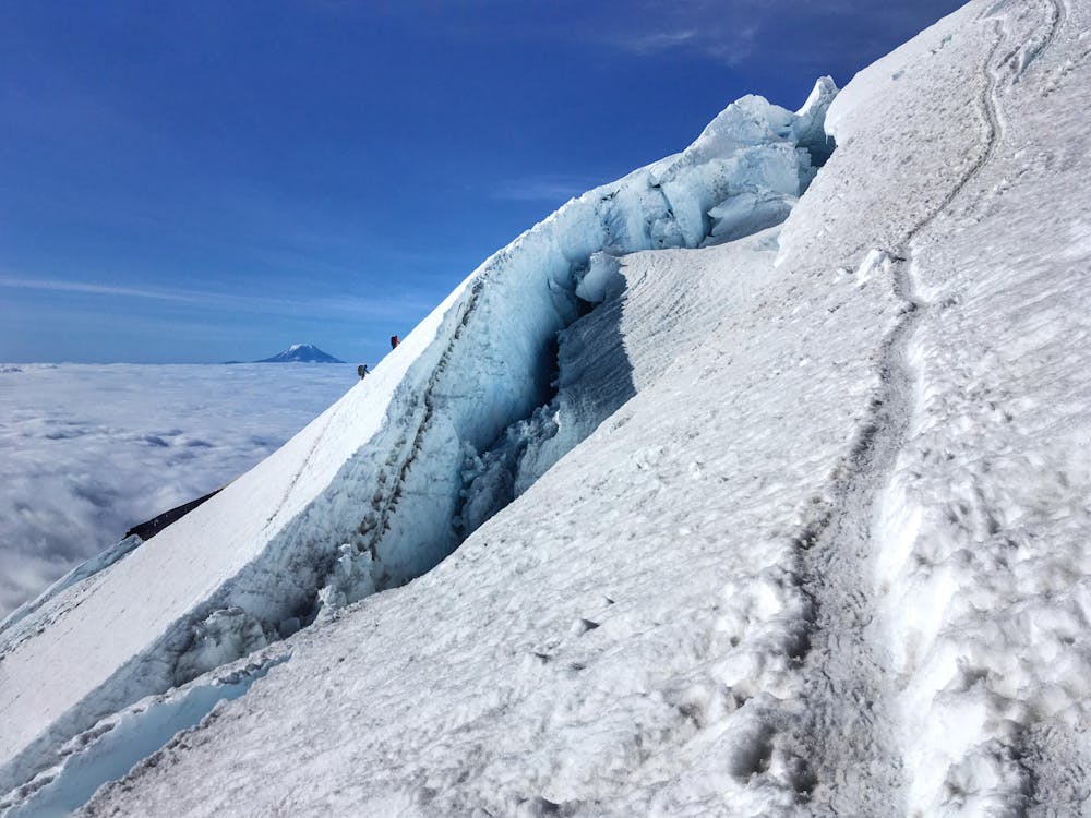
The route crosses the Ingraham Glacier and crosses an area known as the Icebox, the site of the worst mountaineering accident in North American history, before gaining the crumbly rock of the Disappointment Cleaver, the route's namesake. Rockfall is a common hazard here, and most parties navigate up by headlamp, following the reflective wands left by the guides.
From the top of the cleaver, the route continues up the Ingraham glacier, navigating over and around crevasses as needed before reaching the western summit crater. After crossing the crater, the Mazamas summit register is located at Registry Rock, and the true summit, Columbia Crest, is a short distance from there.
Moderate
May involve slightly more complex glacier hikes, easy but possibly long rock ridges and steep snow up to 45 degrees. Equivalent to PD, PD+

The route features some exposed and/or difficult to protect sections.
Away from help but easily accessed.
2 km away
A steep hike and scramble to the summit of Pinnacle Peak.
Moderate Alpine Climbing
5 routes · Alpine Climbing
10 routes · Alpine Climbing · Hiking