9.5 km away
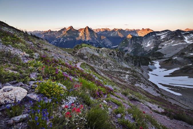
Maple Pass Loop
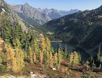
Walk a high ridgeline among wildflowers and larch trees, encircling an alpine lake with mountain views in all directions.
Difficult Hiking
- Distance
- 12 km
- Ascent
- 688 m
- Descent
- 687 m
A not-so-easy hike to Easy Pass, then an extended trek through deep wilderness of the North Cascades.
Hiking Difficult

The hike to Easy Pass packs much of the best of the North Cascades into one concise trip, but it’s not an easy one. The trail actually climbs about 3,000 feet in 3.5 miles to reach the pass, so the name is not only deceptive, it totally belies the splendor of this area. Views include jagged peaks studded with glaciers, berry-bush and wildflower meadows, and larch trees––uncommon in the United States––which turn gold in the fall. An out and back to Easy Pass makes a good half-day hike, but backpackers can go much farther. The route mapped here is a one-way hike from Easy Pass trailhead to Colonial Creek campground. This makes a good one- or two-night trip with a vehicle shuttle. Alternatively, backpackers could go out and back from Easy Pass Trailhead to Fisher Camp or Junction Camp. Note that all overnight trips require a wilderness permit from the national park.
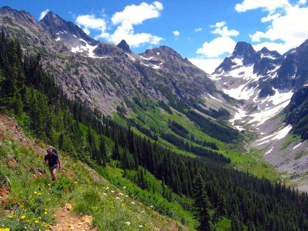
The trail to Easy Pass goes up gradually at first, among thick forest of hemlock and fir. As the trail steepens, the surroundings transition to scattered trees and a sprinkling of flowers among mountainside meadows. A small creek tumbles down from the pass, and must be crossed a few times on rocks and logs. Snow can linger through early summer, adding hazard to the slopes beneath the pass. An ice axe could be useful for safety in early season. When free of snow, the section cuts across aprons of scree, which can be loose underfoot. At the pass at last, you’ll skirt a grove of larch and reach an inspiring vista of Fisher Peak, and a glacial valley unfolding beneath it. You can find more views in all directions by exploring social trails around the pass, but take care not to trample vegetation. You’ll likely see marmots and pika, and perhaps larger residents like deer or maybe a black bear.
If you continue over Easy Pass into Fisher Basin, you’ll descend rugged trail through similar scenery as before, but now with even more impressive peaks on the horizon, and with even better chances at spotting wildlife. At the bottom of a long set of switchbacks is Fisher Camp, the first option for spending the night with a wilderness permit. From there, the trail continues a bit farther through avalanche meadows before re-entering the forest. The remaining 10 or so miles of Fisher Creek Valley are among dense foliage, with intermittent views of the peaks that surround.
Nearing Junction Camp, you’ll realize that this valley is elevated still, as gaps in the trees reveal an even deeper expanse below. That is Thunder Creek Valley, which you’ll overlook from your tent if spending the night at Junction Camp. From there, the trail begins the final 10 miles along Thunder Creek, first dropping steeply down then meandering alongside this glacial river. There are a handful of other backcountry camps besides Fisher and Junction, if you need to break up the mileage differently or can’t get a permit for one of those. The journey ends at Colonial Creek campground, which is a popular trailhead for casual hikes along Thunder Creek.
Sources: https://www.nps.gov/noca/planyourvisit/easy-pass-trail.htm https://www.wta.org/go-hiking/hikes/easy-pass https://www.wta.org/go-hiking/hikes/fisher-creek
Difficult
Hiking trails where obstacles such as rocks or roots are prevalent. Some obstacles can require care to step over or around. At times, the trail can be worn and eroded. The grade of the trail is generally quite steep, and can often lead to strenuous hiking.

The trail contains some obstacles such as outcroppings and rock which could cause injury.

Little chance of being seen or helped in case of an accident.
9.5 km away
Walk a high ridgeline among wildflowers and larch trees, encircling an alpine lake with mountain views in all directions.
Difficult Hiking
9.6 km away
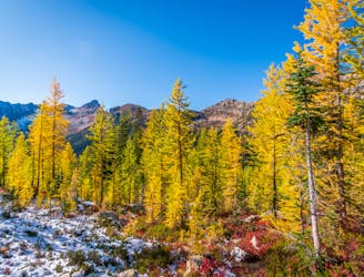
Miles 2591.1-2622 of the northbound PCT: The last of the big elevation swings in the North Cascades, featuring high ridges with larch trees and a sheltered valley with abundant creeks.
Moderate Hiking
7 routes · Hiking

72 routes · Hiking

19 routes · Hiking