1.5 km away
Grand Ridge Park
A point-to-point multi-use trail connecting Duthie Hill and West Tiger
Moderate Hiking
- Distance
- 20 km
- Ascent
- 672 m
- Descent
- 672 m
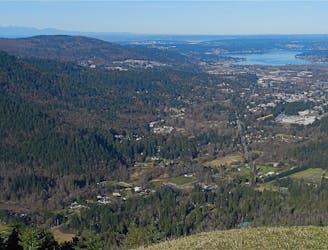
One of the most popular hikes in Seattle leads to a gorgeous view of the Cascades.
Hiking Moderate

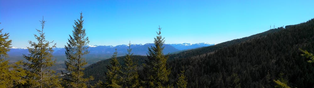
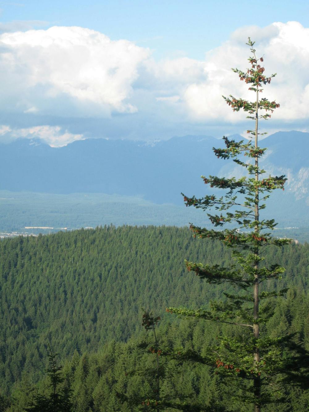
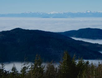
Located a mere 20 miles from downtown Seattle, the climb to the summit of West Tiger 3 attracts masses of hikers and runners. The gorgeous views of the Cascades from the summit provide a welcome reward for the effort and only help bolster West Tiger 3’s popularity. Expect to share the trail with tons of other trail users, but thankfully "the trail is wide and its travelers respectful of the woodland’s tranquility,” according to SeattleMet.com.
Most of the climb to the summit of Tiger 3 (T-3 for short) follows an old logging roadbed. Consequently, the hike climbs at a steady grade, gaining about 2,000 vertical feet over the course of three miles.
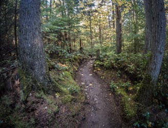
Almost the entire climb takes place under the deep forest canopy, with green ferns and dense undergrowth creating a middle-of-nowhere feel, even though you’re just minutes from the city. Once you reach the summit, the view opens up in front of you to reveal the stunning mountain peaks in the distance.
The trail to the summit is well-signed, but be aware that there are several trails beginning at this parking lot. The various trails head off in different directions—they don't all lead to the summit of T-3. However, these other trails provide options to turn T-3 into a longer hike… such as the loop mapped here. If you don't want to turn this hike into a loop, then simply return to the car on the trail you ascended.
Sources: https://www.seattlemet.com/trails/tiger-mountain-west-tiger-3 https://www.wta.org/go-hiking/hikes/west-tiger-3
Moderate
Hiking along trails with some uneven terrain and small hills. Small rocks and roots may be present.

The path is on completely flat land and potential injury is limited to falling over.
Close to help in case of emergency.
1.5 km away
A point-to-point multi-use trail connecting Duthie Hill and West Tiger
Moderate Hiking
2.2 km away
This grassy knoll on the shoulder of West Tiger Mountain provides beautiful views of Mt. Rainier and the nearby suburbs.
Moderate Hiking
6.9 km away
A remote-feeling hike just minutes from downtown Seattle.
Difficult Hiking

10 routes · Hiking

5 routes · Hiking