2.1 km away
Grand Ridge Park
A point-to-point multi-use trail connecting Duthie Hill and West Tiger
Moderate Hiking
- Distance
- 20 km
- Ascent
- 672 m
- Descent
- 672 m
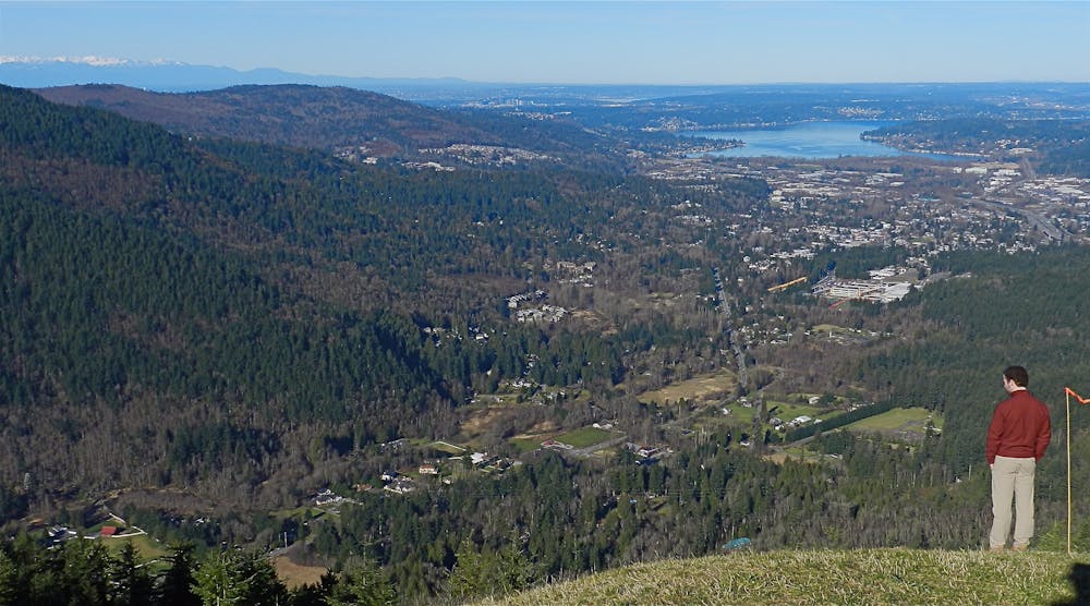
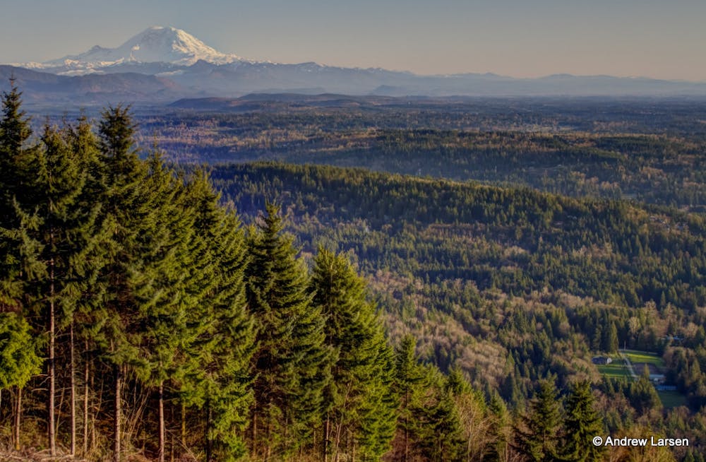
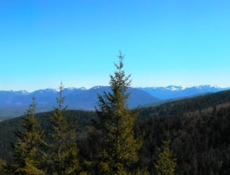
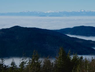
This grassy knoll on the shoulder of West Tiger Mountain provides beautiful views of Mt. Rainier and the nearby suburbs.
Hiking Moderate

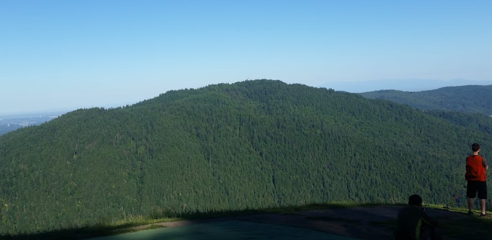
Poo Poo Point is a low shoulder of West Tiger Mountain. This exposed grassy knoll provides impressive views of Issaquah, Bellvue, and Lake Sammamish spread below you. On clear days, you might even spot Mt. Rainier.
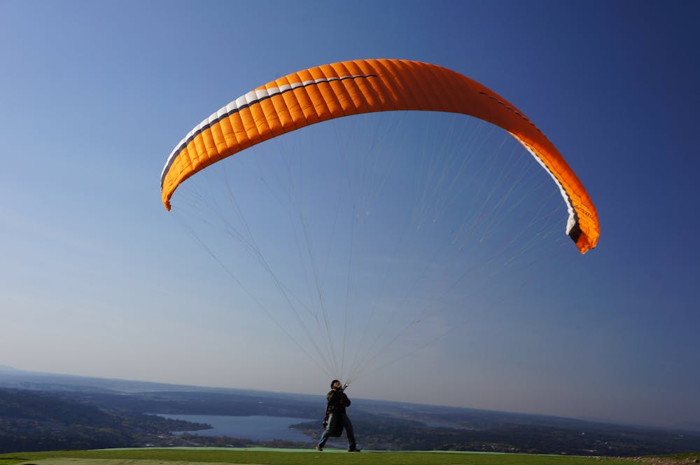
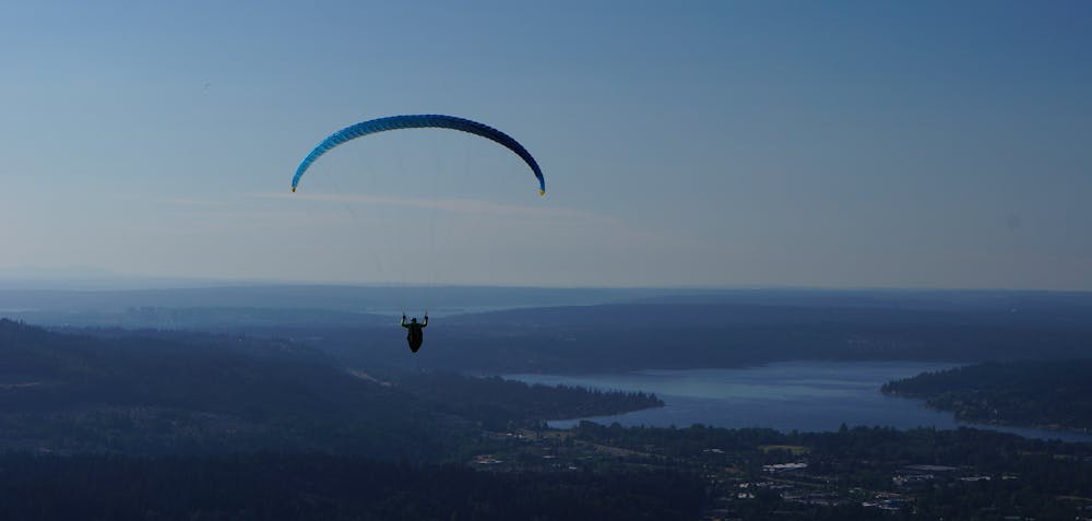
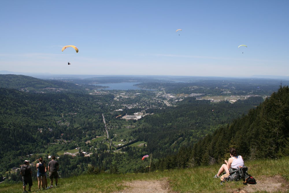
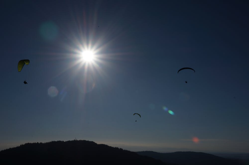
This knoll also serves as a popular takeoff site for paragliders. Look for the windsock on the point, which the pilots use to judge wind direction. If the conditions are right, you may very well get to watch paragliders take to the skies from Poo Poo Point!
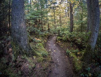
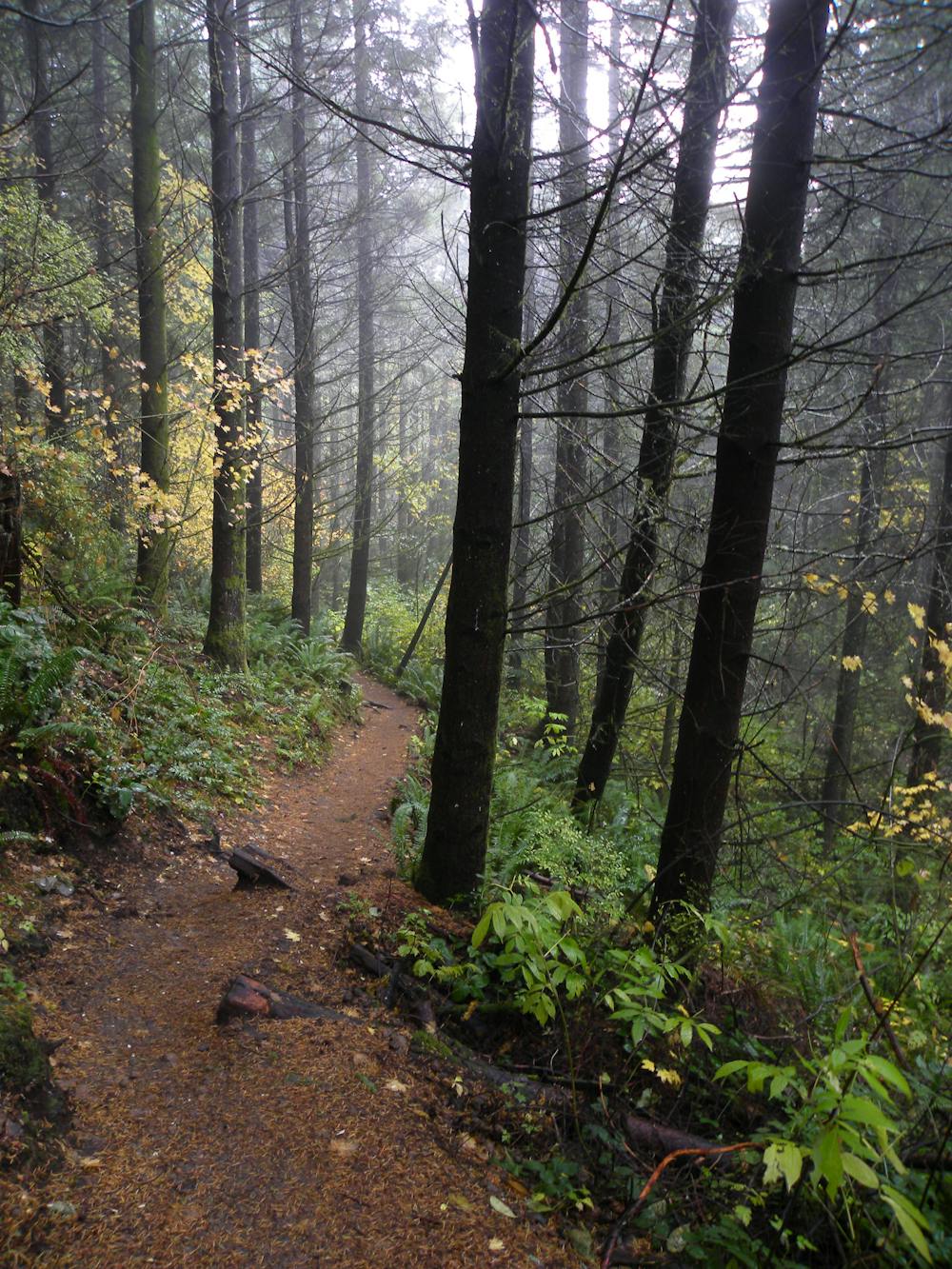
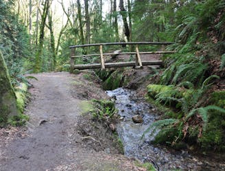
Two different trails lead to the point, and the route mapped here is the longer—but less steep—of the two options. The hike begins by slowly ascending the hillside, passing through some swampy areas before climbing into a taller, more majestic forest.
After crossing an open cut in the trees for a buried gas line, the trail “climbs steadily up an old railroad grade through mixed deciduous and coniferous forest,” according to Alan Gibbs of WTA.org. In the spring, this section of trail is home to an assortment of beautiful wildflowers! But any time of the year, you’ll enjoy the beautiful ferns, green moss, and dark mystery of the rain forest.
As you continue to climb through the rain forest, you’ll cross beautiful babbling brooks and a bridge over the more formidable Gap Creek.
Eventually, you’ll reach a three-way trail junction, which is the high point of your hike. Turn right and descend about 170 vertical feet in a half-mile to reach your destination. Enjoy your time on the point, and retrace your steps to get back to your car.
Sources: https://www.wta.org/go-hiking/hikes/poo-poo-point https://rootsrated.com/seattle-wa/hiking/poo-poo-point https://www.theoutbound.com/washington/hiking/hike-to-poo-poo-point
Moderate
Hiking along trails with some uneven terrain and small hills. Small rocks and roots may be present.

The trail contains some obstacles such as outcroppings and rock which could cause injury.

Close to help in case of emergency.
2.1 km away
A point-to-point multi-use trail connecting Duthie Hill and West Tiger
Moderate Hiking
2.2 km away
One of the most popular hikes in Seattle leads to a gorgeous view of the Cascades.
Moderate Hiking
5.8 km away
A remote-feeling hike just minutes from downtown Seattle.
Difficult Hiking
7.8 km away
One of the best trail systems near the Seattle suburbs.
Moderate Hiking

10 routes · Hiking

5 routes · Hiking