3 km away
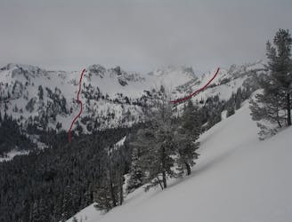
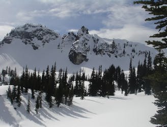
Pickhandle Peak and Crown Point
Linking together two great lines in Pickhandle Basin
Moderate Ski Touring
- Distance
- 6.4 km
- Ascent
- 908 m
- Descent
- 909 m
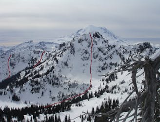
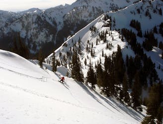
A steep, open glade for experts.
Ski Touring Severe

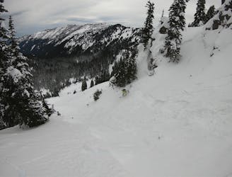
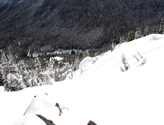
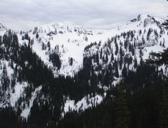
This steep, open glade gets surprisingly few tracks. This glade gets its name from a vertically aligned rocky outcropping that resembles a shark fin. The name is used by ski patrollers who use the shark fin rock as an avalanche control point. Hidden from view by trees of the same size, this demarcation often goes unnoticed. Access this glade from SE King Left. Stay right, traversing towards SE King Right Proper. About halfway down, the trees open up and a broad face opens up. Watch for rocks at the top of this broad face. This slope avalanches regularly and can sometimes be stripped bare of snow at its steepest section. Once through the rocks, the slope opens up for another several hundred feet into Silver Basin.
Severe
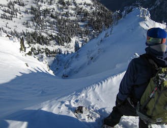
Steep skiing at 38-45 degrees. This requires very good technique and the risk of falling has serious consequences.

As well as the slope itself, there are some obstacles (such as rock outcrops) which could aggravate injury.
Away from help but easily accessed.
3 km away
Linking together two great lines in Pickhandle Basin
Moderate Ski Touring
3 km away
A Long Day route tagging 4 Separate lines South of Crystal Mountain
Difficult Ski Touring
3 km away
A steep and potential dangerous line just beyond the ski resort
Difficult Ski Touring
3 km away
Heading South of Crystal Mountain making a scenic loop
Difficult Ski Touring
3 km away
A great and scenic ski tour just South of Crystal Mountain
Moderate Ski Touring
3 km away
Heading out to Chinook Pass during the Winter
Difficult Ski Touring
3 km away
Hitting all the main peaks in the Backcountry of Crystal Mountain
Difficult Ski Touring
3 km away
Making the most out of the slopes around Dogleg Peak
Moderate Ski Touring
3.1 km away
A great ski tour based out of Bear Gap
Moderate Ski Touring
3.1 km away
Making the most of of some great North Facing Chutes
Moderate Ski Touring