17 m away
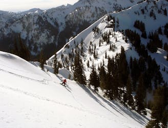
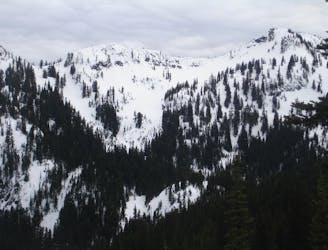
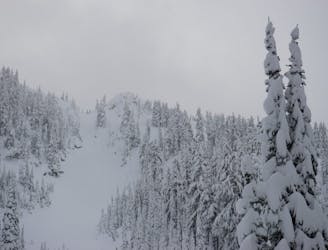
Morse Creek Chutes
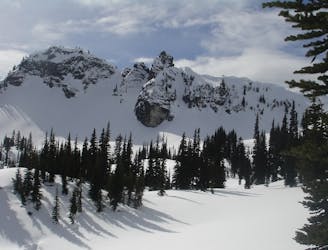
Making the most of of some great North Facing Chutes
Moderate Ski Touring
- Distance
- 12 km
- Ascent
- 1.3 km
- Descent
- 1.3 km
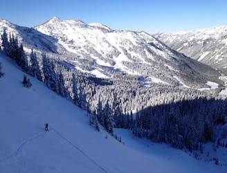
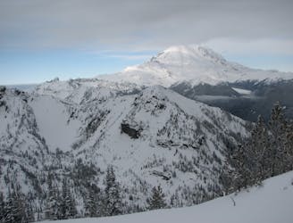
Heading out to Chinook Pass during the Winter
Ski Touring Difficult

Like many people I had always wanted to see Chinook Pass in Winter. Looking through the maps I wanted to make the most out of my time and decided the best way to do so was via an overnight trip. The plan was to ski around Sheep Lake Basin before spending the night there then the next day push over into the Pass area following the main road which is closed during the summer. This tour is incredibly remote and one of those trips you will only do once as it is quite far.
Starting off at the ski resort base make your way up the Quick Silver run before heading into Silver Basin. From here make your way over towards the Eastern Col of 3 Way Peak where you want to descend heading a bit skiers right until getting into the upper basin of Morse Creek. It is time to ascent up to Sourdough Gap which is the obvious notch to the Southwest. Standing on the gap start riding down the open southern slopes until arriving at Sheep Lake where we dropped off our overnight gear and started coming up with a plan.
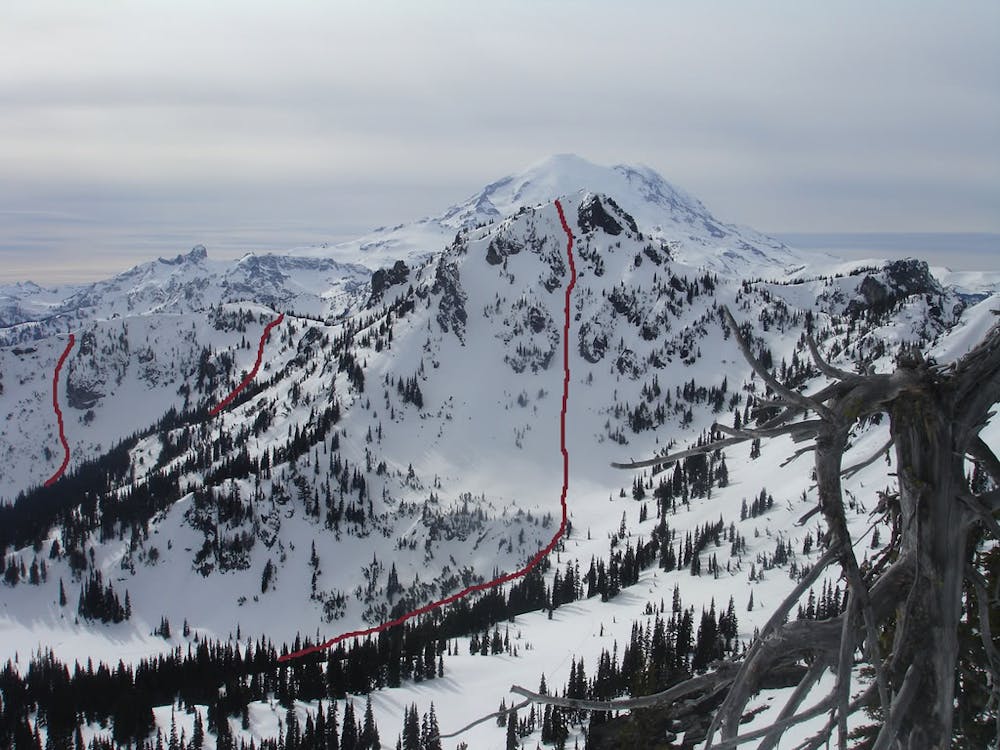
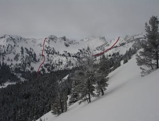
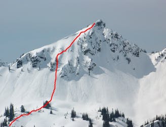
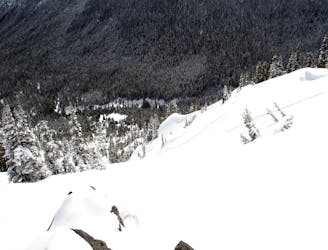
Making our way southwest we were able to loosely follow the Pacific Crest trail until arriving in a lower basin on the South side of Chinook Peak. From here we climbed north to the ridgeline and pushed all the way up to the summit. the slope to the East is the Sheep Lake Chute which is one of the most aesthetic lines in the Crystal Mountain Backcountry and a perfect descent all the way back down to Sheep Lake.
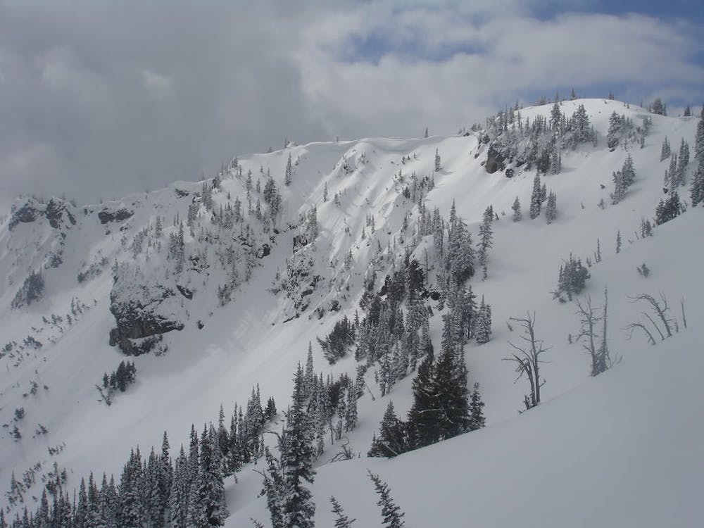
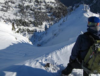
Being back at Sheep Lake and with time to spare we made our way back southwest into the basin before climb back onto the ridge. Instead of heading up Chinook Peak again we went Southwest along the ridge. I refer to this zone as 1 in 10 ridge as if you drop in blind you have a 1 in 10 chance of the line going. The best way to go about this is to take a photo from below and make sure you are in the right spot before descending. This area is short but steep and can very easily slab off so only ride it when you feel comfortable with avalanche conditions as it ends in trees. Once at the base make your way back up to Sheep Lake for the descent down to Highway 410 on the East side and where we camped for the night.
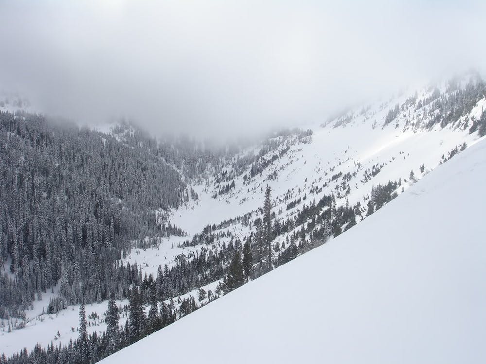
From Sheep Lake you can follow the main outsource drainage and before long you will be on the snow covered road leading West towards Chinook Pass. Follow the road up but be cautious and fast as this is just one huge slide path and far from safe so space out and go!! Our intentions were to tour around Chinook Pass but the weather was bad so decided on a quick (if that can be said) exit climbing over the low col just north of Yakima Peak and riding the West Bowl all the way down to 410 on the western side. From here we could ride to within 2 miles of Crystal Mountain Boulevard and had to walk the last bit. Fortunately we were able to hitch a ride back to the parking lot. We were both glad that we did the tour but decided that it would be better just to wait for spring to go to the Chinook Pass area again.
Click here for a trip within the area and much more photos https://www.whereiskylemiller.com/crystal-mountain/sheep-lake/
Difficult
Serious gradient of 30-38 degrees where a real risk of slipping exists.

In case of a fall, death is highly likely.
Little chance of being seen or helped in case of an accident.
17 m away
Making the most of of some great North Facing Chutes
Moderate Ski Touring
27 m away
A great ski tour based out of Bear Gap
Moderate Ski Touring
28 m away
Making the most out of the slopes around Dogleg Peak
Moderate Ski Touring
31 m away
A great and scenic ski tour just South of Crystal Mountain
Moderate Ski Touring
35 m away
Hitting all the main peaks in the Backcountry of Crystal Mountain
Difficult Ski Touring
36 m away
Heading South of Crystal Mountain making a scenic loop
Difficult Ski Touring
39 m away
A full day of ski touring around Crystal Peak with an exit down 410
Difficult Ski Touring
40 m away
A steep and potential dangerous line just beyond the ski resort
Difficult Ski Touring
41 m away
A Long Day route tagging 4 Separate lines South of Crystal Mountain
Difficult Ski Touring
46 m away
Two options for riding the Gunbarrel area
Moderate Ski Touring