32 m away
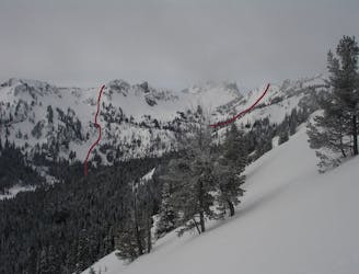
Morse Creek Chutes
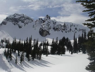
Making the most of of some great North Facing Chutes
Moderate Ski Touring
- Distance
- 12 km
- Ascent
- 1.3 km
- Descent
- 1.3 km
A full day of ski touring around Crystal Peak with an exit down 410
Ski Touring Difficult

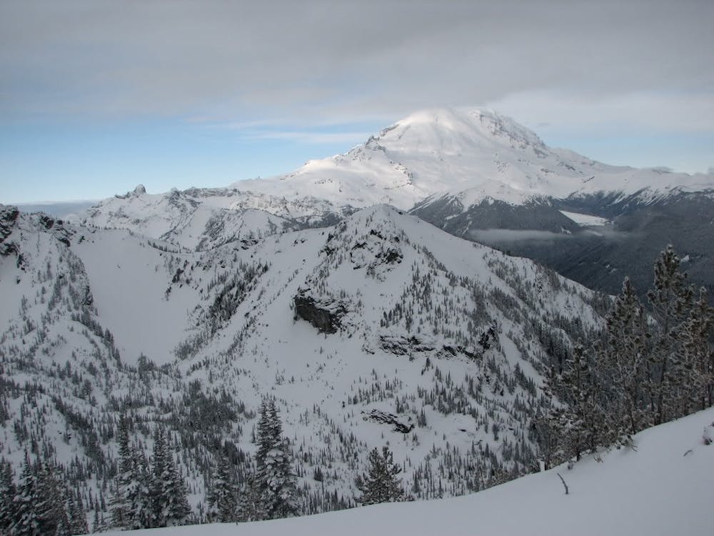
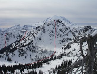
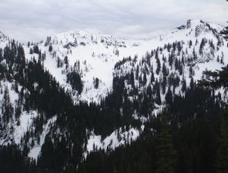
This tour links a handful of great lines in the Crystal Peak area as well as an “adventurous” exit down to 410. The Crystal Peak area has some great lines and if done correctly the final descent can be amazing as well. It should be said that if you do choose to go down to the highway you will have to go 5 miles to Crystal Mountain boulevard. While the first 3 miles you can ride the last 2 you will have to walk. This tour links together South Facing Slopes on Crystal Peak, A north facing line that I like to call the Y couloir and some West facing trees.
When I originally did this tour the ski touring policy was different at Crystal but now with limited access in Silver Basin I will describe it as if I was using the policy that is being used now. Basically the only way you can access this is by wrapping around 3 Way Peak….doe’s it make it impossible, definitely not but it does add an hour to the ski tour so below is how you can get into one of the lines in Crystal Basin.
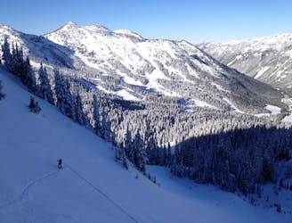
Leaving the base of Crystal Mountain make your way up the Quick Silver Run until reaching Silver Basin. If I understand correct you can still skin up the basin but they ask that you stay lookers left of the groomed trail before heading to the Eastern Col of 3 Way Peak. While a bit challenging and steep you can wrap clockwise around the Peak before heading into Crystal Basin. From there you can head northeast back up to the Crystal Mountain Ridge before arriving at a flat spot known as the Beach. In my opinion this is one of if not the best line to drop into Crystal Basin and the main one I was using for many years.
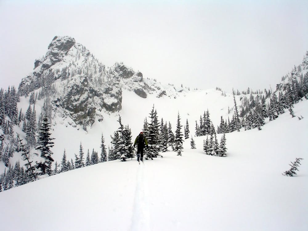
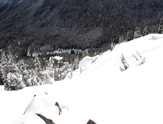
Once down at Lower Crystal Lake you are pretty much standing under the South face of Crystal Peak. Keep your skin track low as you ascend West making sure not to be too close to the open slopes above you in case they do slide. Before long you will noticed a small tree section that climbs 2/3 of the route and make sure to stick to this when ascending. Once out of the trees you need to commit and get into the open slopes a person at a time. From the trees you can see once your partner makes it up to the ridge then quickly follow their bootpack until regrouping and heading towards the summit.
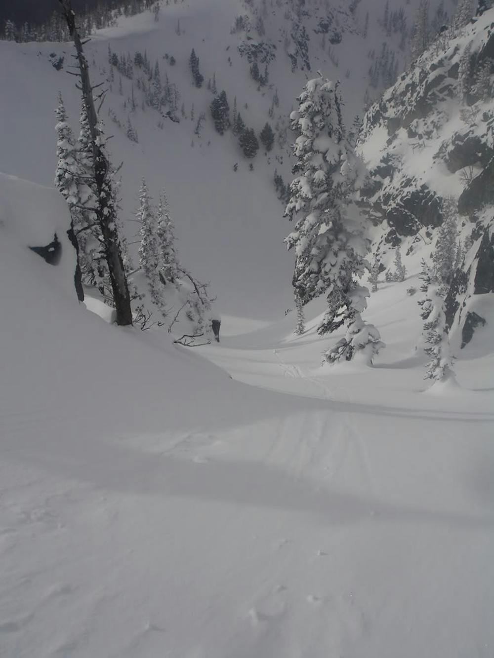
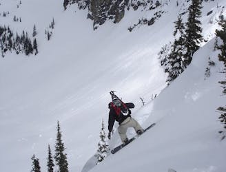
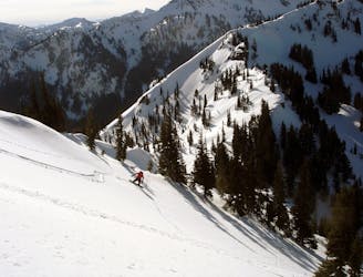
Once on the top of Crystal Peak and ready to descend you need to be incredibly careful that you stick to the Northeast Ridge as you have a cliff directly below you and you have to navigate around it. Once past the rock walls then it is a sweet fall line run all the way down to the valley and back to your skin track. Now follow it back up to the ridge where you will be heading for another great north facing line.
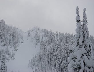
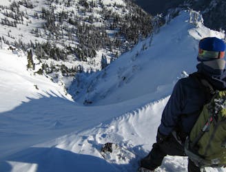
Standing back on the ridge look directly south across the small valley and you will notice a Y shaped couloir, this was the next objective. Stay on the high ridge wrapping around on easy slopes until standing on top of either of the entrances. This line is a gem as with wind loading and a bit of shelter it gets loaded with snow which can be both a blessing and a curse if snow is unstable. Drop in and enjoy a few seconds of powder bliss before arriving back in the valley.
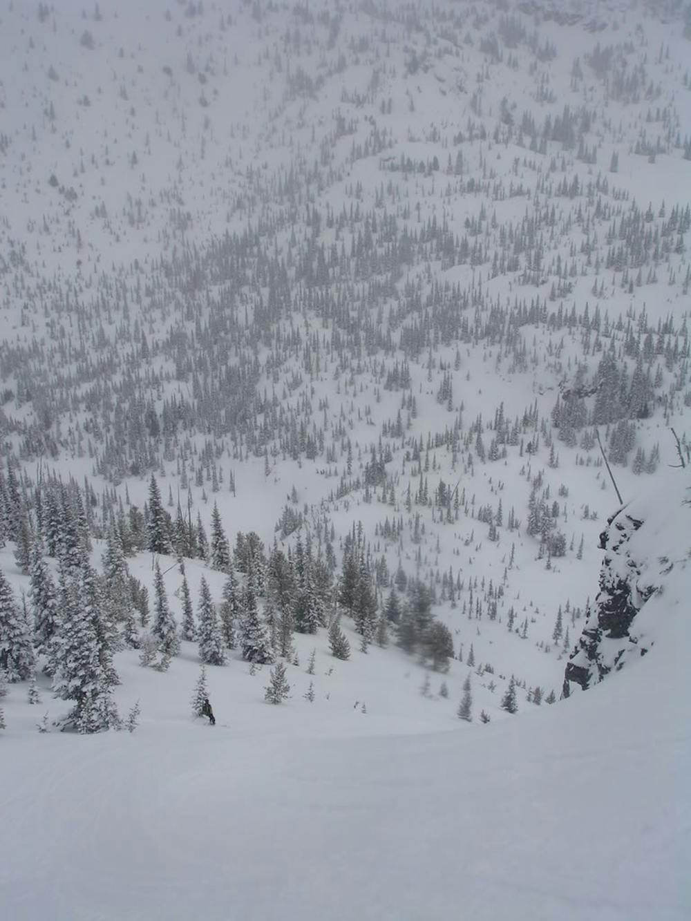
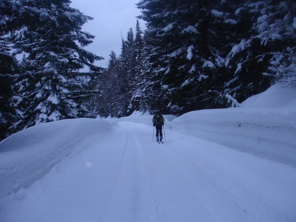
For our last run we decided to head down to 410 but if you wanted to head back to Crystal Mountain just follow Crystal Lakes Basin to 3 Way Peak and ride back into Silver Basin. If feeling more adventurous as we did follow your skin track back up to the col. Normally people would ride down the Northwest slope which is open all the way to the road but we wanted to try something different heading directly west. What was great up top became thick forest down low like so many of the 410 runs. After a few branches in the face and some swearing we were back on 410 and skiing the first 3 miles before walking the last 2. Around an hour of attempting to hitchhike and hoping for the best we were back up at the ski resort and happy that we made the most out of the day.
Click here for a trip within the area and much more photos https://www.whereiskylemiller.com/crystal-mountain/crystal-peak/
Difficult
Serious gradient of 30-38 degrees where a real risk of slipping exists.

In case of a fall, death is highly likely.
Little chance of being seen or helped in case of an accident.
32 m away
Making the most of of some great North Facing Chutes
Moderate Ski Touring
39 m away
Heading out to Chinook Pass during the Winter
Difficult Ski Touring
45 m away
Two options for riding the Gunbarrel area
Moderate Ski Touring
45 m away
A great and scenic ski tour just South of Crystal Mountain
Moderate Ski Touring
52 m away
Linking up 3 great runs in a single day
Moderate Ski Touring
59 m away
A great ski tour based out of Bear Gap
Moderate Ski Touring
61 m away
Making the most out of the slopes around Dogleg Peak
Moderate Ski Touring
61 m away
Heading South of Crystal Mountain making a scenic loop
Difficult Ski Touring
65 m away
A steep and potential dangerous line just beyond the ski resort
Difficult Ski Touring
68 m away
A Long Day route tagging 4 Separate lines South of Crystal Mountain
Difficult Ski Touring