7.1 km away
Lost Creek Falls
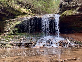
A short, easy hike to a hidden waterfall.
Easy Hiking
- Distance
- 3.8 km
- Ascent
- 71 m
- Descent
- 71 m
The best hike on the mainland for viewing Lake Superior's sea caves.
Hiking Difficult

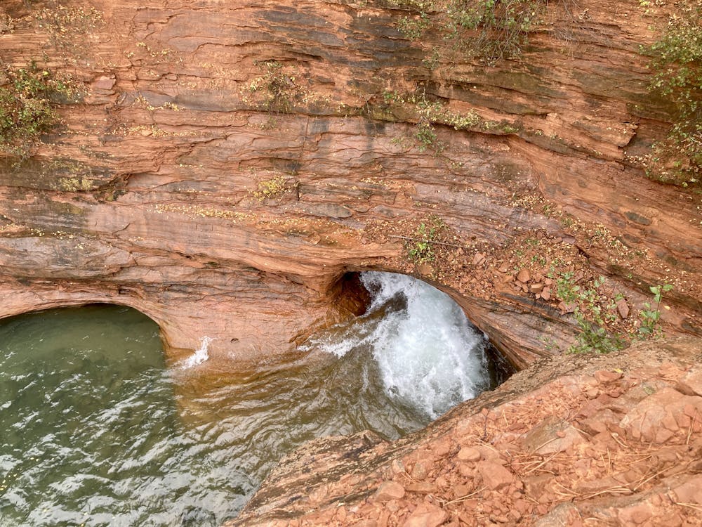
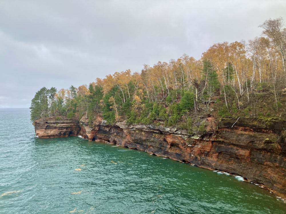
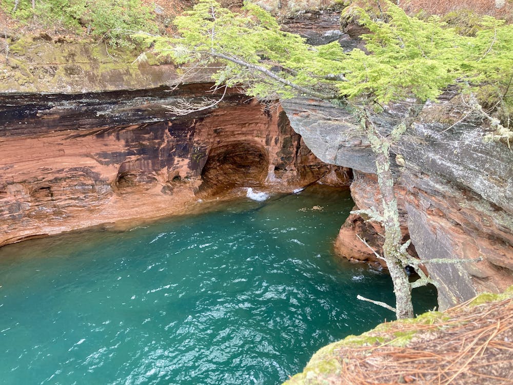
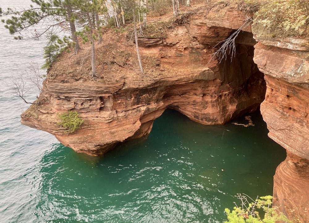
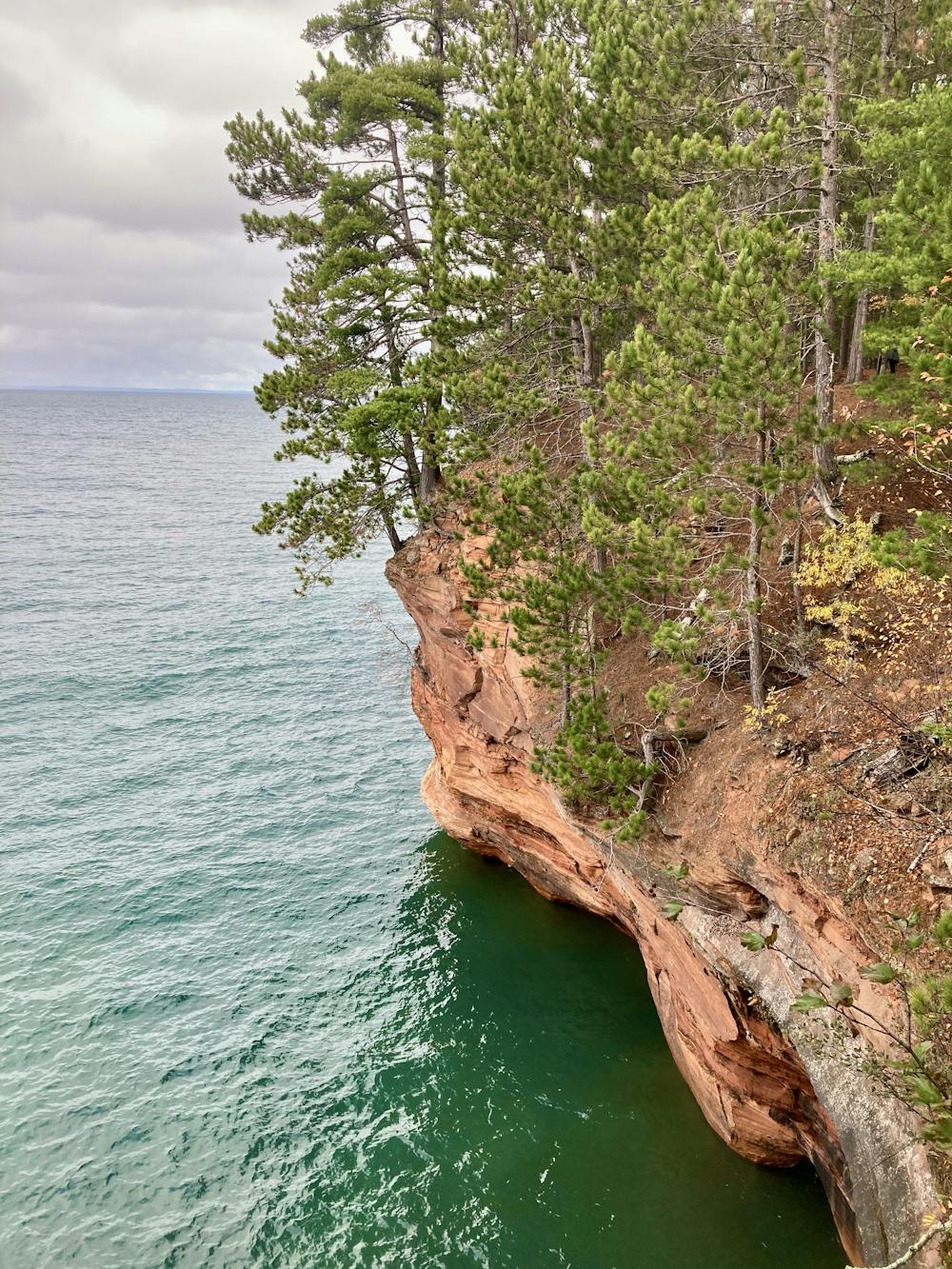
The Apostles Island National Lake Shore protects a beautiful array of islands, shoreline, and pristine water just off the Wisconsin mainland in Lake Superior. "Centuries of wave action, freezing, and thawing have sculpted shorelines throughout Apostle Islands National Lakeshore," according to the NPS. "Some of the Great Lakes' most spectacular scenery occurs where these forces interact with sandstone" to "create extensive sea caves," they continue. "Nature has carved delicate arches, vaulted chambers, and honeycombed passageways into cliffs on the north shore of Devils Island, Swallow Point on Sand Island, and along the mainland near the Lakeshore's western boundary. People come to Apostle Islands National Lakeshore in summer and winter to visit the sea caves and witness Lake Superior's ever-changing handiwork."
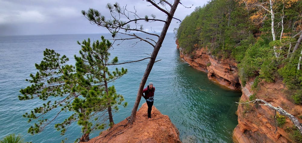
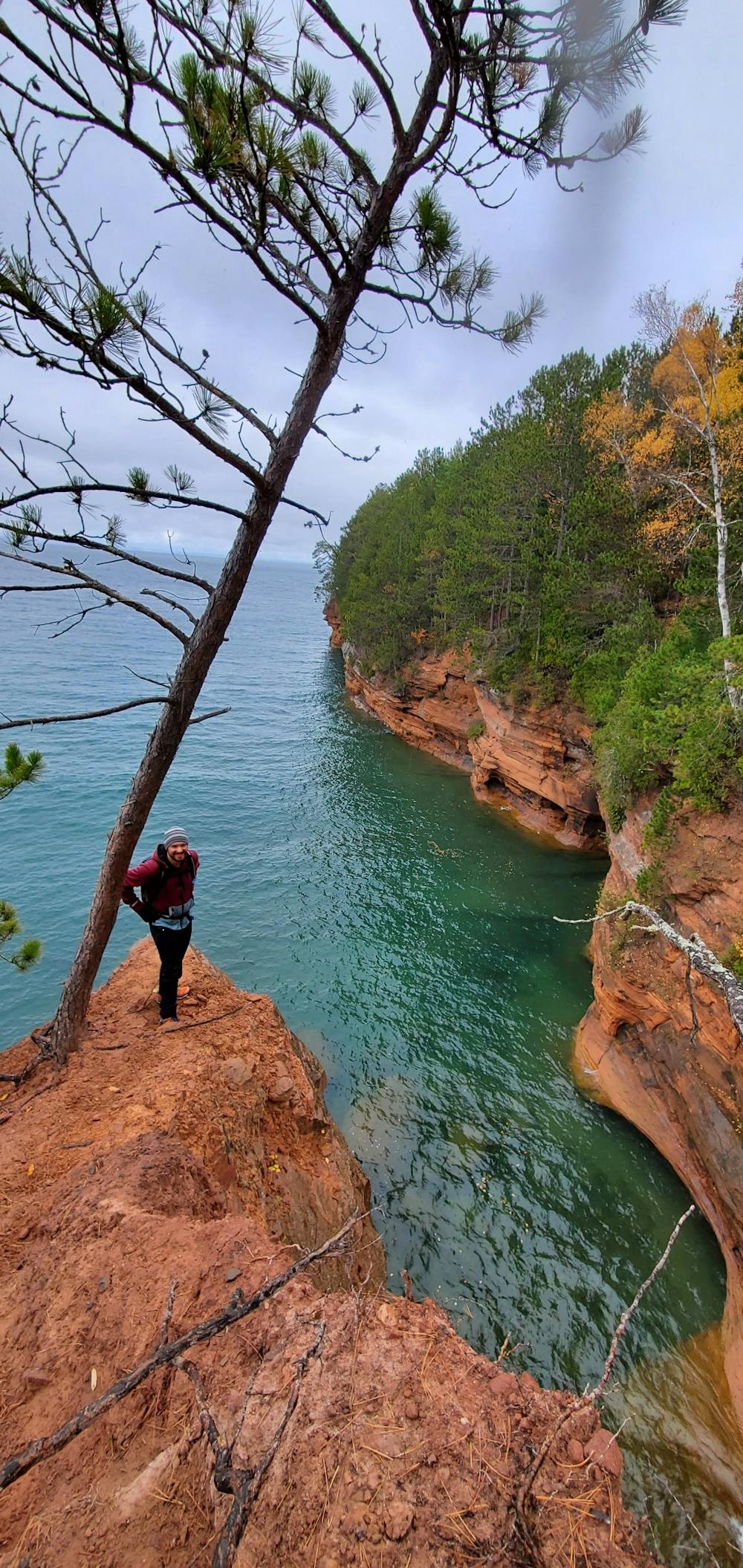
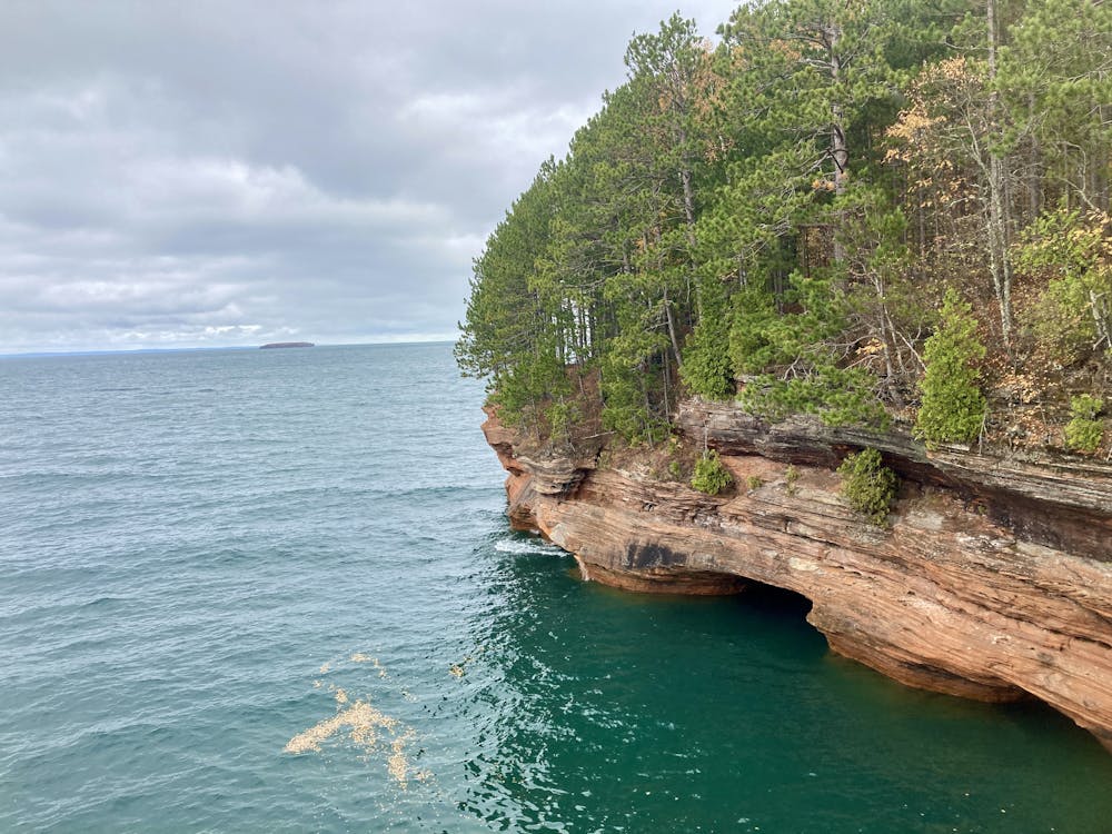
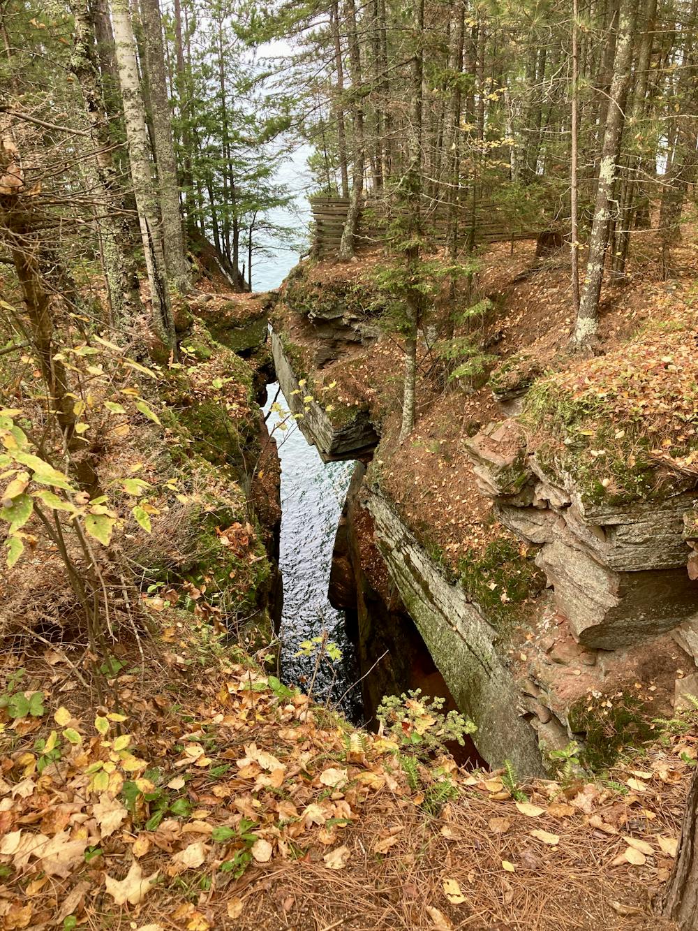
While reaching the sea caves carved into the islands further out in the lake can be a difficult excursion, this hike offers some of the best sea cave views accessible on the mainland. While you can also paddle along the shore to reach these caves, if you don't have a boat or aren't big on paddling, you can choose to simply hike along the shore above the caves.
While that might not sound all that promising for viewing caves formed by wave action, this hike actually over-delivers on viewpoints and natural beauty! Small points of land jutting out into the lake allow you to hike out and look back on the shoreline, watching the waves wash into the caves, the crash and boom echoing up and down the shoreline. The long-distance vistas out into the lake are to die for, and the contrast of the blue-green water against the orange and tan sandstone is gorgeous.
The route mapped here is an out-and-back day hike to the Big Bay viewpoint that measures about 4.3 miles round-trip. You can continue hiking much farther down the shoreline, however, and if you secure backcountry camping permits in advance, you can even turn this into a beautiful overnight backpacking trip. But if you're simply day hiking, Big Bay makes for a great turnaround point.
After departing Meyers Beach, the first stretch of the trail traverses well-built boardwalks with nary a sign of dirt. Don't worry—the trail's character will soon change. The boardwalks disappear abruptly, and steep, eroded hills undulating up and down will replace them. Some sections of the trail are flat and mostly smooth, but the rooty, rocky climbs and descents earn this trail a "Difficult" FATMAP rating. It's hard to believe when you leave the parking lot, but by the time you reach Big Bay, you'll see why the rating is justified. Even though this hike looks flat and easy on the map, in the further reaches, it will prove challenging to some hikers.
Even so, this is an extremely rewarding hike with an unbelievable array of views! You'll begin enjoying vistas and viewpoints well before reaching Big Bay, so be sure to take your time and enjoy all the remarkably different cave views and formations along the way.
Finally, if you get to Big Bay and haven't had enough yet, you can definitely keep on hiking. Just remember that this is an out-and-back, and you'll have to return the same way that you came.
Difficult
Hiking trails where obstacles such as rocks or roots are prevalent. Some obstacles can require care to step over or around. At times, the trail can be worn and eroded. The grade of the trail is generally quite steep, and can often lead to strenuous hiking.

Some trail sections are extremely exposed where falling will almost certainly result in serious injury or death.

Little chance of being seen or helped in case of an accident.
7.1 km away
A short, easy hike to a hidden waterfall.
Easy Hiking

10 routes · Hiking