81 m away
Makwa -> Hatchery Lollipop
According to CAMBA, "you will love this ride!"
Moderate Mountain Biking
- Distance
- 47 km
- Ascent
- 696 m
- Descent
- 697 m
Flowy northwoods singletrack, with over 100 berms on the Flow Mama trail alone!
Mountain Biking Moderate

"The CAMBA system has become recognized as the Singletrack Capital of the Midwest, with the most extensive system of interconnected singletrack east of the Mississippi,” according to the CAMBA Trail Guide. With over 300 miles of trail in this expansive system, it’s tough to choose a favorite trail… but the Seeley Pass, Flow Mama, and Ojibwe trails are high on the list.


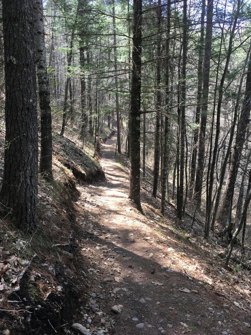
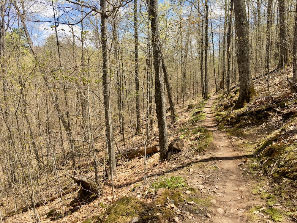
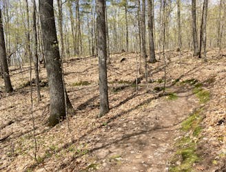
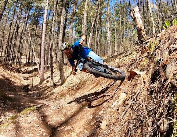
Seeley Pass provides flowy, serpentine singletrack that rolls through the remote Wisconsin Northwoods. Twisting between tight trees, the trail is always bench cut beautifully into the hillside or ripping downhill through a series of delightful, low berms.
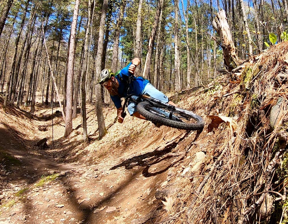
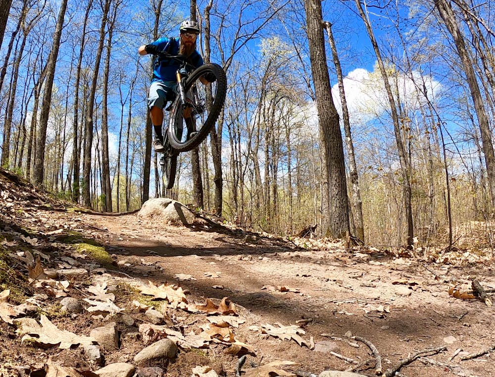
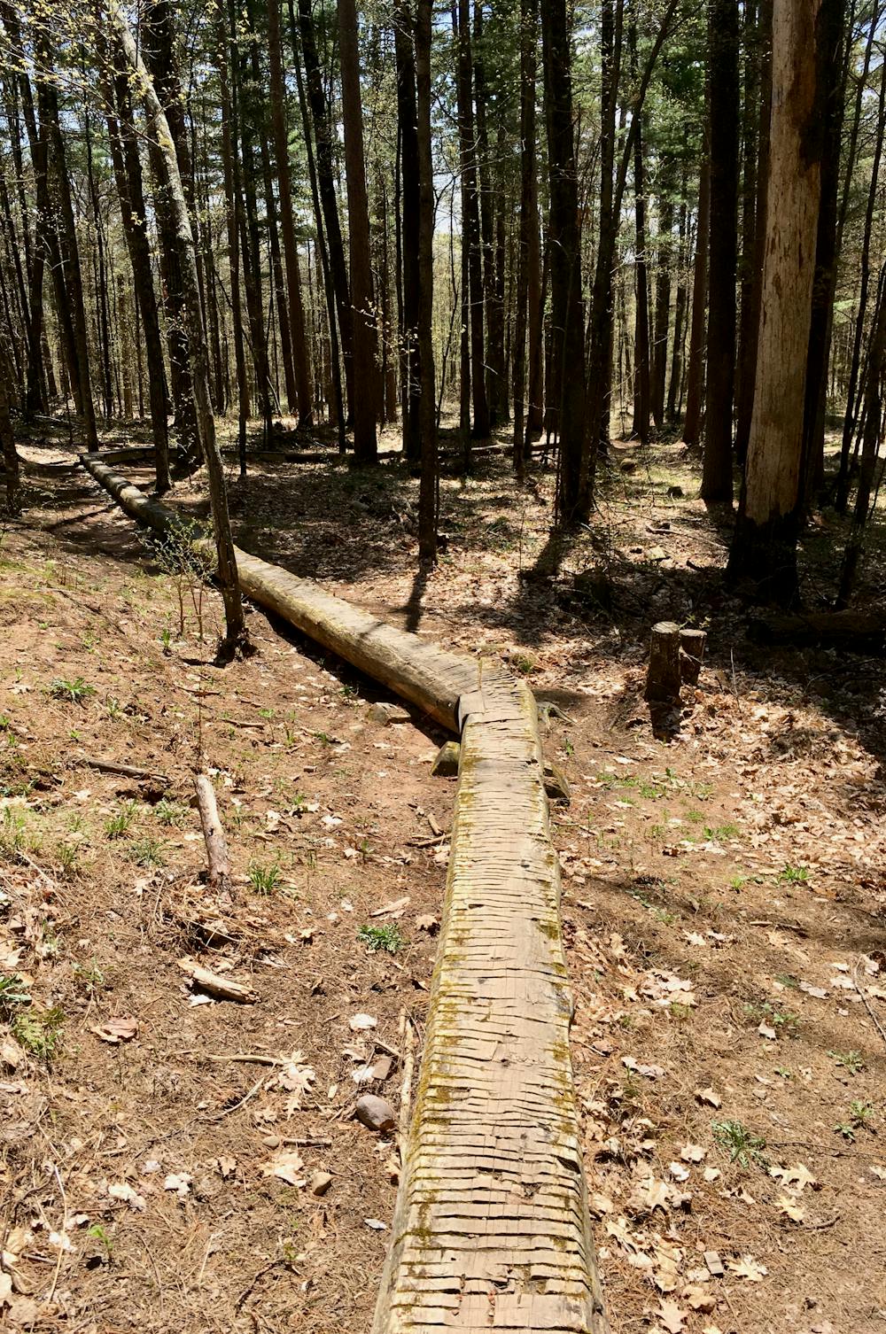
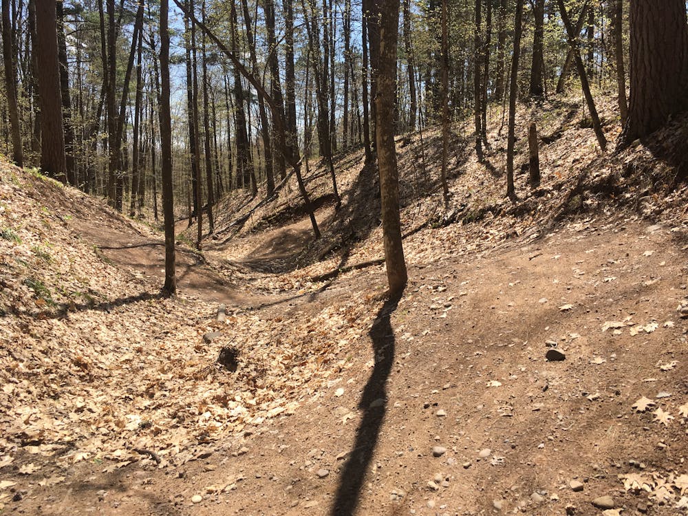
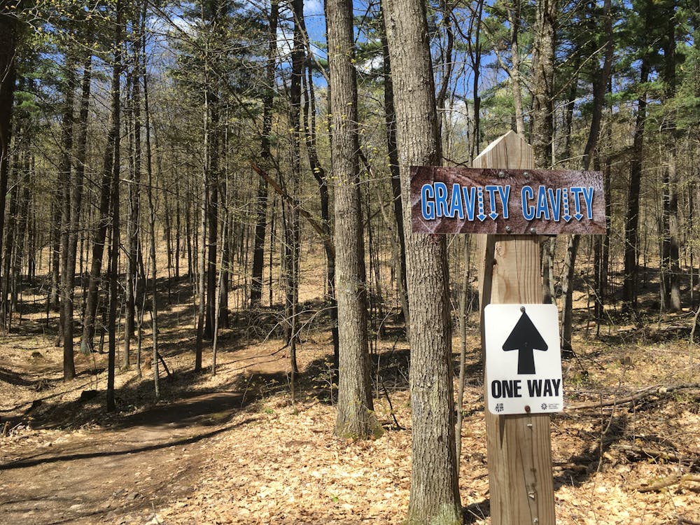
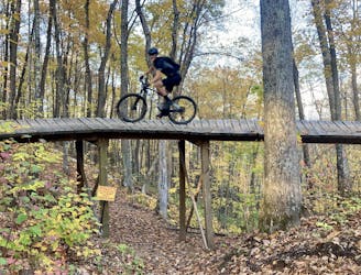
Flow Mama, however, is the true highlight. This aptly-named trail is filled with fantastic flowy, bermed sections of singletrack—over 100 berms, in fact. The trail includes a few directional gravity lines that you will want to lap over and over. Gravity Cavity offers ripping berms and rollers, and 38 Special provides a similar experience with a slightly different vibe. If you like skinnies, the River Pig log ride measures a whopping 180 feet long! Finally, Flow Mama climbs to the highest point on the Birkie Trail, at 1,730 feet above sea level.
After pedaling Seeley Pass to Flow Mama, tack on the Ojibwe trail for a rewarding loop before you begin your pedal back. Part of the Cable cluster of trails, Ojibwe provides riders with “deep woods singletrack with frequent punchy climbs,” according to CAMBA. The trail features a “great blend of old school and more contemporary style trail.”
While of course, it is possible to connect to a variety of other trails in the network and just keep on pedaling, the lollipop mapped here should provide a respectable ride length for most riders. If you want to speed up the return trip, you can skip the singletrack and instead pedal the gravel roads. Use the posted trail maps to navigate this alternate route.
Moderate
Mostly stable trail tread with some variability, with unavoidable obstacles 8in/20cm tall or less. Other obstacles such as rock gullies and steep sections may exist. Ideal for lower intermediate riders.

The path is on completely flat land and potential injury is limited to falling over.

Little chance of being seen or helped in case of an accident.
81 m away
According to CAMBA, "you will love this ride!"
Moderate Mountain Biking
8.3 km away
One of CAMBA's most feature-rich trails.
Difficult Mountain Biking
8 routes · Mountain Biking