278 m away
CDT: Lewis Lake (US-191) to Targhee Pass (US-20)
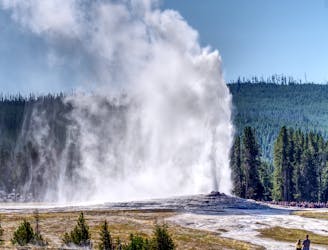
The CDT's passage through the southwest corner of Yellowstone National Park, including the stunning Old Faithful Geyser.
Difficult Hiking
- Distance
- 124 km
- Ascent
- 1.9 km
- Descent
- 2.1 km
23-mile out-and-back with an active geyser basin, picturesque lakeside camping, and spectacular summit views.
Hiking Difficult

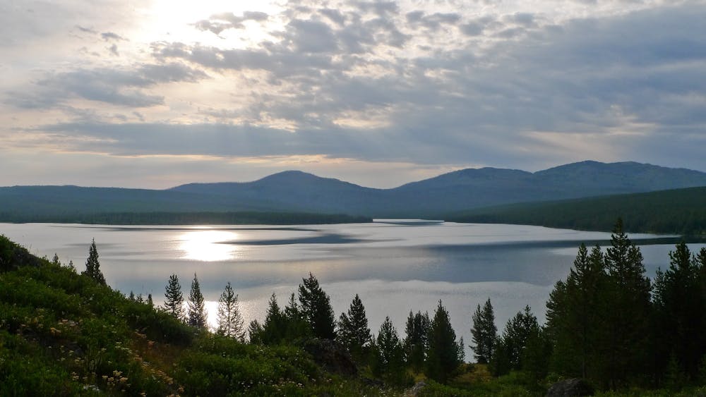
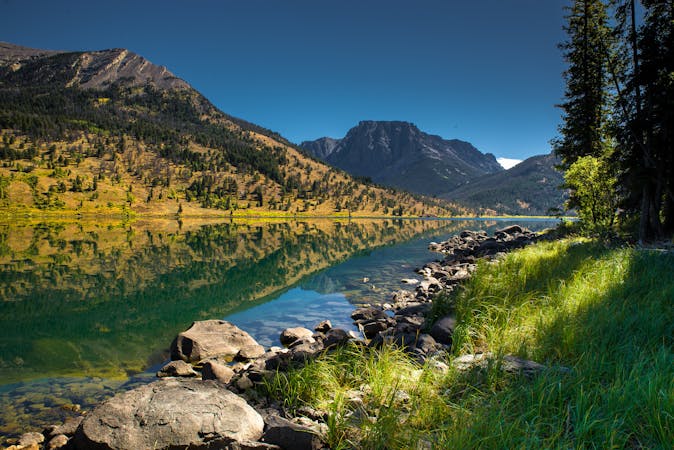
Heart Lake is a whopping 2,150-acre lake at 7,461 feet elevation, sitting at the base of Mount Sheridan, deep in Yellowstone’s backcountry. With campsites next to a gorgeous lakeside setting, trails through thick woodland, and a thrilling summit climb, it's no wonder that the Heart Lake and Sheridan Trail is Yellowstone’s most popular backcountry route. Famed for its diverse wildlife, look out for elk, trumpeter swans, grey wolves, and grizzly bears in the area, and many kinds of fish in the lake.

Directions:
Find the Heart Lake trailhead on the West Thumb Rd near Yellowstone Park’s southern entrance.
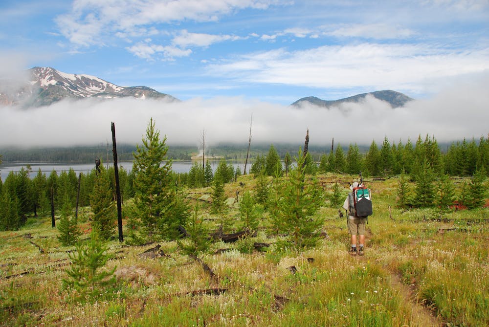
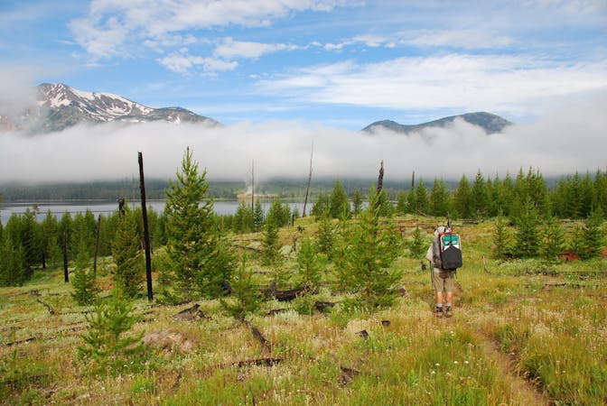
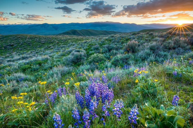
After meandering through a couple of meadows, the trail starts to ascend through a forest at about a mile into the hike. You will notice that some of the trees still appear black and singed, an eerie reminder of the 1988 Yellowstone Fires. Leaving the forest, the path continues in a southeasterly direction, passing by a meadow on your left, and climbs gently until you hit the route’s highpoint at 8,140 feet. From here, you will be rewarded with stunning views of Heart Lake and Factory Hill. After you’ve stopped to catch your breath, brace yourself for the rapid descent down to the isolated Heart Lake Geyser Basin. You’ll pass by bright blue thermal pools, as well as many hot springs, bubbling mud pots and fumaroles. At the 7.6-mile marker, you will hit the Heart Lake shoreline, where the path splits. Take the path to the west, going around the lake until you come to a series of 5 back-to-back campsites, the first is ¾ of a mile away and the furthest is 4-miles from the path junction.
Once you’ve rested the night and recharged your batteries at one of the campsites, start the next day with an epic 2,500-foot climb up to the summit of Mount Sheridan. From the fifth furthest campsite, carry along the path for a short while until you hit the turnoff for the Mount Sheridan Trail. Follow the trail for 3-miles, first passing through a forest before steeply ascending the mammoth 10,305-ft Mount Sheridan, scrambling over rocks and traversing the mountain’s ridgeline. At the summit, enjoy tremendous views of Heart Lake and the surrounding lakes, as well as the Absaroka and Teton mountain ranges looming in the background.
Turn back the way you came, first along the Mount Sheridan Trail, and then along the Heart Lake Trail.
Tips:
Before setting out, check on the NPS website or at the ranger huts to see if the path is definitely open. In recent years, The Heart Lake Bear Management Area is closed to hikers from April 1 to June 30, making it impossible to reach Heart Lake or Mount Sheridan until July 1.
The Heart Lake Thermal Basin is not equipped with boardwalks, so stay clear of areas devoid of vegetation, as there could be boiling water lying just beneath the surface.
With over 40% of Yellowstone’s backcountry overnight hikers choosing Heart Lake trail, it’s necessary to reserve your campsite in advance. This can be done at any of Yellowstone’s ranger stations, free of charge.
Sources: https://www.backpacker.com/trips/yellowstone-national-park-heart-lake-and-mount-sheridan https://www.hikingproject.com/trail/7017579/heart-lakemt-sheridan
Difficult
Hiking trails where obstacles such as rocks or roots are prevalent. Some obstacles can require care to step over or around. At times, the trail can be worn and eroded. The grade of the trail is generally quite steep, and can often lead to strenuous hiking.

Some trail sections have exposed ledges or steep ascents/descents where falling could cause serious injury.
Little chance of being seen or helped in case of an accident.
278 m away
The CDT's passage through the southwest corner of Yellowstone National Park, including the stunning Old Faithful Geyser.
Difficult Hiking
5 routes · Hiking
6 routes · Hiking

40 routes · Hiking
13 routes · Hiking