5.5 km away
Cache Creek -> Game Creek
One of the most popular and beautiful singletrack loops accessible from downtown Jackson.
Moderate Mountain Biking
- Distance
- 33 km
- Ascent
- 549 m
- Descent
- 550 m
Skyline Ridge offers stunning views of 4 different mountain ranges, and Josie's Ridge finishes the ride with a technical descent.
Mountain Biking Difficult

The Skyline Ridge Trail “connects the top of the Ferrin’s trail to the Cache-Game Divide, offering up incredible views in all directions in addition to creating a multitude of new singletrack options for trail users,” writes Patrick on JacksonHole.com.
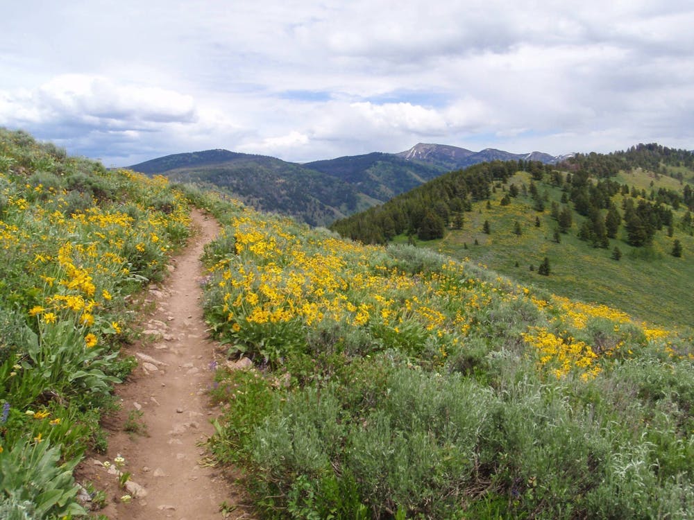
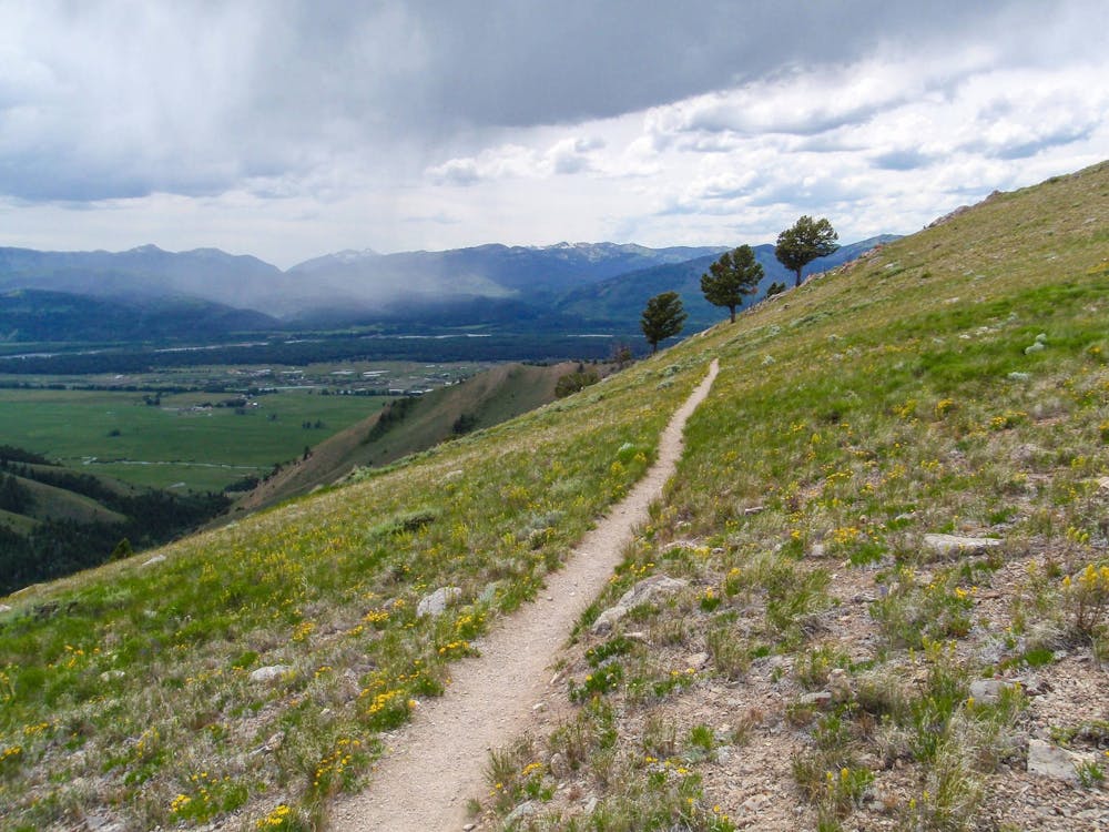
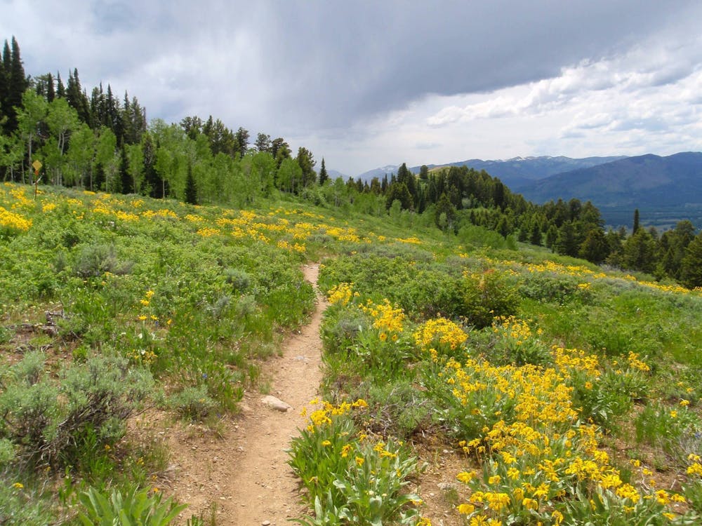
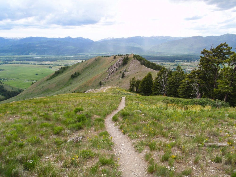
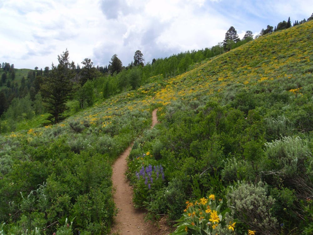
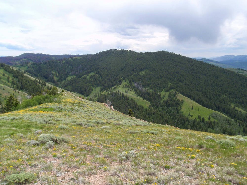
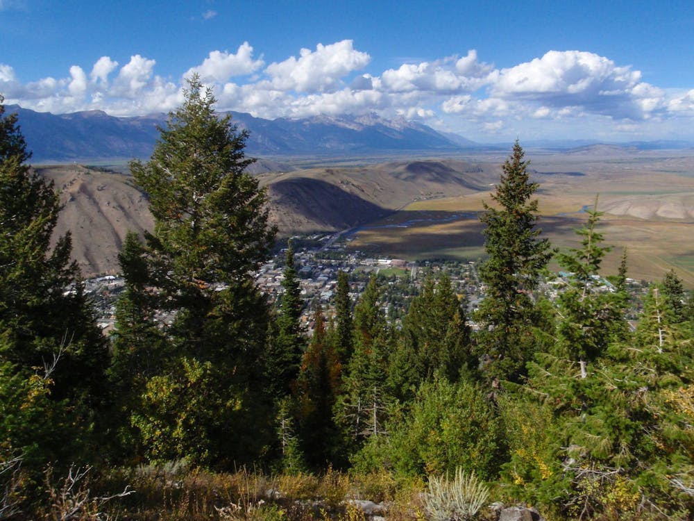
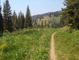
As you’d imagine, the trail follows Skyline Ridge, and thanks to the incredible real estate that this singletrack occupies, the entire ride is extremely photogenic—from wildflowers to views of mountain peaks. In fact, according to Brigid Mander on JacksonHoleMagazine.com, the trail offers views of 4 distinct mountain ranges.
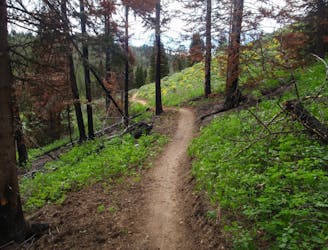
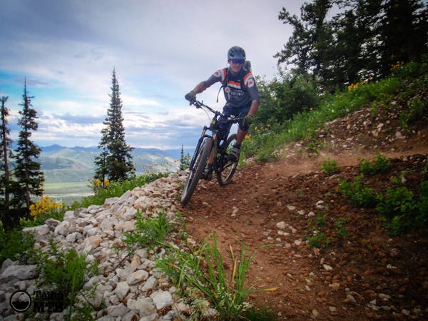
Skyline Ridge can be ridden in either direction. The route mapped here sends riders up the most technical section of the trail—1.5 miles of switchbacks up a steep, rocky slope. Many riders choose to ride down this section. However, if you climb up Cache Creek and then climb these switchbacks, Skyline Ridge will lead you over to the top of Snow King Mountain and then offer up a challenging descent down Josie’s Ridge, back into town.
"Josies's is, in places, a VERY steep, loose switchbacking trail with numerous stairs,” according to Mountain Bike The Tetons. As a result, it’s recommended to only ride this trail in the downhill direction.
Sources: https://www.jacksonhole.com/blog/riding-building-new-skyline-trail-andrew-whiteford/ http://jacksonholemagazine.com/head-for-the-skyline/ https://mountainbiketetons.org/region/trails/jackson-hole/cache-creek-snow-king/josies-ridge/
Difficult
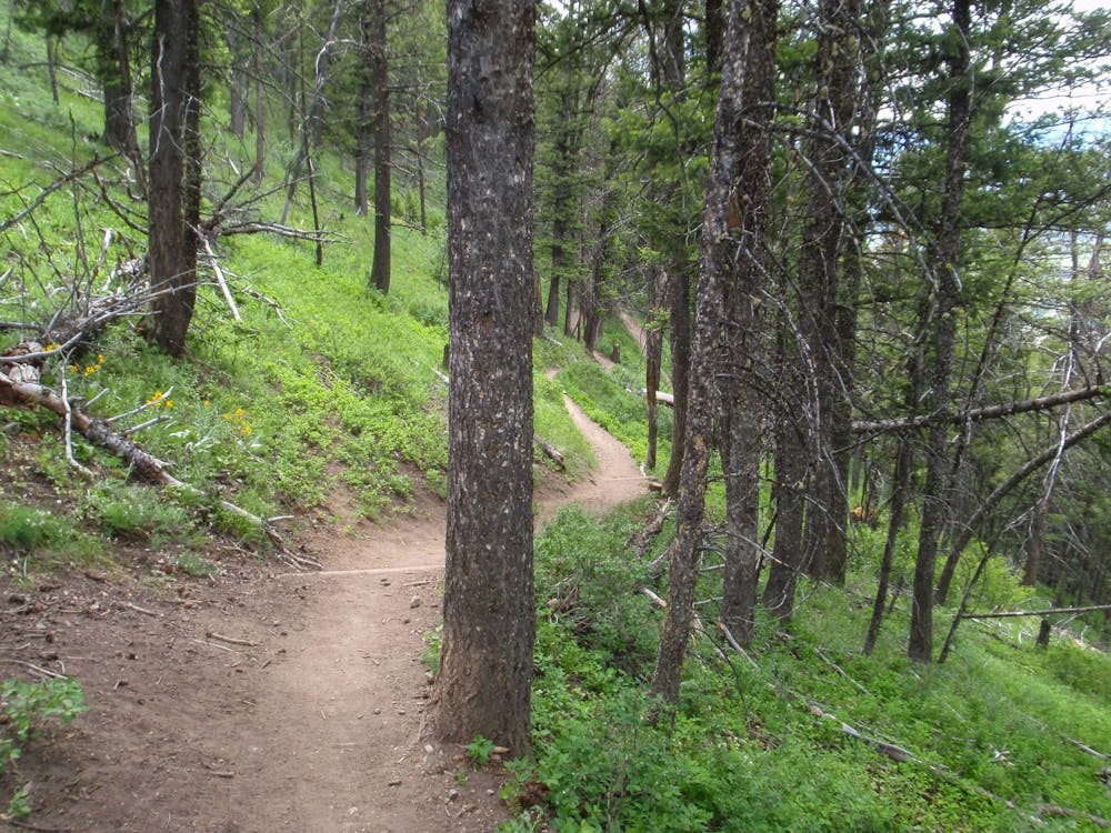
Mostly stable trail tread with some variability featuring larger and more unavoidable obstacles that may include, but not be limited to: bigger stones, roots, steps, and narrow curves. Compared to lower intermediate, technical difficulty is more advanced and grades of slopes are steeper. Ideal for upper intermediate riders.

The trail contains some obstacles such as outcroppings and rock which could cause injury.
Away from help but easily accessed.
5.5 km away
One of the most popular and beautiful singletrack loops accessible from downtown Jackson.
Moderate Mountain Biking
8.1 km away
The gnarliest descent in the greater Snow King trail system.
Severe Mountain Biking
8 routes · Mountain Biking