Tsitsikamma Weekend Hike - Bloukrans to Lottering

A Weekend Section of the Tsitsikamma Hiking Trail
Moderate Hiking
- Distance
- 32 km
- Ascent
- 1.1 km
- Descent
- 1.1 km
Go hiking in Western Cape with curated guides of the best hikes across the region. With over 38 3D trail maps in FATMAP, you can easily discover and navigate the best trails in Western Cape.
No matter what your next adventure has in store, you can find a guide on FATMAP to help you plan your next epic trip.
Get a top hiking trail recommendation in Western Cape, or get inspired by the 38 local adventures uploaded by the FATMAP community. Start exploring now!
A Weekend Section of the Tsitsikamma Hiking Trail
Moderate Hiking

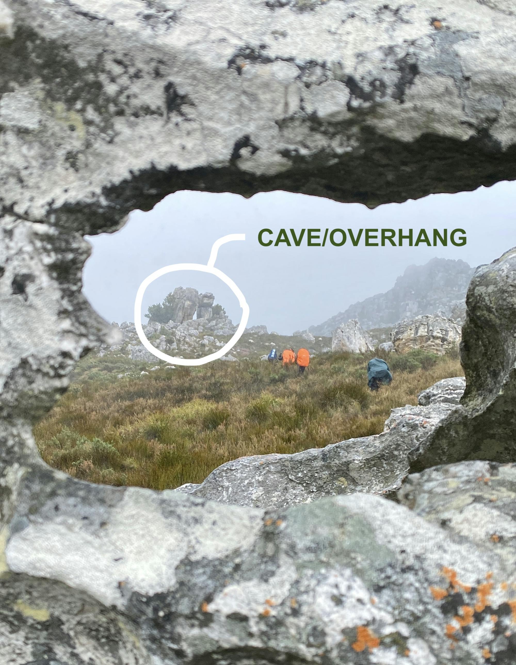
Start and finish are on trail. Middle section is off trail. Follow the kerns.
Difficult Hiking
One of the routes for the RBHS Journey
Moderate Hiking
An 8.4km hike from De Hoek Nature Reserve to Botha Hoek Hut
Difficult Hiking
11km trail loop through coastal flynbos
Difficult Hiking

Up to Saronsberg baken
Difficult Hiking

A Mountain Slayers Hike
Extreme Hiking

Panorama trail, taking Kirktrekker down to the waterfalls.
Difficult Hiking