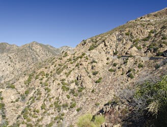
Mount Baldy Summit Loop
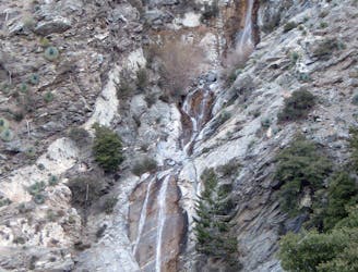
Challenging and scenic hike in the alpine terrain of Los Angeles County's tallest mountain.
Difficult Hiking
- Distance
- 16 km
- Ascent
- 1.2 km
- Descent
- 1.2 km
Explore Angeles National Forest with curated guides of the best hiking trails, mountain bike trails, and more. With over 23 3D trail maps in FATMAP, you can easily discover and navigate the best trails in Angeles National Forest.
No matter what your next adventure has in store, you can find a guide on FATMAP to help you plan your next epic trip.
Get a top trail recommendation in Angeles National Forest from one of our 10 guidebooks, or get inspired by the 23 local adventures uploaded by the FATMAP community. Start exploring now!
Challenging and scenic hike in the alpine terrain of Los Angeles County's tallest mountain.
Difficult Hiking
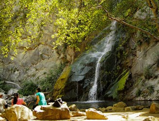
Full-value loop combining Sturtevant Falls, Mt. Zion summit, and swimming holes in Big Santa Anita Canyon.
Difficult Hiking
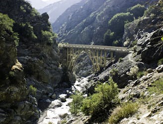
Hike to a photogenic arch bridge curiously placed in a mountain wilderness area, with river crossings and swimming holes along the way.
Moderate Hiking
A steep, technical shuttle run down Mount Wilson of epic proportions.
Severe Mountain Biking
The LA Area's premiere shuttle run!
Severe Mountain Biking
A hidden gem far from the bustle of Pasadena!
Moderate Hiking

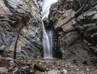
One of the most popular waterfalls close to Los Angeles.
Difficult Hiking