Mount Lowe -> Idlehour
A remote, rugged option off of the classic Mount Lowe shuttle run.
Severe Mountain Biking
- Distance
- 19 km
- Ascent
- 465 m
- Descent
- 1.6 km
The LA Area's premiere shuttle run!
Mountain Biking Severe

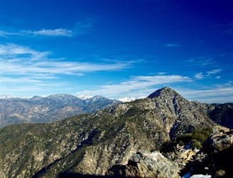
Mount Lowe is hands-down the Los Angeles-area's premiere legal shuttle run. Along with nearby Mount Wilson, a plethora of singletrack trails and dirt roads descend from the crest of the mountain range all the way down to the outskirts of the megalopolis far, far below. To get to the top, either cajole a friend or family member into driving you up, or book a commercial shuttle from one of several local shuttle companies.
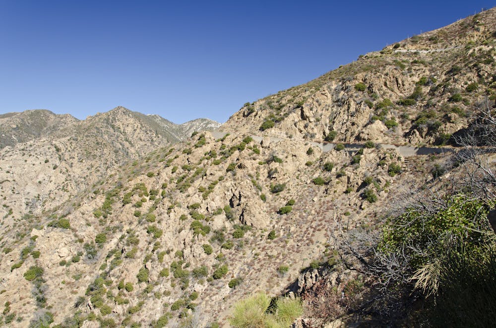
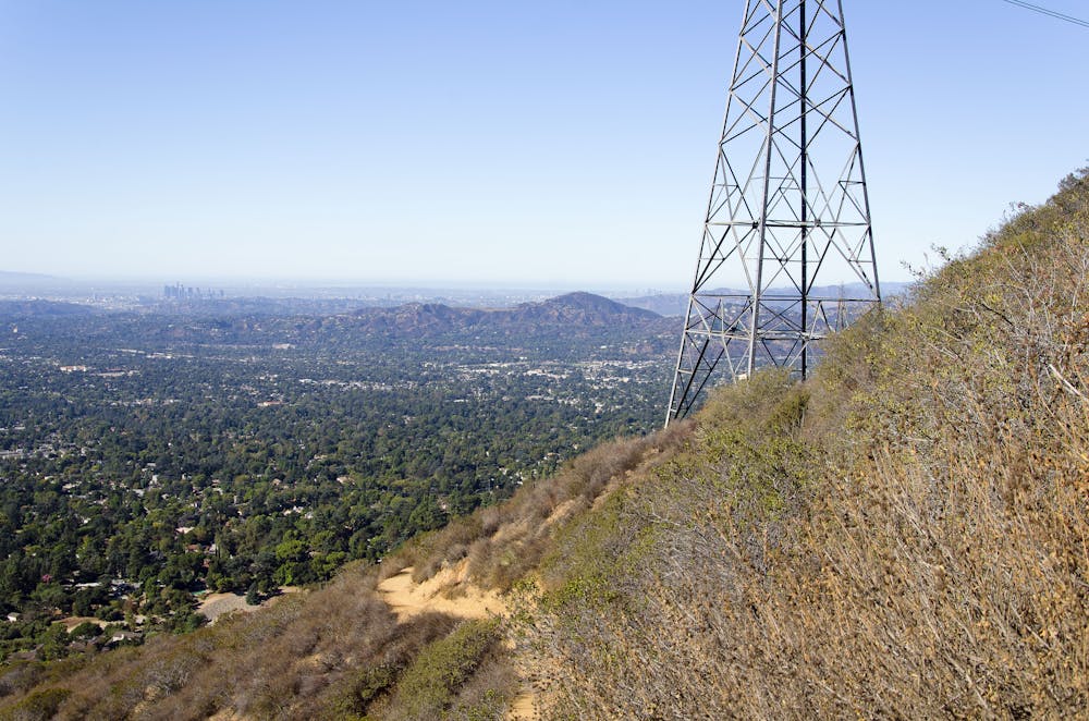
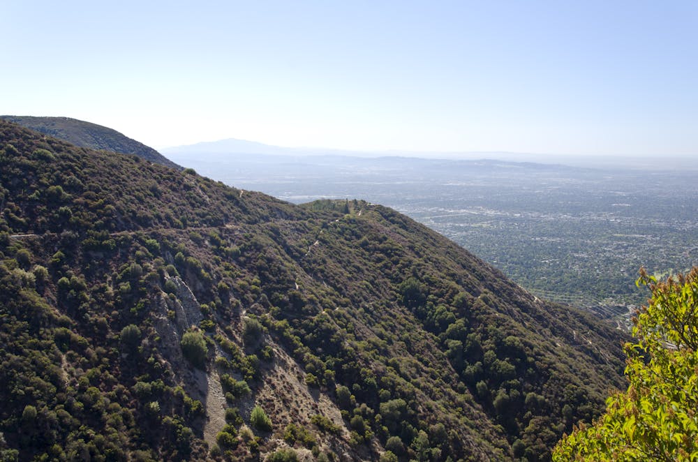

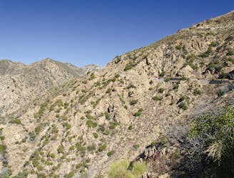
Mount Lowe in particular offers a variety of descent options. Want to enjoy an easy, scenic cruise from mountaintop to city limits on an abandoned railroad grade? You can do that, as the now-defunct railway (complete with a tunnel through the mountainside) is the anchor of all the routes in this region.
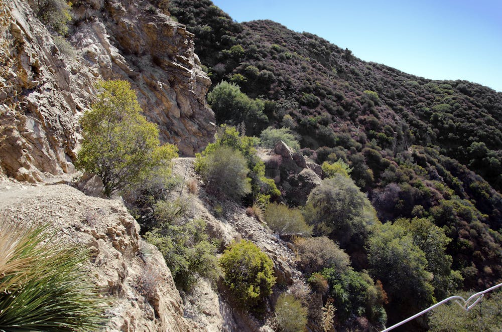
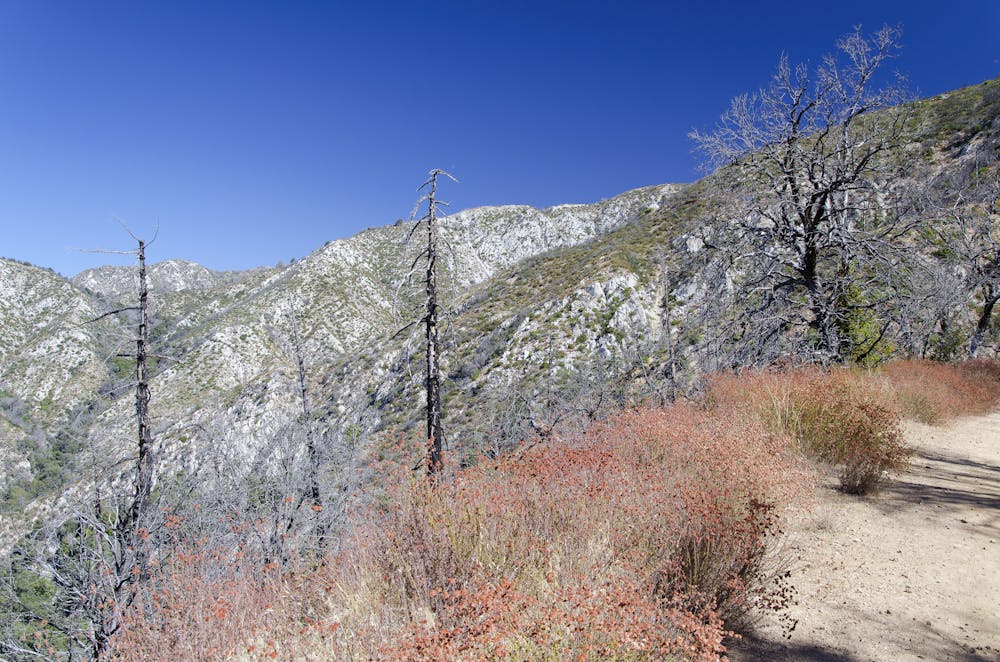
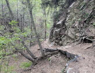
Want to drop down narrow, technical singletrack with breathtaking views and death-defying exposure? Mount Lowe offers that type of mountain bike ride as well. The route mapped here follows the most popular mostly-singletrack descent from the top of the mountain down to Loma Alto Park. That said, there are even more singletrack options to finish the descent, including the Lower Sam Merrill trail, Firebreak, and more.
The singletrack itself is rocky and ledgy in places, and buff and flowy in others. Mountain bikers have crafted ledge drops, jumps, and other alternate features into the trail for more fun and challenge. While everything here is very achievable on an enduro or trail bike, it's not uncommon to see riders unloading dual crown downhill bikes off of shuttle vehicles and donning full face helmets at the top of the mountain.
While Mount Lowe does boast a well-used and relatively easy-to-follow route, it's more informative to think of this zone as a massive web of shuttleable singletrack trails that can be mixed and matched to your heart's content, creating as gnarly or as chill of a downhill rip as you want!
Severe
Widely variable, narrow trail tread with steeper grades and unavoidable obstacles of 15in/38cm tall or less. Obstacles may include unavoidable bridges 24in/61cm wide or less, large rocks, gravel, difficult root sections, and more. Ideal for advanced-level riders.

Some trail sections are extremely exposed where falling will almost certainly result in serious injury or death.

Away from help but easily accessed.
A remote, rugged option off of the classic Mount Lowe shuttle run.
Severe Mountain Biking
1 m away

A Mount Lowe descent variant finishing on the tight and twisty Lower Sam Merrill trail.
Severe Mountain Biking
2.7 km away
A steep, technical shuttle run down Mount Wilson of epic proportions.
Severe Mountain Biking
6.5 km away
Shuttle run down the final portion of the Gabrielino Trail
Severe Mountain Biking
6.5 km away
A visually-stunning loop around the highest peak on the San Gabriel front range.
Difficult Mountain Biking
6.5 km away

An epic point-to-point route combination with a net elevation loss.
Severe Mountain Biking
8.6 km away
One of the most popular loops up into the mountains for Los Angeles-area mountain bikers.
Difficult Mountain Biking
13 routes · Mountain Biking

5 routes · Mountain Biking

10 routes · Mountain Biking