Tryumph

Great trail for beginners or to warm up on.
Easy Mountain Biking
- Distance
- 5.7 km
- Ascent
- 14 m
- Descent
- 340 m
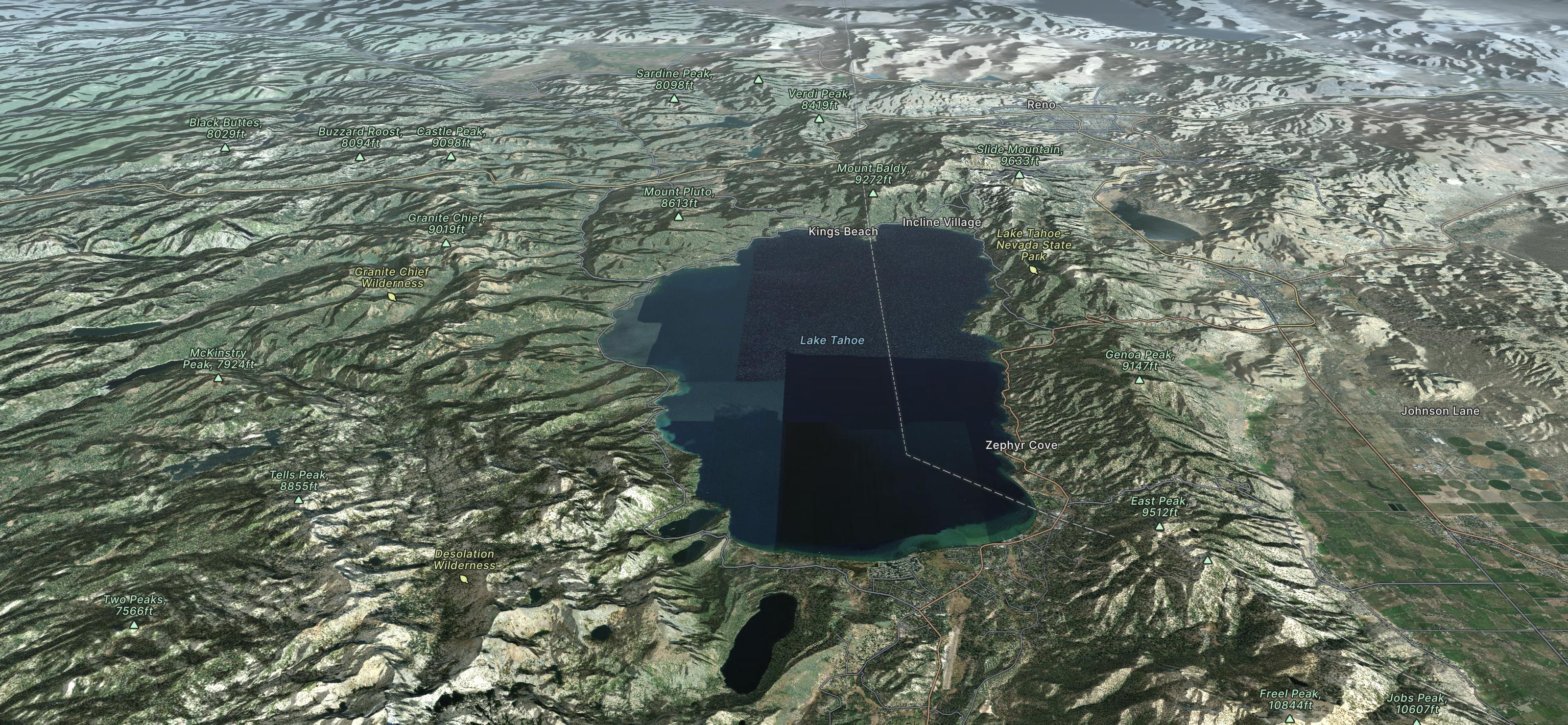
Explore Lake Tahoe with curated guides of the best hiking trails, mountain bike trails, ski routes, and more. With over 522 3D trail maps in FATMAP, you can easily discover and navigate the best trails in Lake Tahoe.
No matter what your next adventure has in store, you can find a guide on FATMAP to help you plan your next epic trip.
Get a top trail recommendation in Lake Tahoe from one of our 17 guidebooks, or get inspired by the 522 local adventures uploaded by the FATMAP community. Start exploring now!

Great trail for beginners or to warm up on.
Easy Mountain Biking
Great trail to practice small jumps and berms
Easy Mountain Biking

A great zone to finish a ski tour back to Chair 3
Moderate Ski Touring

Steep bowl that is out of bounds from Glove Rock to the skier's left of Palisades Ridge
Difficult Freeride Skiing

A zone with a few medium cliffs with better than average takeoffs
Difficult Freeride Skiing

Located in South Lake Tahoe, this peak has one of the most amazing views of the surrounding area. The north facing aspects can hold really dry powder and the east side can hold amazing corn snow when the melt-freeze cycle begins.
Difficult Ski Touring

Iconic peak overlooking Meyers and South Lake Tahoe. Great tree skiing and playful terrain.
Difficult Ski Touring

A fun north facing aspect with mellow tree skiing, playful terrain features and an easy hike in and out. Located above Lower and Upper Echo Lakes near Echo Summit and High Way 50.
Difficult Ski Touring

A fun, north facing aspect with mellow tree skiing and playful terrain features with an easy hike in and out. Located above Lower and Upper Echo Lakes near Echo Summit and High Way 50.
Difficult Ski Touring

An extremely technical area with multiple lines and airs off a big rock
Difficult Freeride Skiing