PCT: Donner Pass to Sierra City
A meandering course over consecutive ridges and valleys, with no shortage of vast views or comfortable camps.
Moderate Hiking
- Distance
- 65 km
- Ascent
- 1.8 km
- Descent
- 2.6 km
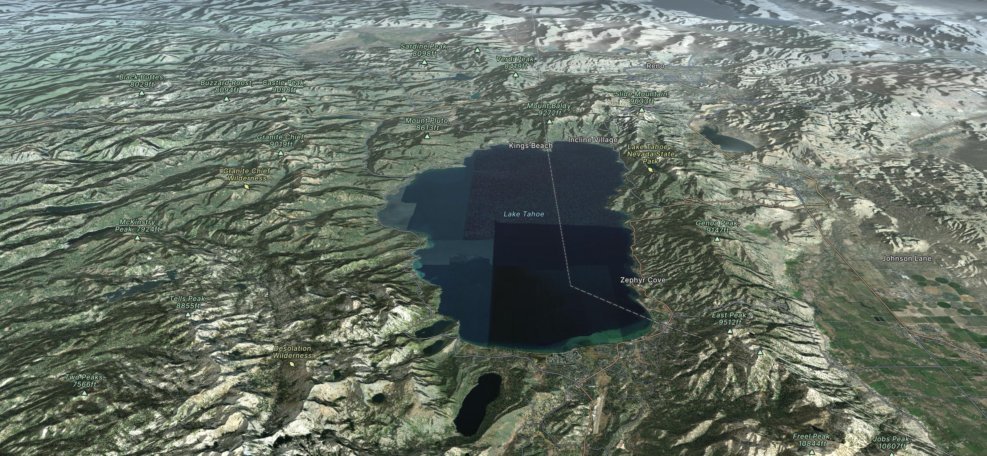
Go hiking in Lake Tahoe with curated guides of the best hikes across the region. With over 523 3D trail maps in FATMAP, you can easily discover and navigate the best trails in Lake Tahoe.
No matter what your next adventure has in store, you can find a guide on FATMAP to help you plan your next epic trip.
Get a top hiking trail recommendation in Lake Tahoe from one of our 17 guidebooks, or get inspired by the 523 local adventures uploaded by the FATMAP community. Start exploring now!

A meandering course over consecutive ridges and valleys, with no shortage of vast views or comfortable camps.
Moderate Hiking
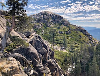
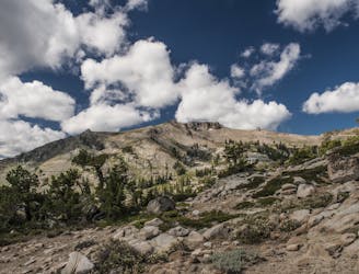
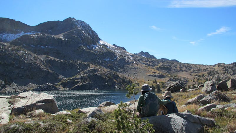
Miles 1124.8-1153.4 of the northbound PCT: Tracing a line across the sky above Lake Tahoe, on a bald crest of craggy peaks.
Difficult Hiking
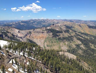
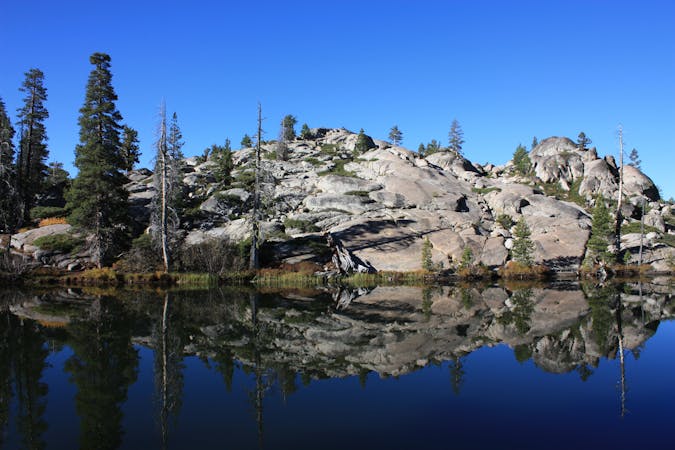
Miles 1092.3-1124.8 of the northbound PCT: Through the Desolation Wilderness near Lake Tahoe, packed with alpine lakes and prime camping within polished granite basins.
Moderate Hiking
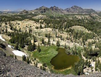
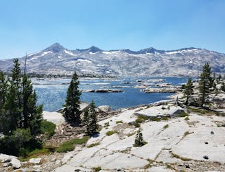
Miles 1048.8-1092.3 of the northbound PCT: Approaching Lake Tahoe through a mosaic of volcanic peaks and granite mounds, with mountainside meadows and alpine lakes around every turn.
Moderate Hiking
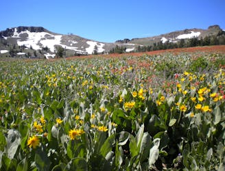
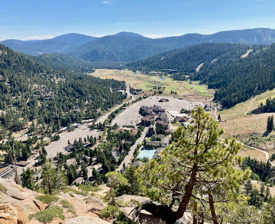
Summer hike from Palisades Tahoe Lodge to High Camp, along a rushing stream and through flower-filled meadows on the mountainside.
Moderate Hiking
Hike through meadows and along ridgelines to reach the peaks at the top of Palisades Tahoe.
Moderate Hiking
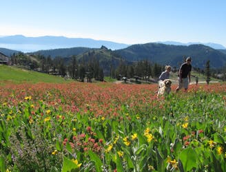
Easy hike from the top of the tram, through flower-filled meadows with a view of Lake Tahoe.
Easy Hiking

Forested canyon with a flowing creek where an isolated mining town used to thrive, leading to a panoramic mountain pass.
Moderate Hiking

8 routes · Hiking
6 routes · Mountain Biking · Hiking

14 routes · Hiking
4 routes · Hiking

5 routes · Alpine Climbing · Hiking
5 routes · Hiking

72 routes · Hiking