Upper Grizzly Bowl

Technical Entry into alternative portion of Grizzly Bowl
Severe Freeride Skiing
- Distance
- 630 m
- Ascent
- 3 m
- Descent
- 181 m
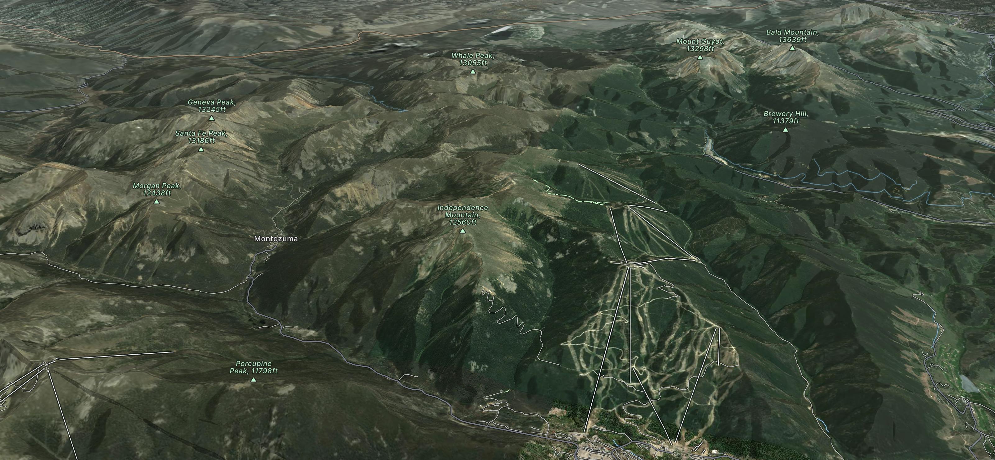
The largest mountain in Summit County offering 3,148 skiable acres, 20 lifts and two gondolas, all nestled at the foot of 2 unique villages.
Explore Keystone with curated guides of the best mountain bike trails, ski routes, and more. With over 41 3D trail maps in FATMAP, you can easily discover and navigate the best trails in Keystone.
No matter what your next adventure has in store, you can find a guide on FATMAP to help you plan your next epic trip.
Get a top trail recommendation in Keystone from one of our 7 guidebooks, or get inspired by the 41 local adventures uploaded by the FATMAP community. Start exploring now!
Technical Entry into alternative portion of Grizzly Bowl
Severe Freeride Skiing

Fantastic Bowl Option in Keystone Adjacent Backcountry Zone
Difficult Freeride Skiing

Steep Corniced Backcountry Bowl
Difficult Freeride Skiing

Steep Chute in adjacent Keystone Backcountry Zone
Difficult Freeride Skiing

Rocky Southeast facing chutes in Keystone Backcountry Zone
Severe Freeride Skiing

Rocky South Facing Chutes in Keystone Backcountry Zone
Severe Freeride Skiing

By far the gnarliest line in this Keystone-Adjacent Backcountry Zone
Extreme Freeride Skiing

More trees next to Wolverine.
Moderate Freeride Skiing

Excellent trees with enough snow.
Moderate Freeride Skiing