4 m away
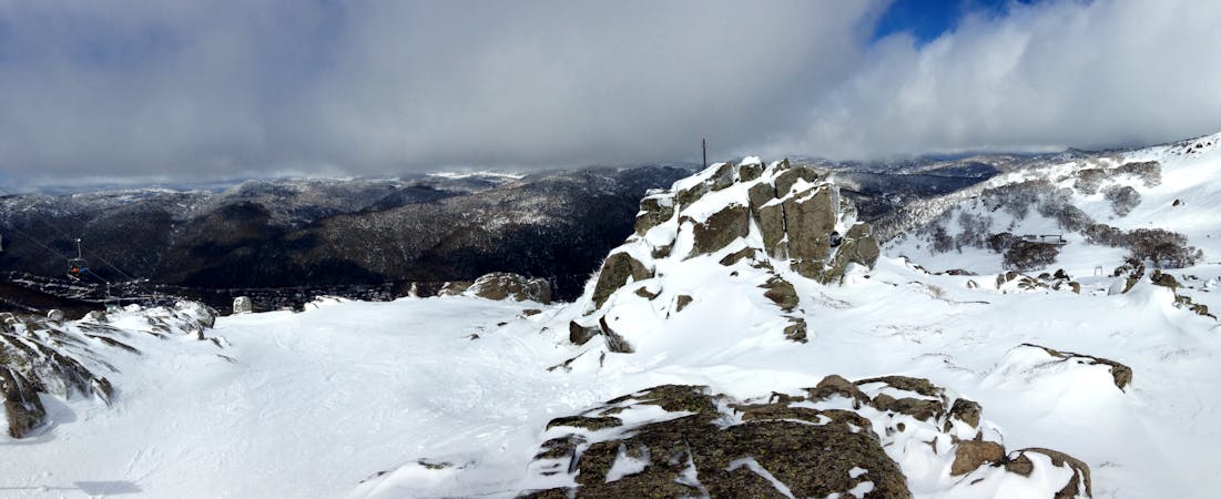
The Alice Rawson Run

A fantastic run with consistent fall line from Alice Rawson Peak, down into Lady Northcote Canyon
Difficult Freeride Skiing
- Distance
- 1.3 km
- Ascent
- 0 m
- Descent
- 550 m
Heading north west, then hooking southwest off Alice Rawson Peak, this run provides fews and the vertical to boot.
Freeride Skiing Difficult

Providing over 500 metres of vertical in a good year, this run can be absolutely brilliant in the right conditions. Facing west, and as a result copping the full force of the westerly prevailing winds, this area loses snow quickly in spring, unless it has been a truly great year. Dropping off to the north west along the obvious spur for the peak itself, then then line the cuts to the southwest. This area provides some really nicely spaced trees lower down, yet at the same time the top section is and can be quite harmful. The snow further down gets quite thin later in the season, however the south westerly faces can not do that. Follow the ridge line down and you will have no issues whatsoever, just take care of lurking hazards beneath the snow, including some pretty hefty boulders. The best return for this run is to hike/skin straight up the way you came.
Difficult
Serious gradient of 30-38 degrees where a real risk of slipping exists.

As well as the slope itself, there are some obstacles (such as rock outcrops) which could aggravate injury.
Away from help but easily accessed.
4 m away
A fantastic run with consistent fall line from Alice Rawson Peak, down into Lady Northcote Canyon
Difficult Freeride Skiing
4 m away

450 vertical metres of well graded skiing down towards Lady Northcote Canyon
Difficult Freeride Skiing
4 m away

Leading off the north spur to the west with wide lines available and views out across the plains
Moderate Freeride Skiing
227 m away

Really nice terrain giving way to gladed areas at a nice sustained pitch.
Moderate Freeride Skiing
233 m away

Another classic off piste run, with incredible views down the valley to boot.
Difficult Freeride Skiing
625 m away

Off Townsend North Spur, this run follows a steep drainage gully eastwards into Lady Northcote Canyon.
Difficult Freeride Skiing
743 m away

A real favourite in the right conditions, a great gullied run from the shoulder of Townsend down to Lake Albina.
Difficult Freeride Skiing
900 m away

From the summit of Townsend, this run provides 500 metres of continuous fall line, some of the highest on the range
Difficult Freeride Skiing
903 m away

Heading west off the summit of Townsend this drops into the bowl left towards Abbott Peak
Moderate Freeride Skiing
1.7 km away

A canyon like rocky gully which feeds down from the bowl to Lady Northcote Canyon
Moderate Freeride Skiing
34 routes · Freeride Skiing · Ski Touring