3 m away
Townsend West Face

From the summit of Townsend, this run provides 500 metres of continuous fall line, some of the highest on the range
Difficult Freeride Skiing
- Distance
- 1.6 km
- Ascent
- 0 m
- Descent
- 445 m
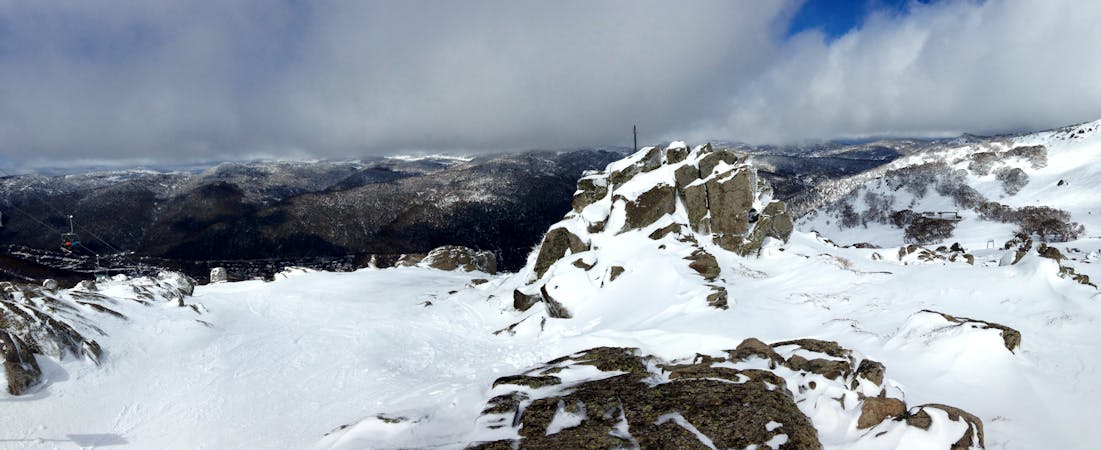
Heading west off the summit of Townsend this drops into the bowl left towards Abbott Peak
Freeride Skiing Moderate

Leading out west between Abbott Peak and Mt Townsend this run can grant about 500 metres of vertical with incredible views out over the range, and can often catch snow which blows into the bowl after a snow storm, despite its westerly exposure. The easiest access point is to drop down directly towards Abbott Peak from Townsend to the saddle between the two peaks, from there I would suggest sticking to the skiers right side of the gully, as lower down the trees getting thicker far faster on the left hand side costing you some vertical, and snow can hold better on the more southerly facing right hand side. That being said, this run can hold sharks lurking beneath the cover, and is best skied when there is at least one metre of snow at Spencer's Creek, but of course make sure you scout conditions whilst you are there. For the adrenaline seekers, another option to access this area is from the top of Townsend, head along the ridge line in between the West Face and the Gully, (make sure you have good visibility for this one) and as you ski down you will see a sort of saddle before the ridge drops down after the approaching knoll. Swing left before the obvious rocky outcrop and you will see a nice wide chute of sorts, which gives a bit of a kick to an otherwise mellower run. Make sure you have the conditions right for this one, it can sometimes hold really, really nice snow, whilst other times can be icy as hell. Negotiate the rocks, and you will find a relatively open slope down towards the creek. The best return route is to hike back up the drainage gully to the saddle between Abbott and Townsend. Take care in early and late season, and always assess snow conditions.
Moderate
Slopes become slightly steeper at around 25-30 degrees.

As well as the slope itself, there are some obstacles (such as rock outcrops) which could aggravate injury.

Little chance of being seen or helped in case of an accident.
3 m away
From the summit of Townsend, this run provides 500 metres of continuous fall line, some of the highest on the range
Difficult Freeride Skiing
212 m away

A real favourite in the right conditions, a great gullied run from the shoulder of Townsend down to Lake Albina.
Difficult Freeride Skiing
675 m away

Another classic off piste run, with incredible views down the valley to boot.
Difficult Freeride Skiing
899 m away

A fantastic run with consistent fall line from Alice Rawson Peak, down into Lady Northcote Canyon
Difficult Freeride Skiing
901 m away

Leading off the north spur to the west with wide lines available and views out across the plains
Moderate Freeride Skiing
902 m away

450 vertical metres of well graded skiing down towards Lady Northcote Canyon
Difficult Freeride Skiing
903 m away

Heading north west, then hooking southwest off Alice Rawson Peak, this run provides fews and the vertical to boot.
Difficult Freeride Skiing
1.1 km away

Really nice terrain giving way to gladed areas at a nice sustained pitch.
Moderate Freeride Skiing
1.5 km away

Off Townsend North Spur, this run follows a steep drainage gully eastwards into Lady Northcote Canyon.
Difficult Freeride Skiing
2.4 km away

A canyon like rocky gully which feeds down from the bowl to Lady Northcote Canyon
Moderate Freeride Skiing
34 routes · Freeride Skiing · Ski Touring