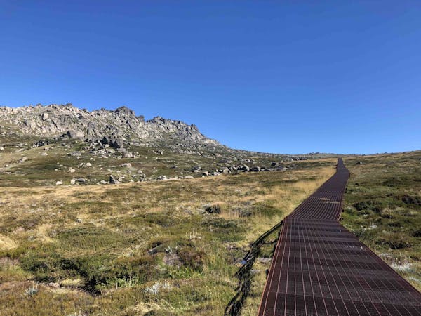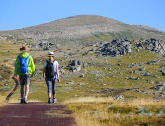
A hike to the highest point in Australia, the Mount Kosciuszko summit walk offers beautiful views and a good challenge for hikers of all abilities.
Moderate Hiking
- Distance
- 19 km
- Ascent
- 426 m
- Descent
- 427 m

Some of the most unforgiving lines on the continent.
Extreme Freeride Skiing
- Distance
- 294 m
- Ascent
- 0 m
- Descent
- 206 m

Following a narrow gully running down from Twynam, The Scimitar plummets down for over 400 metres of vertical to Watson's Creek
Difficult Freeride Skiing
- Distance
- 1.3 km
- Ascent
- 1 m
- Descent
- 436 m

Offering some of the greatest continuous fall line in Australia, The Triple A is fantastic in Spring, holding a consistent pitch all the way through.
Difficult Freeride Skiing
- Distance
- 1.3 km
- Ascent
- 1 m
- Descent
- 430 m

Off Townsend North Spur, this run follows a steep drainage gully eastwards into Lady Northcote Canyon.
Difficult Freeride Skiing
- Distance
- 960 m
- Ascent
- 14 m
- Descent
- 424 m

A fantastic run with consistent fall line from Alice Rawson Peak, down into Lady Northcote Canyon
Difficult Freeride Skiing
- Distance
- 1.3 km
- Ascent
- 0 m
- Descent
- 550 m

450 vertical metres of well graded skiing down towards Lady Northcote Canyon
Difficult Freeride Skiing
- Distance
- 918 m
- Ascent
- 0 m
- Descent
- 381 m

Leading off the north spur to the west with wide lines available and views out across the plains
Moderate Freeride Skiing
- Distance
- 1.4 km
- Ascent
- 0 m
- Descent
- 450 m