41 m away
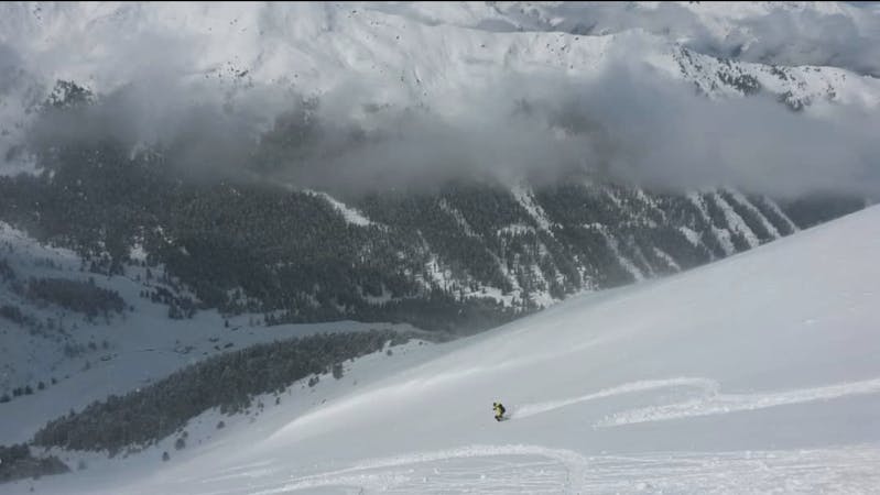
Rinne 1
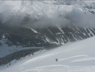
A VERY narrow and exciting couloir!
Severe Freeride Skiing
- Distance
- 620 m
- Ascent
- 0 m
- Descent
- 267 m
A steep and often rocky line which is great in a fat snow year.
Freeride Skiing Severe

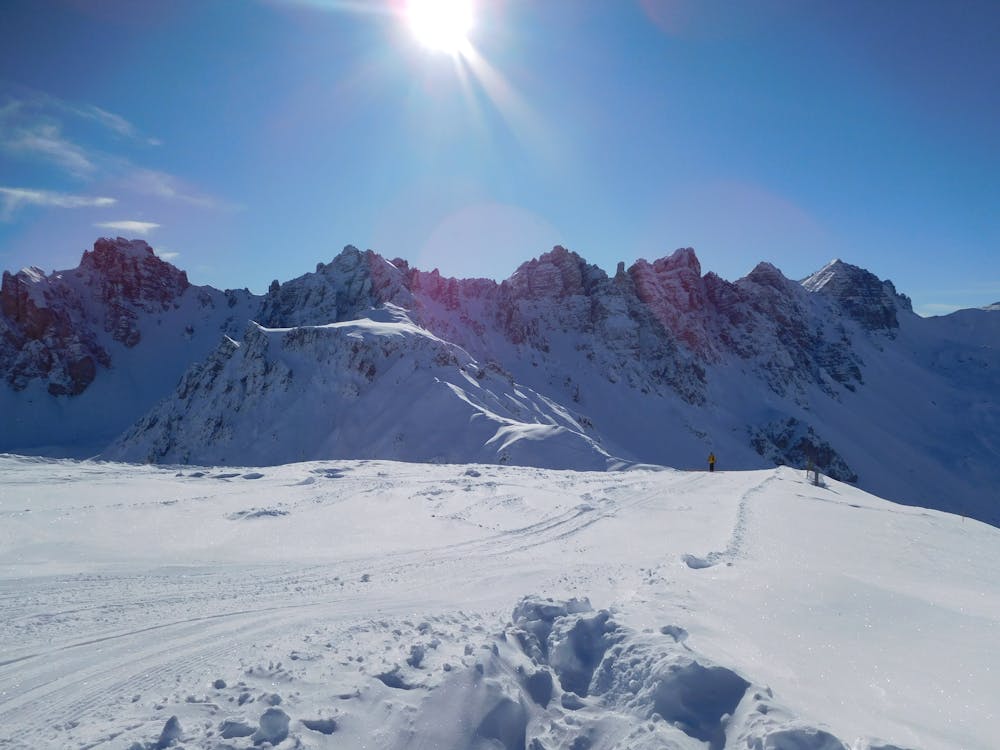
From the Hoadlhaus restaurant (2340 metres), ski south down the Olympia Abfahrt Damen piste for 1 minute to reach the HoadlSattel col (2264 metres), where the piste bends sharply to the left. At the Hoadlsattel, take your skis off, put them on your rucksack (there's a short and easy rocky scramble on the bootpack so carrying skis on your shoulder isn't advised - you'll need your hands free) and start hiking southwards along the snowy ridge that is straight ahead. Hike for 10 minutes on the low angled ridge crest and then, when you reach a steeper, rockier section, drift right and climb up through a 10 metre rock band via a short little gully. This is easy enough but can feel a bit exposed in icy conditions and you'll be glad of having strapped your skis to your rucksack so that you have your hands free. If the rock step looks too icy and difficult, it's also possible to traverse around it to the right (west) and then climb back up onto the ridge crest on the far side of it. Whether you go through or around the rock band, both options lead to a 10 metre wide col. Rinne 2 drops in from here. For Rinne 1, carry on hiking south up a 20 metre slope to reach a large, flat plateau with stunning views of the Kalkogel peaks. Walk out into the middle of this then go due north for 50 metres to reach the northern edge of the plateau. The line is now on your left, and is accessed between 2 small rock towers. Put your skis on and inch into the line. It is steep (40 degrees +) initially and is rocky in all but the best of conditions. Ski carefully down and left for 40 metres, heading for the main couloir section of the line. Once into the main couloir the angle eases to 35 - 40 degrees. Ski the couloir, which gradually opens for its entire length, for 200 vertical metres all the way down to the flatter terrain above the Dohlennest bar. Cruise down to the bar and grab a beer!
Severe
Steep skiing at 38-45 degrees. This requires very good technique and the risk of falling has serious consequences.

As well as the slope itself, there are some obstacles (such as rock outcrops) which could aggravate injury.

Little chance of being seen or helped in case of an accident.
41 m away
A VERY narrow and exciting couloir!
Severe Freeride Skiing
43 m away

A lovely, open slope in a wild range of rocky peaks.
Difficult Freeride Skiing
160 m away

A cracking little couloir which feels atmospheric and exciting.
Difficult Freeride Skiing
227 m away

A tricky little couloir which will test your ability to perform tight turns.
Difficult Freeride Skiing
302 m away

A lovely, wide couloir with a steep section makes this a good place to test your readiness for the tougher lines around here.
Difficult Freeride Skiing
345 m away

An easy, access, open couloir.
Difficult Freeride Skiing
403 m away

A steep and exciting couloir.
Severe Freeride Skiing
499 m away
The access hike for over a dozen freeride lines and ski tours.
Moderate Freeride Skiing
506 m away
A variety of routes leading down to a stunningly positioned mountain hut.
Difficult Freeride Skiing
842 m away

Easily accessed freeride terrain which holds good snow for days after a storm
Difficult Freeride Skiing

7 routes · Freeride Skiing
10 routes · Freeride Skiing

10 routes · Freeride Skiing