79 m away
Rinne 4

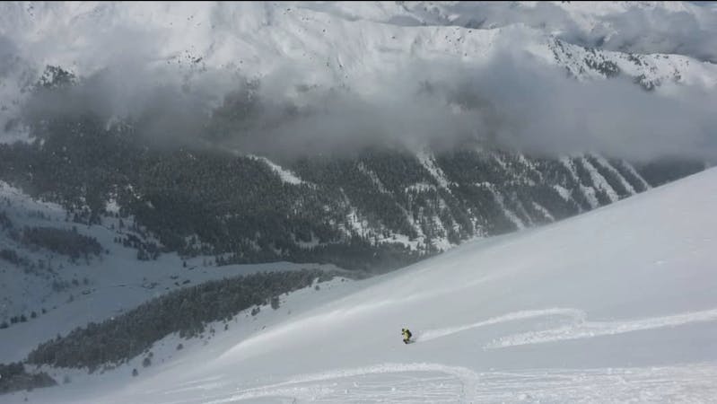
A lovely, wide couloir with a steep section makes this a good place to test your readiness for the tougher lines around here.
Difficult Freeride Skiing
- Distance
- 360 m
- Ascent
- 0 m
- Descent
- 167 m
A tricky little couloir which will test your ability to perform tight turns.
Freeride Skiing Difficult

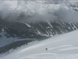
From the Hoadlhaus restaurant (2340 metres), ski south down the Olympia Abfahrt Damen piste for 1 minute to reach the HoadlSattel col (2264 metres), where the piste bends sharply to the left. At the Hoadlsattel, take your skis off and start hiking southwards along the snowy ridge that is straight ahead. Hike for 7 - 8 minutes on the low angled ridge crest and then, when you reach a vague col as the ridge begins to steepen towards a steeper, rockier section, the line is on the left. It often has thinner snow cover than other lines around here so if it looks thin, it's easy enough to detour to a different line. If there's enough snow, the line starts quite wide (10 metres-ish) and then, after 50 vertical metres it bends right and gets narrower for 100 vertical metres before opening up and fanning out into the open, low angled terrain above the Dohelnnest bar. Ski down to the bar and look back at your line - the angle never exceeds 40 degrees but it looks spectacular from below!
Difficult
Serious gradient of 30-38 degrees where a real risk of slipping exists.

As well as the slope itself, there are some obstacles (such as rock outcrops) which could aggravate injury.
Away from help but easily accessed.
79 m away
A lovely, wide couloir with a steep section makes this a good place to test your readiness for the tougher lines around here.
Difficult Freeride Skiing
88 m away

A cracking little couloir which feels atmospheric and exciting.
Difficult Freeride Skiing
122 m away

An easy, access, open couloir.
Difficult Freeride Skiing
226 m away
A VERY narrow and exciting couloir!
Severe Freeride Skiing
227 m away
A steep and often rocky line which is great in a fat snow year.
Severe Freeride Skiing
233 m away

A lovely, open slope in a wild range of rocky peaks.
Difficult Freeride Skiing
277 m away
The access hike for over a dozen freeride lines and ski tours.
Moderate Freeride Skiing
282 m away
A variety of routes leading down to a stunningly positioned mountain hut.
Difficult Freeride Skiing
620 m away

A steep and exciting couloir.
Severe Freeride Skiing
691 m away

Easily accessed freeride terrain which holds good snow for days after a storm
Difficult Freeride Skiing

7 routes · Freeride Skiing
10 routes · Freeride Skiing

10 routes · Freeride Skiing