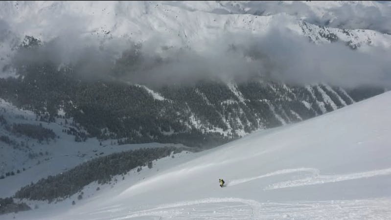
7 m away
Ost Wand

A lovely, open slope in a wild range of rocky peaks.
Difficult Freeride Skiing
- Distance
- 1.1 km
- Ascent
- 0 m
- Descent
- 290 m
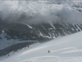
A VERY narrow and exciting couloir!
Freeride Skiing Severe

Follow Plateau Hike to the plateau above this line. Pole east across the plateau and very carefully locate the col at the top of this route. Provided there is enough snow, and that that snow is stable, sideslip into the line. Conditions are rarely good and safe so be fully prepared to bail into a different objective if this line doesn't look right.
If you do drop in, you won't get lost - the couloir is very narrow (less than 4 metres at one point) and steep with it. Ski carefully but try to enjoy the extraordinary ambience this line provides.
Once at the bottom, traverse out left above the Dohlen Lake to rejoin the pistes.
Severe
Steep skiing at 38-45 degrees. This requires very good technique and the risk of falling has serious consequences.

As well as the slope itself, there are some obstacles (such as rock outcrops) which could aggravate injury.

Little chance of being seen or helped in case of an accident.
7 m away
A lovely, open slope in a wild range of rocky peaks.
Difficult Freeride Skiing
41 m away
A steep and often rocky line which is great in a fat snow year.
Severe Freeride Skiing
149 m away

A cracking little couloir which feels atmospheric and exciting.
Difficult Freeride Skiing
226 m away

A tricky little couloir which will test your ability to perform tight turns.
Difficult Freeride Skiing
304 m away

A lovely, wide couloir with a steep section makes this a good place to test your readiness for the tougher lines around here.
Difficult Freeride Skiing
348 m away

An easy, access, open couloir.
Difficult Freeride Skiing
394 m away

A steep and exciting couloir.
Severe Freeride Skiing
503 m away
The access hike for over a dozen freeride lines and ski tours.
Moderate Freeride Skiing
508 m away
A variety of routes leading down to a stunningly positioned mountain hut.
Difficult Freeride Skiing
867 m away

Easily accessed freeride terrain which holds good snow for days after a storm
Difficult Freeride Skiing

7 routes · Freeride Skiing
10 routes · Freeride Skiing

10 routes · Freeride Skiing