13 m away
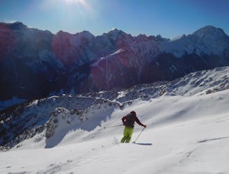
Hoher Burgstall Sud 1

Hoher Sud 1
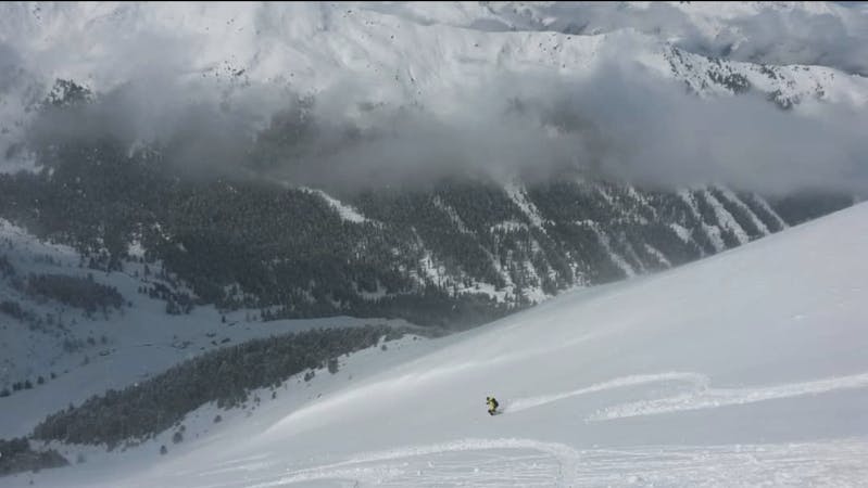
Difficult Freeride Skiing
- Distance
- 1.2 km
- Ascent
- 1 m
- Descent
- 498 m
An excellent little line which is well worth the 10 minute access hike.
Freeride Skiing Difficult

From the top of the Zirmachbahn chairlift, take your skis off and start hiking up the broad ridge to the south-west. Hike up the ridge for 10 minutes to a vague, wide col and drop in here. The line is initially quite steep (35 degrees+) but soon mellows down to 30 but it also narrows so steep, wide turns merge wonderfully into tighter ones. The run is 150 vertical metres and drops you out on the Burgstall Abfahrt piste.
Difficult
Serious gradient of 30-38 degrees where a real risk of slipping exists.

Exposure is limited to that of the slope itself. Getting hurt is still likely if the slope is steep and/or the snow is hard.
Close to help in case of emergency.
13 m away
Hoher Sud 1
Difficult Freeride Skiing
51 m away

A great, narrow couloir and then some brilliant tree skiing.
Difficult Freeride Skiing
79 m away

A fun little variant.
Moderate Freeride Skiing
257 m away
A stunning run with one of the best hike:fun ratios of any freeride line in Austria.
Difficult Freeride Skiing
300 m away

The access hike for 4 freeride lines.
Moderate Freeride Skiing
301 m away

A wide, open and easy slope which usually has lovely snow.
Easy Freeride Skiing
1.4 km away

A fun line that follows an opening through a forest.
Moderate Freeride Skiing
1.5 km away

A short tree run which serves as a good warmup.
Moderate Freeride Skiing
4.2 km away

A steep and exciting couloir.
Severe Freeride Skiing
4.5 km away

A lovely, open slope in a wild range of rocky peaks.
Difficult Freeride Skiing

7 routes · Freeride Skiing

50 routes · Freeride Skiing · Ski Touring
10 routes · Freeride Skiing

10 routes · Freeride Skiing