5.8 km away
Gschnitz to the Innsbrucker Hütte
A long uphill trip which accesses a beautiful hut.
Moderate Hiking
- Distance
- 5.5 km
- Ascent
- 1.1 km
- Descent
- 0 m
An easy ridge hike on the border between Italy and Austria with opportunity for a refreshing dip.
Hiking Difficult

Start of the route is at the end of the Obernberg valley close to the Gasthof Waldesruh. You can get there with the bus (nr. 4145) from Steinach am Brenner or by car.
From the big parking lot the route follows the trail in direction of the famous Obernberg lake. Crossing several streams, the trail gently follows the terrain upwards until it reaches the lake, which is famous for its location in between the Lorenzberg and the mighty Tribulaun.
Keep on following the eastern lakeside for a short time, until the gravel road offers the opportunity to turn left (east) onto a smaller trail. Sadly, the restaurant you’ll pass closed a while ago.
As this trail crosses several gravel roads it aims for the grassy ridge. Make sure to keep going uphill onto this small trail.
Every step brings you closer to the tree line and the ridge. As the view opens onto the grassy back the trail follows the ridge south until you’ll reach the first little peak, the Allerleigrubenspitze (Ballons Shooting).
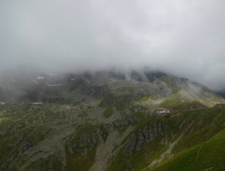
The trail continues on the ridge for a longer time, passing by the Koatnerberg peak and offers a wide view over the surrounding mountains.
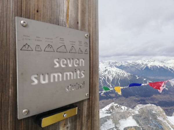
The ridge, with its mellow meadows, guides us directly to the Hoher Lorenzberg summit. This peak sits on the boarder to Italy and offers a view onto the south-tyrollean part of Italy.
Take the trail to the right (west) down, on which you pass the Monte San Lorenzino peak. As the trail reaches the col, turn right (north) and start the steep descent down into the valley.
You’ll then take the direct route to the Obernberger lake. You may enjoy a refreshing dip here and take a deserved rest by the lakeside. If you want to take the photo every visitor took here, you should visit the chapel in between the smaller and bigger part of the lake, which is indeed picturesque!
The route ends with a short walk fro the lake back to the starting point near the Gasthof Wladesruh.
Difficult
Hiking trails where obstacles such as rocks or roots are prevalent. Some obstacles can require care to step over or around. At times, the trail can be worn and eroded. The grade of the trail is generally quite steep, and can often lead to strenuous hiking.

The trail contains some obstacles such as outcroppings and rock which could cause injury.
Away from help but easily accessed.
5.8 km away
A long uphill trip which accesses a beautiful hut.
Moderate Hiking
8.7 km away

A must-do for all wildflower lovers as the Blaser is known as the most beautiful flower-mountain in Tirol.
Moderate Hiking
9 routes · Alpine Climbing · Hiking