5.8 km away
Hoher Lorenzenberg via Koatnerberg

An easy ridge hike on the border between Italy and Austria with opportunity for a refreshing dip.
Difficult Hiking
- Distance
- 14 km
- Ascent
- 1 km
- Descent
- 1 km
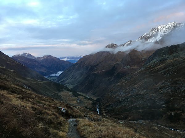
A long uphill trip which accesses a beautiful hut.
Hiking Moderate

The impressive bulk of Habicht can be easily spotted from Innsbruck and the 3277m peak is one of the most dominant in the Stubai range. Being one of the easier 3000m peaks in the area, Habicht is a popular tick for mountaineers in Austria, however it is not without danger with many exposed sections and some of the route is also over glaciated terrain, so it should not be undertaken lightly.
Habicht can be approached from one of two directions, either starting from Neustift to the north and making use of the cable car, or by starting from the village of Gschnitz, to the east of the peak. Of course either route can be used for both the ascent and descent, but the most interesting and enjoyable option, as described here, begins in Gschnitz and finishes in Neustift. This is easily managed using public transport and provides more of an adventure than a simple there and back route.
Begin at the Catholic Church at the western end of Gschnitz and continue along the road for 400m in the direction of Gurns to find a large parking area on the right hand side, where the Innsbrucker Hütte is clearly signposted.
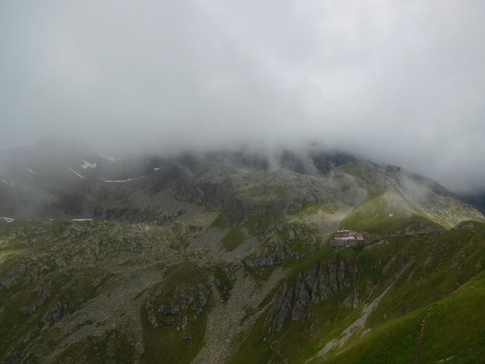
Follow this fairly steep path as it winds up the hillside. The way is always clear with few subsidiary paths, but it does become a little exposed in places. Continue for around 3 hours, which can feel like quite a slog, but eventually, just after rounding a long right hand bend, the Innsbrucker Hütte comes into sight, with only a further 10 minutes walk to reach it. The hut itself is a pretty substantial building, nestled into the surrounding mountains and enjoying some absolutely spectacular scenery. It sleeps around 130 people in a combination of large dorms and smaller private rooms, but it is a popular spot so be sure to book ahead to avoid disappointment.
Moderate
Hiking along trails with some uneven terrain and small hills. Small rocks and roots may be present.

The trail contains some obstacles such as outcroppings and rock which could cause injury.

Little chance of being seen or helped in case of an accident.
5.8 km away
An easy ridge hike on the border between Italy and Austria with opportunity for a refreshing dip.
Difficult Hiking
6.6 km away
A wonderful, mid-length, circular hike with impressive scenery through the dramatic peaks of the Stubai Valley.
Difficult Hiking
7 km away

A must-do for all wildflower lovers as the Blaser is known as the most beautiful flower-mountain in Tirol.
Moderate Hiking
9.2 km away

One of the smaller hiking tours in Stubaital to the beautiful Kaserstattalm.
Difficult Hiking
9.5 km away
A family friendly hike to a traditional hut alongside the Längental stream.
Easy Hiking
9 routes · Alpine Climbing · Hiking
3 routes · Mountain Biking · Hiking
7 routes · Hiking