8.6 km away
Walder Joch Loop
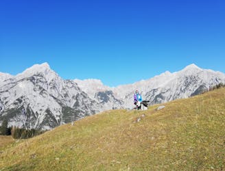
A scenic and peaceful day hike which takes you from some of the Tirol’s busiest trails to some its quietest!
Difficult Hiking
- Distance
- 17 km
- Ascent
- 901 m
- Descent
- 900 m
A wild and remote peak which is tricky by any route
Hiking Extreme

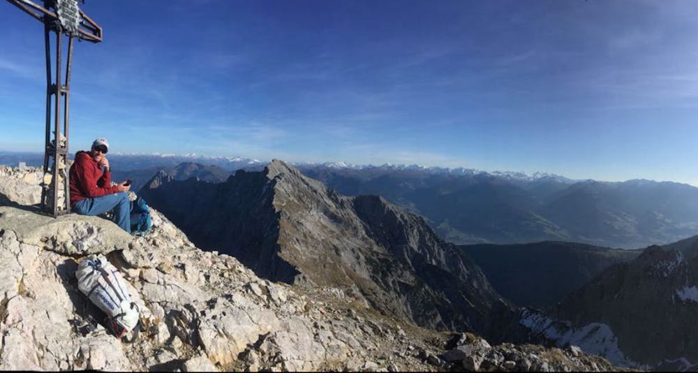
Nestled deep in the Karwendel, difficult to climb by any route and a long hike from just about anywhere, the Lamsenspitze is a wild peak. Climbing it by this route - the easiest on the mountain - starts at the Alpengasthof Gramaialm; a welcoming spot offering ample parking and excellent food!
From the parking area make the long, steep and occasionally scree-covered ascent to the Lamsenjochhütte. The hut isn't visible until you're almost on top of it and sits in a stunning bowl beneath some spectacular cliffs. It is possible to stay at the hut but most people do this route as a "oner".
If the hut is open then grab a quick bite to eat and then climb up a rocky track which ascends a wide scree slope beneath the Lamsenspitze's east face. At the northern end of the face is the mountain's north-east ridge - a classic easy climbing route which features a lot of scrambling and a couple of pitches of UIAA IV rock climbing.
Cross beneath the east face and traverse up to a notch with a fabulous view towards the Inn valley. Hang a right and make an exposed but easy traverse beneath the south face of the Lamsenspitze. Once directly under the summit the trail turns north and leads you via some cable-protected sections of UIAA I - II scrambling to the peak. This final section is usually done without via ferrata equipment - just hold on tight to the cable, take your time and concentrate.
Once on the summit the view is almost overwhelming, with the towns of the Inn valley to the south providing a complete contrast to the desolate peaks of the Karwendel to the north. If you've got some time to spare then using FATMAP to really orientate yourself from the top is well worth doing, and should provide you plenty of inspiration for future adventures.
Once you're done admiring the view, carefully descend the same way you came up and head down for a weissbier at the Alpengasthof Gramaialm!
Extreme
Scrambling up mountains and along technical trails with moderate fall exposure. Handholds are necessary to navigate the trail in its entirety, although they are not necessary at all times. Some obstacles can be very large and difficult to navigate, and the grades can often be near-vertical. The challenge of the trail and the steepness of the grade results in very strenuous hiking. Hikes of this difficulty blur the lines between "hiking" and "climbing".

Some trail sections have exposed ledges or steep ascents/descents where falling could cause serious injury.
Little chance of being seen or helped in case of an accident.
8.6 km away
A scenic and peaceful day hike which takes you from some of the Tirol’s busiest trails to some its quietest!
Difficult Hiking
9.2 km away
An atmospheric walk through the forest to a breathtakingly positioned hut
Moderate Hiking
3 routes · Hiking

7 routes · Alpine Climbing · Mountain Biking · Hiking · Trail Running

25 routes · Hiking