2.1 km away
Walder Joch Loop
A scenic and peaceful day hike which takes you from some of the Tirol’s busiest trails to some its quietest!
Difficult Hiking
- Distance
- 17 km
- Ascent
- 901 m
- Descent
- 900 m
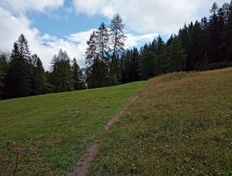
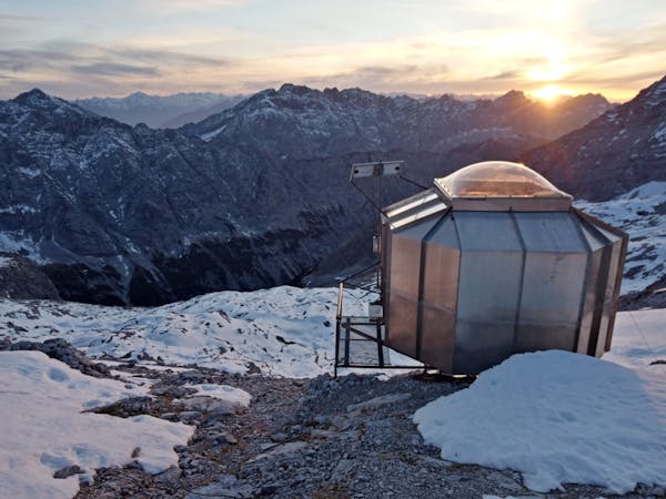
An atmospheric walk through the forest to a breathtakingly positioned hut
Hiking Moderate

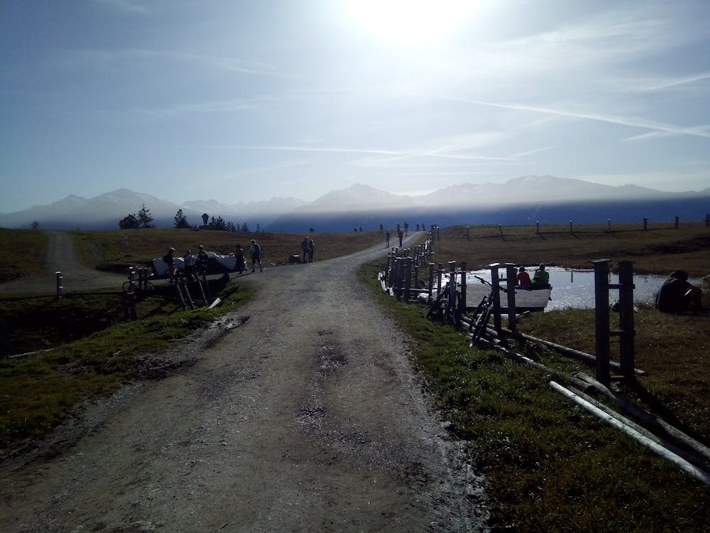
The Walder Alm enjoys one of the finest views of any hut in the Inn valley, but this hike is also an excellent option in wet weather because most of it is in the trees not overly exposed to the conditions.
Park up in Kranzach and follow the clear but steep trail which winds up through the woods. The trail is always close to, and crosses several times, a jeep track which is usually busy with e-bikers. If the hiking track is slippery or in some other way not in good condition, following the jeep track is an easier but slightly tedious alternative.
Eventually the trail and the jeep track both emerge from the forest and lead you onto stunning alpine meadows just to the south of the Walder Alm. Continue up to the hut which - in good weather - will have tables all around it packed with hikers and bikers enjoying a bite to eat. The hut is actually pretty small and very rustic, but the flat area around it means that hundreds of people can enjoy its hospitality when the weather is good. If it's raining, you could well have the place to yourself and the ambience is totally different.
Whether you share it or have exclusive use of it, the Walder Alm offers a warm welcome and the typical array of Tirolian delights. Sample your favourite and then head back down the same way to the road. If you want to extend the hike then making the 20 minute stroll to the Hinterhorn Alm is a good option.
Moderate
Hiking along trails with some uneven terrain and small hills. Small rocks and roots may be present.

The path is on completely flat land and potential injury is limited to falling over.

Away from help but easily accessed.
2.1 km away
A scenic and peaceful day hike which takes you from some of the Tirol’s busiest trails to some its quietest!
Difficult Hiking
5.3 km away
A big day out through some of the finest scenery in Austria.
Severe Hiking
5.4 km away
A long and utterly wild adventure through some stunning, remote terrain.
Extreme Hiking
5.4 km away
A gorgeous trip through a wild valley.
Difficult Hiking
5.8 km away
An adventurous hike to a scenic peak!
Severe Hiking
9.2 km away
A long and scenic journey between some of Tirol's finest huts.
Difficult Hiking
9.2 km away
A wild and remote peak which is tricky by any route
Extreme Hiking
9.6 km away
A tough grind with an epic reward!
Difficult Hiking
3 routes · Hiking

7 routes · Alpine Climbing · Mountain Biking · Hiking · Trail Running

8 routes · Hiking

6 routes · Hiking

25 routes · Hiking
7 routes · Alpine Climbing · Mountain Biking · Hiking · Ski Touring