28 m away
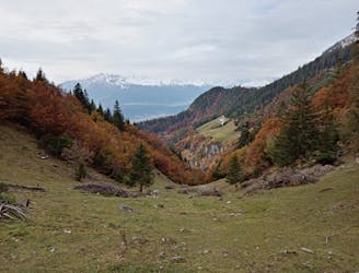
Issanger Loop
A gorgeous trip through a wild valley.
Difficult Hiking
- Distance
- 14 km
- Ascent
- 905 m
- Descent
- 905 m
A long and utterly wild adventure through some stunning, remote terrain.
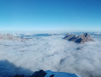
Hiking Extreme

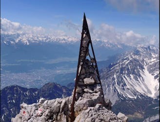
Make no mistake about it - this is a beast of a day and takes you through some remote and untamed mountains. As if the toughness of the terrain wasn't enough, it also has some logistical issues because it's linear and therefore requires a vehicle shuttle or drop-off. The payoff for overcoming the challenges is having one of the best and most adventurous hiking days you'll find anywhere in the Alps.
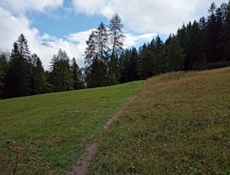
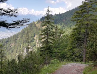
The day starts with a bit of a slog up the road in the lower section of the Halltal from Absam village, and although it's possible to get on and off this a couple of times and get yourself onto some sections of path, the fastest way to get it done is to stick on the road.
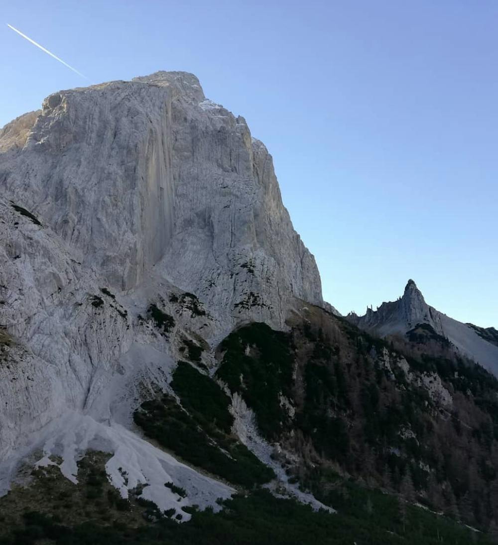
Follow the road all the way up to and then past the St Magdalena hut and then take the right hand valley as the Halltal splits. Follow a small path through some dense forests and then climb up to the stunning Lafatscher Joch col (a contender for the most scenic col accessible from Innsbruck) and soak in the epic mountain vistas all around.
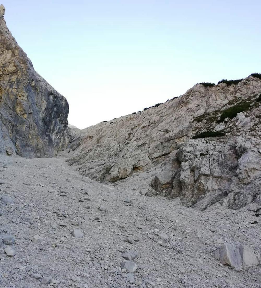
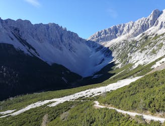
Drop off the back of the Lafatscher Joch and descend down to the Hallerangerhaus via a rocky path and then a scree-filled gully. The Hallerangerhaus is open in the summer and provides an extraordinary view across the nearby peaks. If you're passing here when the hut is open, stock up on calories and then wave goodbye to humans for a while - you're very unlikely to see any for a few hours!
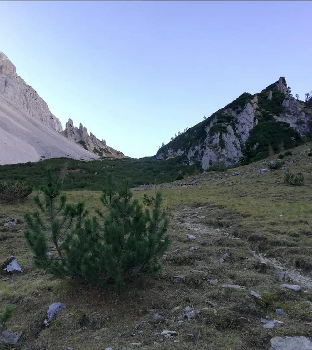
Climb up to the wide col east of the Hallerangerhaus and then follow a small trail which leads down alongside the Vomperbach river into a spectacular and desolate valley sandwiched between the Grubenkarspitze and Großer Bettelwurf peaks. The trail becomes increasingly vague as it drops down to the valley bottom and flattens out. At some stages a good nose of route finding is required which - along with the remoteness and exposed scrambling on the Knappensteig - make this firmly a route for experienced mountaineers.
After following the valley floor for a while, the trail turns right, heads uphill and the Knappensteig proper begins. The "trail" (if we're being generous with the term) climbs up broken slabs and across exposed ledges. At times the trail is clear but at other times you'll really need to sniff out the optimal route for yourself, following the occasional paint mark and a lot of intuition.
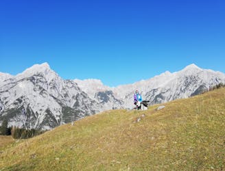
As the trail gets closer to the Walder Alm it gets increasingly clear, and it eventually becomes obvious that the toughest terrain lies behind you. Stroll triumphantly to Walder Alm and then, 20 minutes later, the Hinterhorn Alm, where a well deserved beer awaits!
Extreme
Scrambling up mountains and along technical trails with moderate fall exposure. Handholds are necessary to navigate the trail in its entirety, although they are not necessary at all times. Some obstacles can be very large and difficult to navigate, and the grades can often be near-vertical. The challenge of the trail and the steepness of the grade results in very strenuous hiking. Hikes of this difficulty blur the lines between "hiking" and "climbing".

Some trail sections are extremely exposed where falling will almost certainly result in serious injury or death.
In the high mountains or remote conditions, all individuals must be completely autonomous in every situation.
28 m away
A gorgeous trip through a wild valley.
Difficult Hiking
77 m away
A big day out through some of the finest scenery in Austria.
Severe Hiking
1.9 km away
An adventurous hike to a scenic peak!
Severe Hiking
3.8 km away
A long and scenic journey between some of Tirol's finest huts.
Difficult Hiking
4.5 km away
A scenic and peaceful day hike which takes you from some of the Tirol’s busiest trails to some its quietest!
Difficult Hiking
4.7 km away
A wonderful and wild hike which is best done using a bike for the approach and descent.
Difficult Hiking
5.4 km away
An atmospheric walk through the forest to a breathtakingly positioned hut
Moderate Hiking
5.8 km away
A gorgeous walk between 2 easily-accessed villages.
Moderate Hiking
6.1 km away

Sophisticated alpine hike that offers a great variation of landscapes ending in a ridge with moderate climbing passages.
Severe Hiking
7.6 km away
A tough grind with an epic reward!
Difficult Hiking
3 routes · Hiking

7 routes · Alpine Climbing · Mountain Biking · Hiking · Trail Running

8 routes · Hiking

9 routes · Hiking

6 routes · Hiking

25 routes · Hiking
7 routes · Alpine Climbing · Mountain Biking · Hiking · Ski Touring