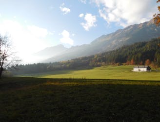
539 m away
Rum to Arzl
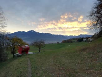
A gorgeous walk between 2 easily-accessed villages.
Moderate Hiking
- Distance
- 5.4 km
- Ascent
- 227 m
- Descent
- 309 m
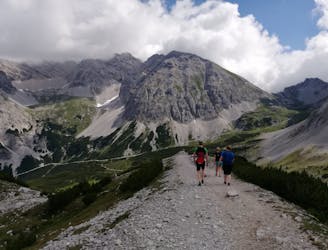
Sophisticated alpine hike that offers a great variation of landscapes ending in a ridge with moderate climbing passages.
Hiking Severe

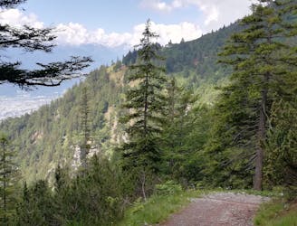
The trail starts at the big hiker’s car park in Arzl, where you’ll find the trail leading uphill from the middle of the parking lot. At the next crossroad, keep on walking strait forward heading to “Sennermahd / Rumer Alm”. The gravel road will soon be shortcutted by a slim path, enabling a fast gain of height. The path steeply leads you uphill onto a woody mountain ridge.
Shortly before you reach the Rumer Alm, continue on the gravel road to the right (east), passing a private mountain cabin. The trail then turns left onto a narrow path (218/5). After quite a long travers to the east in direction of the Vintl hut, you turn to the left and follow the signs leading to the Kreuzjöchl.
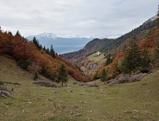
Several serpentines will bring you up to a rubble covered slope. Having crossed that, you will reach the Kreuzjöchl. Enjoy the stunning view into the Karwendel mountains and the valley of the Inn before you proceed walking on footprints (marked with “RSP”) towards the east ridge.
After a few serpentines, an easy climbing passage through a gutter will end on a flat ridge with red marks. Now you shortly head southwards to the steep summit ridge where you climb along the red marks (I-II) until the track gets easier again shortly before you reach the peak t at 2454m. The summit of the Rumer Spitze offers a devastating panorama with beautiful karstic mountains in every direction.
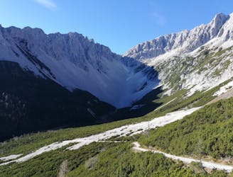
The beginning of the descent is not very difficult heading westwards on the ridge but getting more demanding and exposed. A wonderful climbing passage (II) is waiting for experienced mountaineers. The traverse of the Rumer Spitze from east to west demands a high level of sure foot as well as a head for heights and is the dream of those who enjoy the rougher mountain experiences.
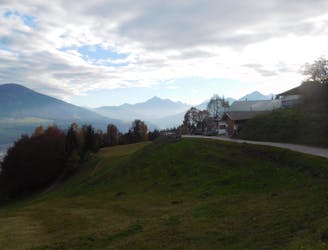
The trail then wiggles between the ridge an its sides until it ends up in alpine meadows at the lowest point of the Arzler saddle.
Here you can choose between never ending serpentines on the hiking path or an adventurous drive through the big debris field. On both ways you will reach a gravel road directing eastward to the Rumer hut. Having passed it, the trail reaches the pathway we took on the ascent, which will guide back down to the parking lot, where our day started.
Severe
Hiking challenging trails where simple scrambling, with the occasional use of the hands, is a distinct possibility. The trails are often filled with all manner of obstacles both small and large, and the hills are very steep. Obstacles and challenges are often unexpected and can be unpredictable.

Some trail sections are extremely exposed where falling will almost certainly result in serious injury or death.

Little chance of being seen or helped in case of an accident.
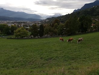
539 m away
A gorgeous walk between 2 easily-accessed villages.
Moderate Hiking
1.5 km away
A wonderful and wild hike which is best done using a bike for the approach and descent.
Difficult Hiking
2.4 km away
A long and scenic journey between some of Tirol's finest huts.
Difficult Hiking
3.3 km away
Possibly the most popular hike in Innsbruck and for good reason - this is a lovely little trip.
Moderate Hiking
3.3 km away
A lovely, easy traverse to a charming Tirolian town.
Moderate Hiking
3.3 km away
A lovely, sunny walk suitable for the whole family.
Moderate Hiking
4.9 km away
A classic Innsbruck hike to a charming mountain hut.
Difficult Hiking
4.9 km away
A long but incredibly rewarding trip through the Karwendel mountains.
Difficult Hiking
4.9 km away
A long and beautiful trip which is almost all downhill and stops at 2 traditional mountain huts.
Difficult Hiking
5.4 km away
A beautiful easy hike to a sunny vantage point above Innsbruck.
Easy Hiking

8 routes · Hiking

5 routes · Hiking

9 routes · Hiking

6 routes · Hiking

25 routes · Hiking