1.3 km away
Vintl Alm Loop
A long and scenic journey between some of Tirol's finest huts.
Difficult Hiking
- Distance
- 13 km
- Ascent
- 1 km
- Descent
- 1.1 km
A wonderful and wild hike which is best done using a bike for the approach and descent.
Hiking Difficult

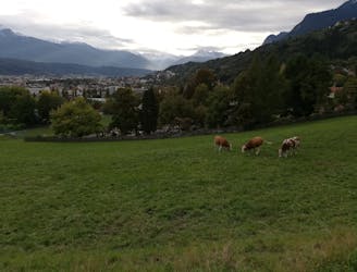
For those seeking a scenic hike to a beautiful summit within easy reach of Innsbruck, this is the trip for you. It also gives you a good excuse to go to the wonderful Thaurer Alm hut, which is always worth a visit.
The line is drawn here as a pure hike and it's still fun done that way, but it's even better if you bike up and down the lower section. If you bike up then ignore the line drawn here to the Thaurer Alm and simply follow the jeep track to the hut.
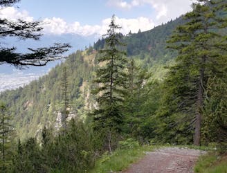
Regardless of how you reach the Thaurer Alm, head north-east away from it on a good track which leads you into a forest. If you've brought a bike then leave it at the edge of the forest.
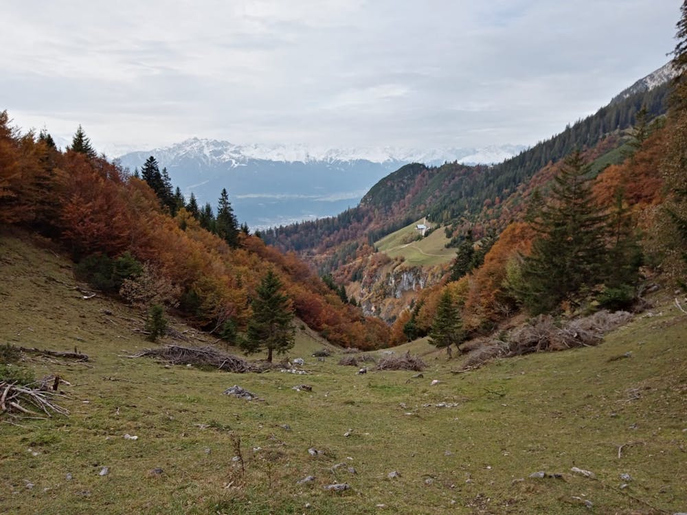
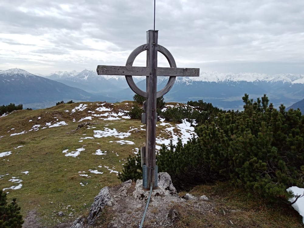
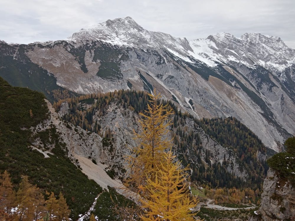
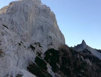
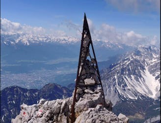
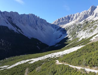
Continue hiking west-northwest up an initially good path which quickly becomes quite vague but is always marked by red and white paint dashes and leads you up to a col overlooking the rugged and wild Halltal valley (which itself is home to some great adventures, most of which are listed in FATMAP). Turn right from the col and keep climbing on a slightly more obvious path which winds up and around to the Thaurer Zunterkopf's south-west ridge. Climb this onto the summit plateau (which is much bigger than it looks from below) and onto the summit itself, which is marked with one of the traditional iron crosses which adorn so many Tirolian peaks. The view across the Inn valley to the south and the imposing peaks of the Halltal to the north is fantastic and, given that it's all downhill from here, you can enjoy the panorama knowing that there's no more grunt required.
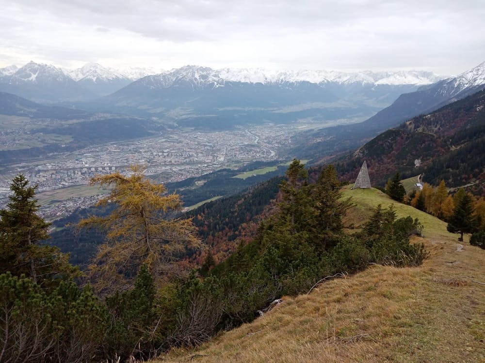
When you're done admiring the view, follow the ascent path down and then branch off it leftwards and make a steep and rocky descent down to the Kaisersäule - a huge stone pyramid which was built to commemorate the visit of Emperor Franz I to Hall in Tirol in 1815. The local tourism office tell you that the pyramid is 14 metres high. Their tape measure might be a little out but it's certainly very impressive!
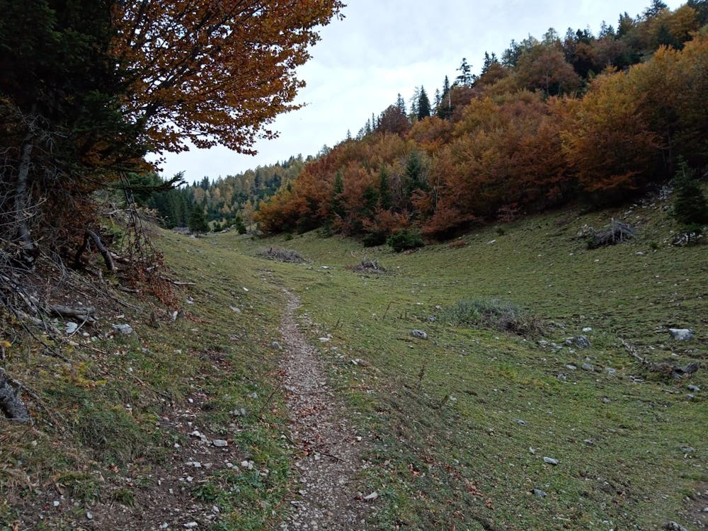
Descend from the Kaisersäule down to the Thaurer Alm and then down further to the valley (via a knödel and a drink!)
Difficult
Hiking trails where obstacles such as rocks or roots are prevalent. Some obstacles can require care to step over or around. At times, the trail can be worn and eroded. The grade of the trail is generally quite steep, and can often lead to strenuous hiking.

The trail contains some obstacles such as outcroppings and rock which could cause injury.

Little chance of being seen or helped in case of an accident.
1.3 km away
A long and scenic journey between some of Tirol's finest huts.
Difficult Hiking
1.4 km away
A gorgeous walk between 2 easily-accessed villages.
Moderate Hiking
1.5 km away

Sophisticated alpine hike that offers a great variation of landscapes ending in a ridge with moderate climbing passages.
Severe Hiking
4.7 km away
A gorgeous trip through a wild valley.
Difficult Hiking
4.7 km away
Possibly the most popular hike in Innsbruck and for good reason - this is a lovely little trip.
Moderate Hiking
4.7 km away
A lovely, easy traverse to a charming Tirolian town.
Moderate Hiking
4.7 km away
A long and utterly wild adventure through some stunning, remote terrain.
Extreme Hiking
4.8 km away
An adventurous hike to a scenic peak!
Severe Hiking
4.8 km away
A lovely, sunny walk suitable for the whole family.
Moderate Hiking
4.8 km away
A big day out through some of the finest scenery in Austria.
Severe Hiking

8 routes · Hiking

5 routes · Hiking

9 routes · Hiking

6 routes · Hiking

25 routes · Hiking
7 routes · Alpine Climbing · Mountain Biking · Hiking · Ski Touring