39 m away
Around the Zäunkopf to the Oberbrunnalm.
A short but physically challenging ride through some of the most rugged scenery in Austria.
Moderate Mountain Biking
- Distance
- 18 km
- Ascent
- 663 m
- Descent
- 663 m
A long and scenic ride into one of the most remote valleys in Austria
Mountain Biking Moderate

This is an epic ride scenery-wise and although it's not technically challenging, its remoteness and the lack of cell phone coverage throughout make it a serious proposition. Plan for a fun day but carry spares and prepare to be completely autonomous, particularly in the Roßlack valley itself. The ride is an excellent journey in its own right and also serves as the approach to the Laliderer Spitze and Dreizinkenspitze hike/climb.
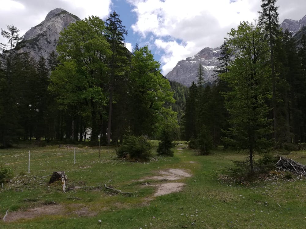
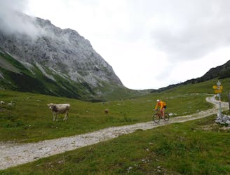
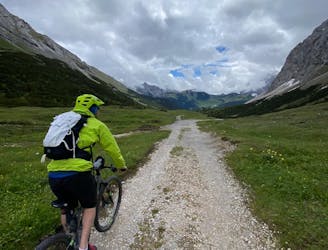
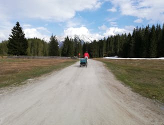
Start out in the village of Scharnitz, which can be easily reached from Austria or Germany by train or car. Follow Hinterautalstrasse (a road) east out of the village and into the deep and spectacular Hinterautal valley. The road quickly becomes a jeep track and keeps going almost due east.
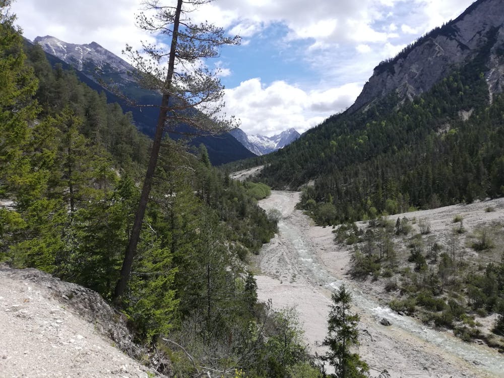
The scenery as you ride up the valley is fabulous and there are a couple of particularly impressive viewpoints overlooking the Isar river in the first half of the trip. As you get deeper into the valley the scenery becomes increasingly rugged, and the mountains begin to loom dramatically over you. After around an hour or so of easy riding on the jeep track you reach the point at which the valley splits, right beneath an imposing rocky wall. (In the right hand valley lies the Hallerangerhaus and Hallerangeralm - 2 extremely remote mountain huts which are reachable only on foot. There is actually a jeep track leading to them from the valley split but it is so steep as to be all but unrideable. One option - if you really want to visit them - is to push your bike up and ride it back down).
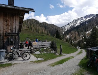
Where the valley splits lies the wonderfully quaint Kastenalm - a traditional Austrian hut serving all the usual delicious fare. The hut can't actually be cycled to but there's a fence to lean your bike against and from there it's only a 3 minute walk to the hut itself; a classic example of a good effort:reward ratio!
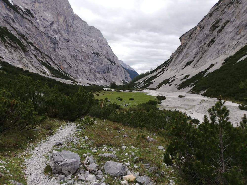
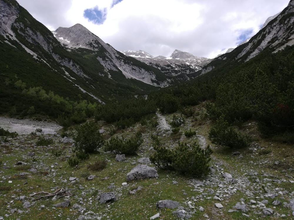
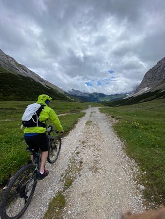
Suitably refreshed after visiting the Kastenalm, return to your bike and ride up a much rougher and vaguer (but still easily identifiable) jeep track which leads up the utterly wild Roßlach valley. After around 4km the track all but ends and you'll need to follow our line, the occasional cairn and a bit of intuition to find a way along the dried up riverbed at the bottom of the valley. The track becomes slightly more clear just before it becomes a hiking path, which it does at the treeline, right as the valley steepens.
Whether you're carrying on to the Laliderer Spitze and Dreizinkenspitze hike/climb or just came up here for a bike ride, take a moment to soak in just how desolate your surroundings are - this wild and remote valley is what the Karwendel is all about.
To return to civilisation simply retrace your route all the way back to Scharnitz.
Moderate
Mostly stable trail tread with some variability, with unavoidable obstacles 8in/20cm tall or less. Other obstacles such as rock gullies and steep sections may exist. Ideal for lower intermediate riders.

The trail contains some obstacles such as outcroppings and rock which could cause injury.

Little chance of being seen or helped in case of an accident.
39 m away
A short but physically challenging ride through some of the most rugged scenery in Austria.
Moderate Mountain Biking
48 m away
An über classic loop through one of Europe's wildest mountain ranges
Moderate Mountain Biking
679 m away
A huge ride traversing one of Europe's wildest National Parks.
Difficult Mountain Biking
8.8 km away
A cruisy loop through quiet and atmospheric forests
Moderate Mountain Biking
9.6 km away
A gorgeous circuit through peaceful forests
Moderate Mountain Biking

7 routes · Alpine Climbing · Mountain Biking · Hiking · Trail Running
6 routes · Mountain Biking

24 routes · Mountain Biking
7 routes · Alpine Climbing · Mountain Biking · Hiking · Ski Touring