6.6 km away
Bergisel Panorama
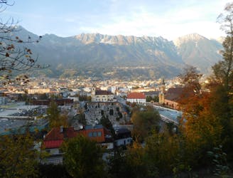
A great little hit of wilderness which is easily reached from the city.
Moderate Trail Running
- Distance
- 2.8 km
- Ascent
- 122 m
- Descent
- 119 m
https://www.runskitirol.com/trails/brandjochspitze-south-ridge
Trail Running Difficult

This is a popular trail running route which is generally considered to be difficult. It's not remote, it features extreme exposure and is typically done between June and October. From a low point of 1.8 km to the maximum altitude of 2.5 km, the route covers 11 km, 1025 vertical metres of ascent and 1022 vertical metres of descent.
One of the technical Innsbruck classic scrambles on the south ridge of Brandjochspitze.
Difficult

Some trail sections are extremely exposed where falling will almost certainly result in serious injury or death.

Close to help in case of emergency.
6.6 km away
A great little hit of wilderness which is easily reached from the city.
Moderate Trail Running