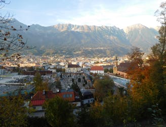
4.1 km away
Bergisel Panorama
A great little hit of wilderness which is easily reached from the city.
Moderate Trail Running
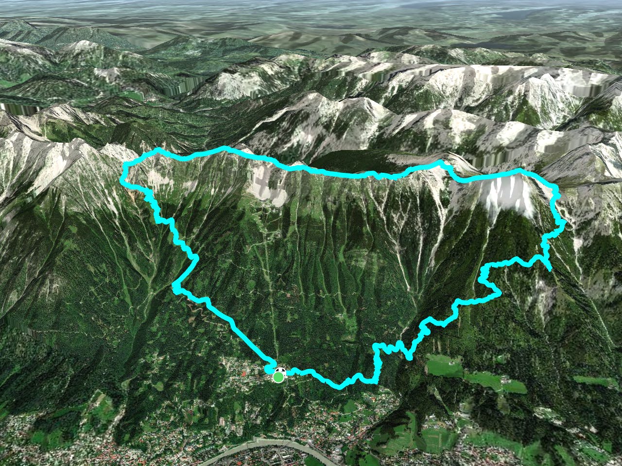
- Distance
- 2.8 km
- Ascent
- 122 m
- Descent
- 119 m
Start your journey from Hungerburg where you can park your car. Alternatively, run from the Golden Dachl in the city centre for the true Innsbruck experience and an extra few hundred metres of vertical ascent after you take the flat path along the river and climb up through the loamy forest trail beside the Alpenzoo and up to Hungerburg.
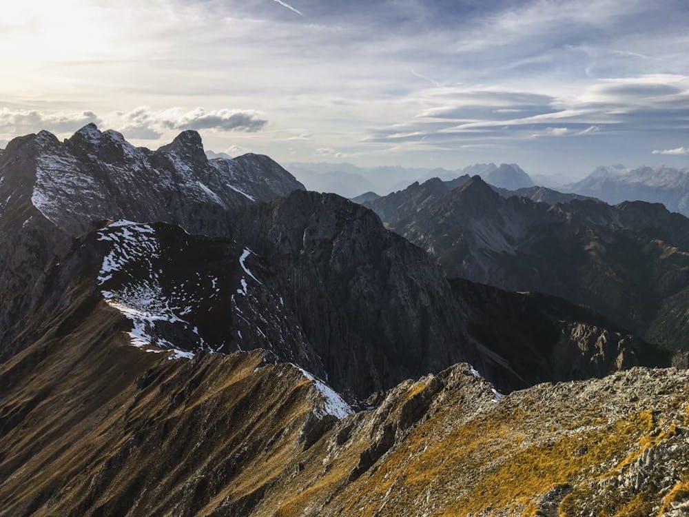
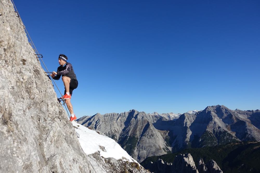
From Hungerburg, you begin with a gentle climb through the forest on a combination of dirt tracks and singletrail until you reach Umbrüggler Alm. Continue to ascend up past Höttinger Alm where you can refill water bottles before reaching the ridge. Continue north along the ridge of Nordkette, peering down at views over the entire city. Additionally, for the experienced climbers, you can bag the peak of Frau Hitt. Otherwise skip the chossy summit and reach Frau Hitt saddle where a grade C Via Ferrata awaits you. If the heights and exposure haven't deterred you yet, continue along to Hafelekar to refresh. There is a cable car from here directly down to Seegrube and then Hungerburg for a shortened loop, or continue along Goetheweg to Gleirschspitze. If you're extra motivated here, there is an additional summit to bag.
Another technical section greets you at Arzler Scharte. Drop down to the valley from here or continue to another iconic summit – Rumer Spitze. With grade 2 climbing and scrambling along the ridge, it makes for a real adventure!
Descend from Rumer Spitze in the direction of Vintl Alm where there are more refreshments, before you reach Enzian Hütte and begin your final descent down tight forest switchbacks and a smooth and fast track back to Hungerburg.
We recommend taking a via ferrata set and climbing harness with you for this epic trail run. An incredible route with incredible views and all trail!
Created by TypeTwoRun: http://typetworun.com
Severe

Some trail sections are extremely exposed where falling will almost certainly result in serious injury or death.

Little chance of being seen or helped in case of an accident.
4.1 km away
A great little hit of wilderness which is easily reached from the city.
Moderate Trail Running