6 km away
Brazeau Loop: Nigel Creek to Four Point campground
The first (and also the final) leg of the Brazeau Loop trek, climbing over a high pass and tracing a river from its headwaters.
Difficult Hiking
- Distance
- 14 km
- Ascent
- 450 m
- Descent
- 402 m
A fantastic day hiking - mainly above the treeline - which offers stunning views for most of the day.
Hiking Difficult

This is another very long day in the mountains that should only be attempted by experienced hikers who are comfortable with the distance and elevation.
If you would rather do this trail over 2 days, then plan to camp at Four Point Campground. This is the last campground before starting the long trail over Jonas Pass.
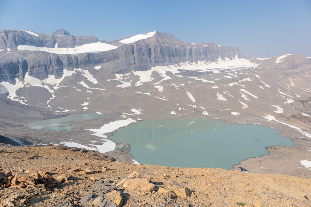
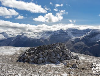
This route starts by climbing over Cataract Pass. This is actually quite a short climb, but the open alpine terrain leads to some stunning views of the mountains towering overhead.
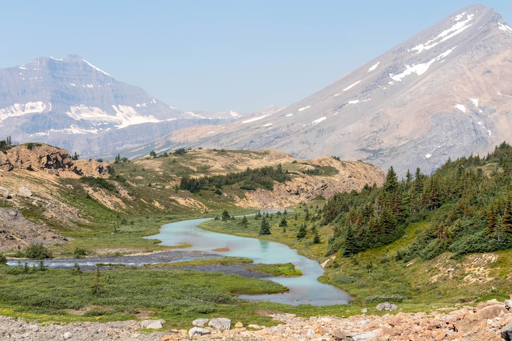
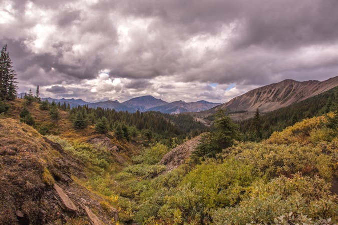
The descent down Cataract Pass follows a beautiful glacial river that meanders down the valley. The scenery here looks like it's straight out of a movie set and it's an amazing area to hike through.
After spending multiple days hiking through a wilderness area and seeing very few people, it's a nice change to be back in a National Park. The well maintained trail make for easy navigation and allows you to make good time as you head towards Jonas Pass.
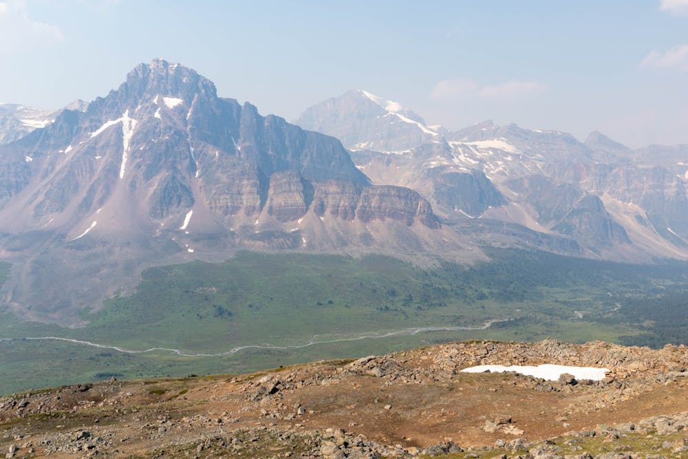
The hike over Jonas Pass is a long one, but very gradual and has some spectacular scenery. This is one of the most scenic days on trail, with most of the trail at or above treeline.
The final challenge for the day is climbing up Jonas shoulder. This is the last of the elevation gain for the day and has another outstanding viewpoint at the top.
From here it's a straight forward hike down to Jonas Cutoff campground. If you are camping here you will want a bug net, the mosquitos here are insane!
Along with the mosquitos bears are also common in this area, especially around Jonas Shoulder.
Although this is a long trail with lots of elevation, this is very doable in a single day. After hiking in the wilderness area for 2 days, this route feels like a highway and allows you to make really good time. Make sure you start early to allow for plenty of time to stop and take in all the scenery along the way.
Difficult
Hiking trails where obstacles such as rocks or roots are prevalent. Some obstacles can require care to step over or around. At times, the trail can be worn and eroded. The grade of the trail is generally quite steep, and can often lead to strenuous hiking.

Some trail sections have exposed ledges or steep ascents/descents where falling could cause serious injury.
Little chance of being seen or helped in case of an accident.
6 km away
The first (and also the final) leg of the Brazeau Loop trek, climbing over a high pass and tracing a river from its headwaters.
Difficult Hiking
8.5 km away
Parker Ridge, a walk between ice and mountains
Moderate Hiking
8.7 km away

Day 2 on a typical itinerary for the Brazeau Loop.
Moderate Hiking
5 routes · Hiking

4 routes · Hiking

8 routes · Hiking