641 m away
Pale Face
A great Mid-Mountain powder field or burly bumps run- snow dependant.
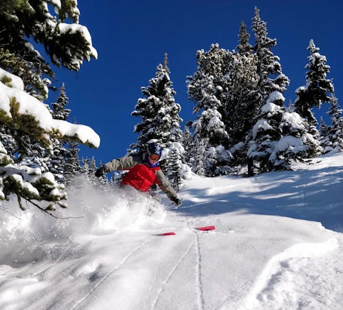
Difficult Freeride Skiing
- Distance
- 340 m
- Ascent
- 0 m
- Descent
- 125 m
Fun tree line under Peak to Peak
Freeride Skiing Moderate

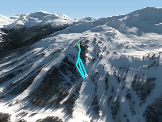
This is a popular freeride skiing route which is generally considered to be moderate. It's not remote, it features low exposure (e1) and is typically done between November and March. From a low point of 1.5 km to the maximum altitude of 1.7 km, the route covers 555 m, 0 vertical metres of ascent and 146 vertical metres of descent. It's graded 2.2 and Labande grade 3.
Tree run directly under Peak to Peak on Whistler. Access this run by taking Jolly Green Giant to marmot, and getting off when you see the trees open up under Peak to Peak.
Moderate
Slopes become slightly steeper at around 25-30 degrees.

Exposure is limited to that of the slope itself. Getting hurt is still likely if the slope is steep and/or the snow is hard.
Close to help in case of emergency.
641 m away
A great Mid-Mountain powder field or burly bumps run- snow dependant.
Difficult Freeride Skiing
945 m away

A wide open field with a couple of fun features running into a short gladed area.
Moderate Freeride Skiing
1.1 km away

A tight, steep, short chute with a couple of funky options.
Severe Freeride Skiing
1.2 km away

Gladed skiing on the last pitch down to Harmony Chair
Moderate Freeride Skiing
1.3 km away

Small glades which stash good powder - a last little hit before the chairlift
Difficult Freeride Skiing
1.4 km away

Two options: Cliff yourself out or send it!
Severe Freeride Skiing
1.4 km away

Whistler Blackcomb's most famous line. Burley, Insane, Massive, Sketchy, Epic! SEND IT.
Extreme Freeride Skiing
1.5 km away

Nicely spaced gladed skiing heading down towards Symphony Express
Moderate Freeride Skiing
1.6 km away

A short pitch, often forgotten about on a powder day
Difficult Freeride Skiing
1.9 km away

Hollywood Cliff of Kings
Extreme Freeride Skiing
8 routes · Freeride Skiing