2.6 km away
Mt Gardner Hiker's Trail
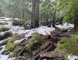
A full adventure day with a ferry and hike
Moderate Hiking
- Distance
- 8.7 km
- Ascent
- 634 m
- Descent
- 635 m
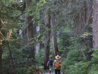
Trail access to the Mt. Gardner hike
Hiking Easy

This is a popular hiking route which is generally considered to be easy. It's not remote, it features low exposure and is typically done all year round. From a low point of 6 m to the maximum altitude of 117 m, the route covers 3.9 km, 141 vertical metres of ascent and 31 vertical metres of descent.
A simple wander from the ferry up to the Mt. Gardner Trail head. Bowen's roads are not especially pedestrian friendly, so this route is a much prettier and safer way to get up to the hikes. Takes 30min-1.5hours.
Easy
Walking along a well-kept trail that’s mostly flat. No obstacles are present.

The path is on completely flat land and potential injury is limited to falling over.
Close to help in case of emergency.
2.6 km away
A full adventure day with a ferry and hike
Moderate Hiking
9.5 km away

Local classic to take in a beautiful Howe Sound sunset
Moderate Hiking
9.6 km away
Popular hike with scenic views over Howe Sound
Moderate Hiking

7 routes · Hiking · Trail Running

6 routes · Hiking