210 m away
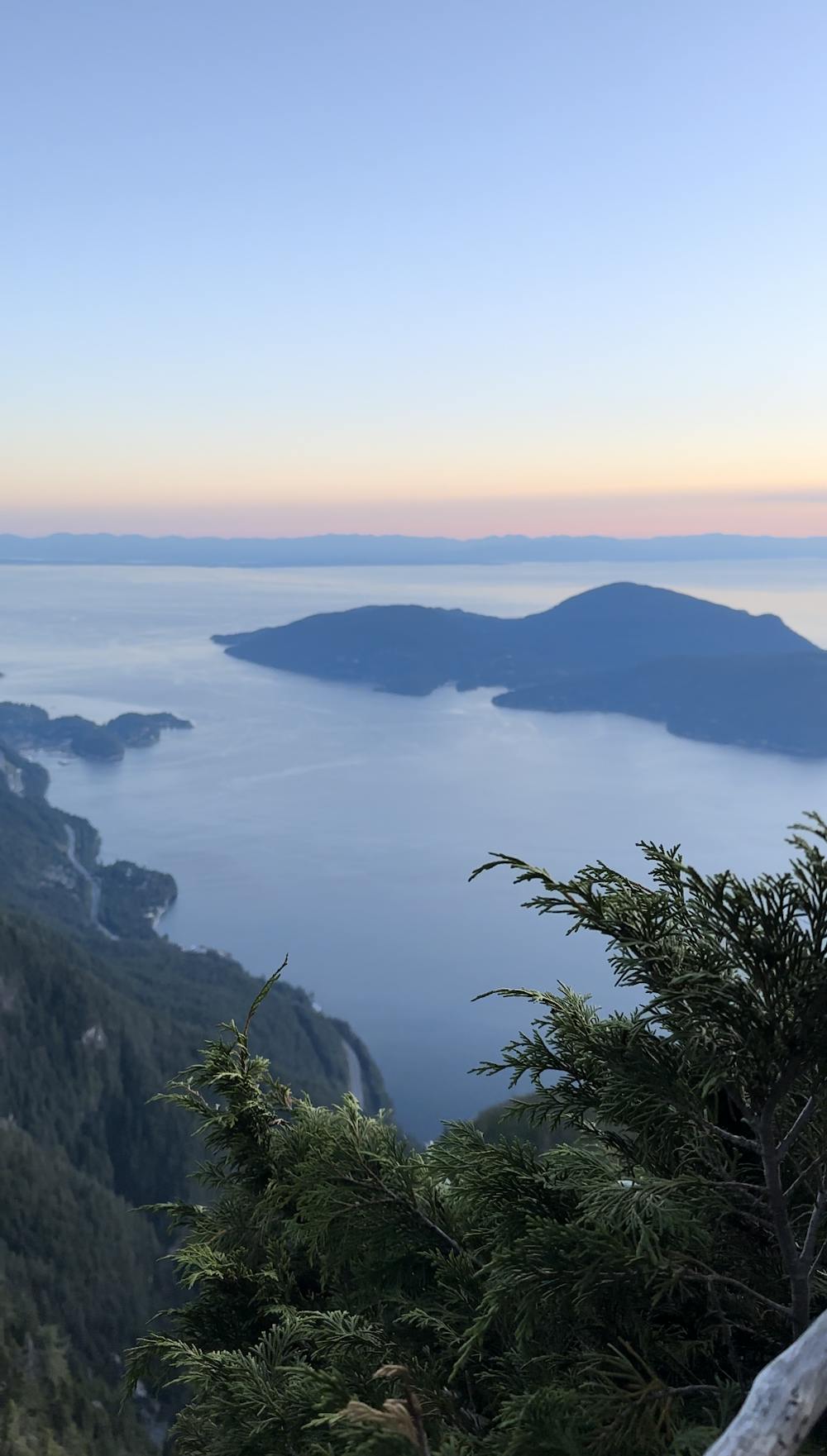
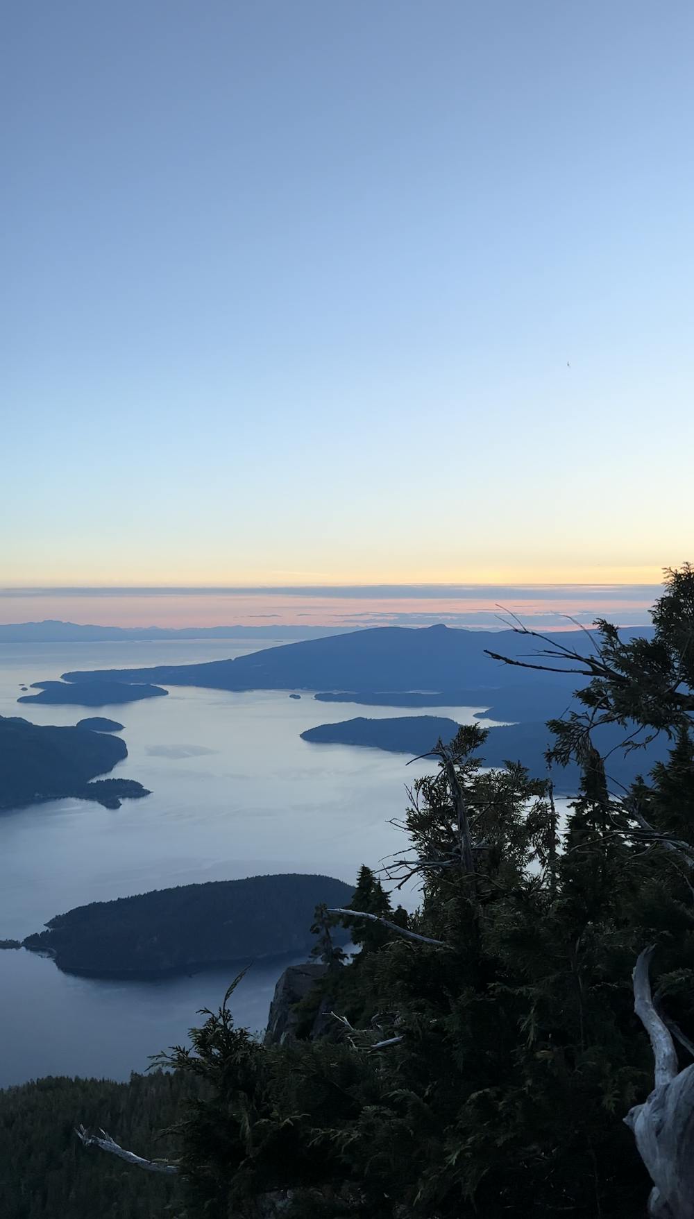
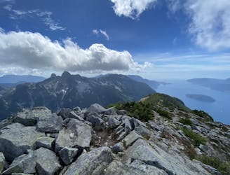
St Marks Summit
Popular hike with scenic views over Howe Sound
Moderate Hiking
- Distance
- 17 km
- Ascent
- 1.1 km
- Descent
- 1.1 km
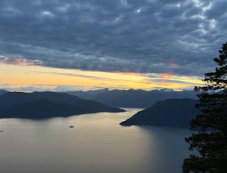
Local classic to take in a beautiful Howe Sound sunset
Hiking Moderate

This 10km in-and-out trail is a local Vancouver classic. Starting at the Cypress Mountain base, much of the elevation work is taken out by driving up to 910m, leaving only ~400m of gain on the trail. Don't forget to bring a headlamp if you are going for the sunset as the descent is fairly technical and many forested sections aren't covered by moonlight.
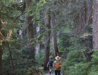
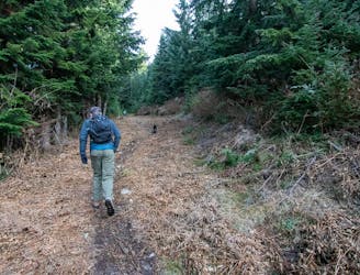
The trail begins at the Cypress Provincial Park trail head at the base of the Cypress Mountain Ski Area, where you'll see a few signs and trail posts before heading into the forest. Keep an eye out for Orange trail markers, and orange flagging tape along the entirety of the trail. Follow signs for the Howe Sound Crest Trail, or Bowen Lookout.
The first section of the trail is mostly moderate climbing through a forested section along a well tracked out dirt trail with some roots. After ~1km, you'll come out of the forested trail and turn left onto a gravel path / road. This path is mostly a mix of packed dirt and gravel / small boulders and is fairly flat with a small amount of climbing.
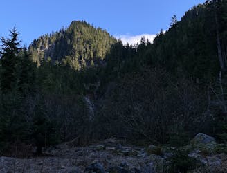
You'll continue along this path until you reach Christmas Gully, where you will cross a bridge and make s short descent before climbing switchbacks up the ridge of St. Marks Summit. This is roughly the halfway point!
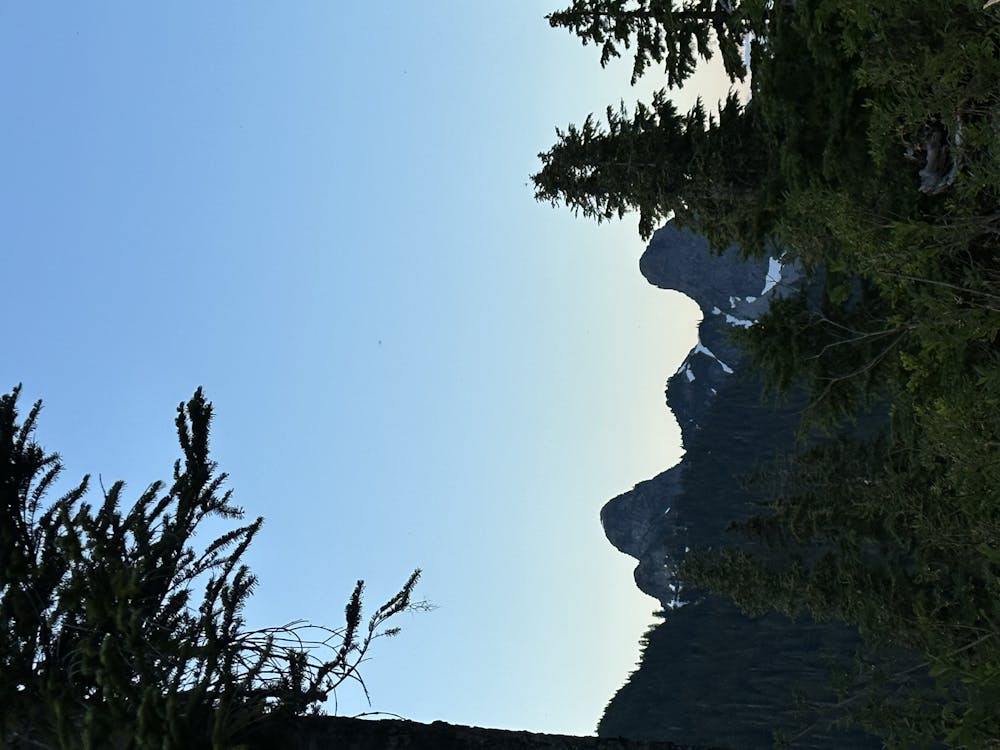
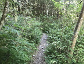
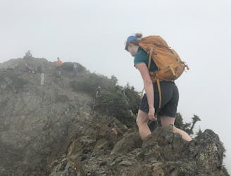
The next ~1.5km of this trail follows the ridge of St. Marks and involves steeper, rooty sections and may be muddy in the shoulder seasons / after rain fall. Watch your step, here!
The last 750m gets a bit steeper with a few small slabs before finally rounding the corner with a beautiful view of the Lions on your right, and Howe Sound on your left. If you plan on sticking around, bug spray is highly recommended (as with most S2S hikes).
Take in the sunset from the multiple viewpoints at the summit before heading down, or you can choose to spend the night and camp up there. If camping, please respect any fire bans, and pack everything out.
NOTE: Currently, permits are not required, but this may change due to its popularity if the area is not respected.
PARKING: Park OUTSIDE of the main Cypress Mountain lot if you will be returning to your car later than 9PM as typically the gate gets locked then and you'll be stuck in the lot until the next morning!
DOGS: Dogs are permitted on this trail.
GEAR: Make sure you bring a headlamp if you are planning on descending after sunset.
Moderate
Hiking along trails with some uneven terrain and small hills. Small rocks and roots may be present.

The trail contains some obstacles such as outcroppings and rock which could cause injury.

Close to help in case of emergency.
210 m away
Popular hike with scenic views over Howe Sound
Moderate Hiking
2.1 km away
A moderate hike with excellent view over Vancouver and the Salish Sea
Moderate Hiking
2.2 km away
Challenging North Shore Hike
Difficult Hiking
8.5 km away
Beautiful Howe Sound sunset with a sneaky peak of Tantalus
Moderate Hiking
8.9 km away
The safe and legal option for hiking Tunnel Bluffs.
Easy Hiking
8.9 km away
A steep hike, with an easy scramble to the summit
Severe Hiking
8.9 km away
A steep climb with an short, but thrilling narrow exposed ridge to a beautiful summit.
Extreme Hiking

7 routes · Hiking · Trail Running

6 routes · Hiking

3 routes · Hiking