210 m away
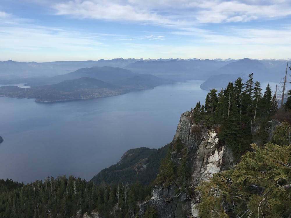
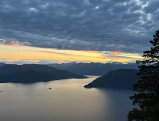
YVR Sunsets: St. Marks Summit
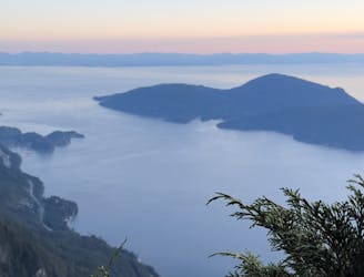
Local classic to take in a beautiful Howe Sound sunset
Moderate Hiking
- Distance
- 9.8 km
- Ascent
- 631 m
- Descent
- 628 m
Popular hike with scenic views over Howe Sound
Hiking Moderate

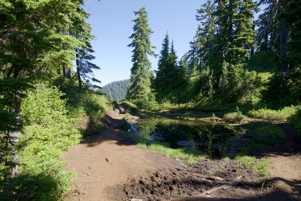
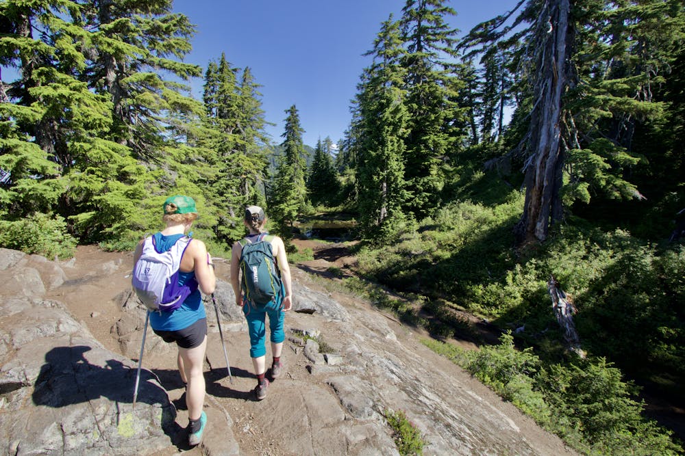
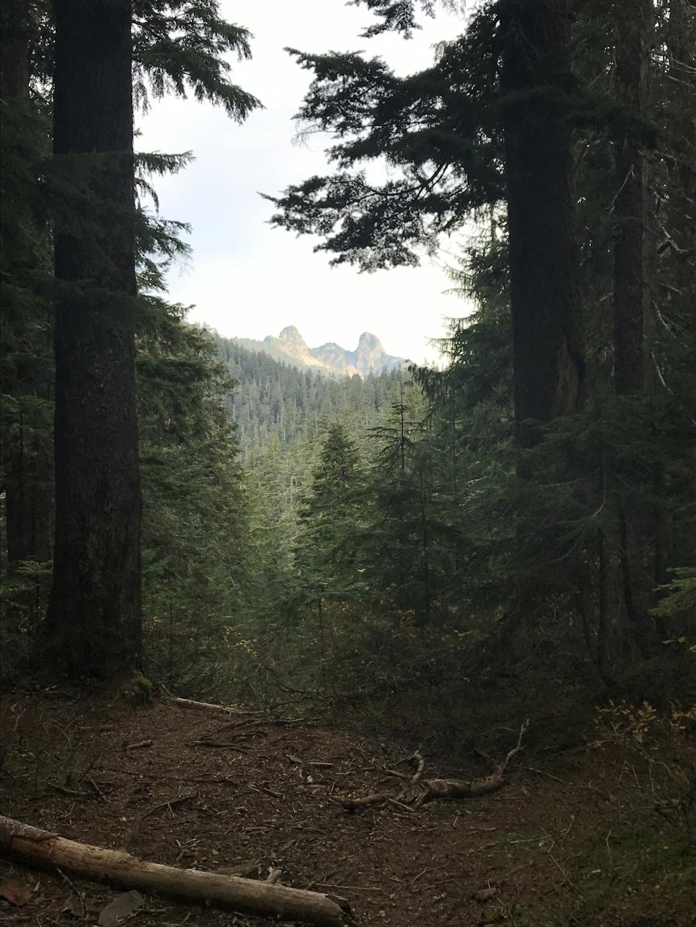
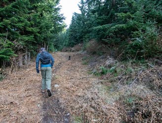
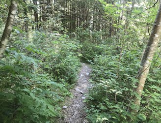
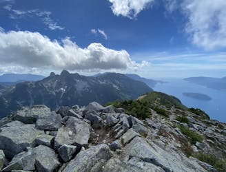
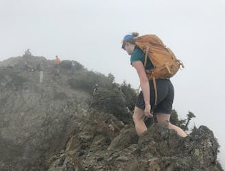
Most local hiking list include St Marks in their top ten list. At firs this may seem odd as the trail meanders through the woods on park like wide gravel pathways. As you travel you might catch the odd vista through the trees, but it isn't until you reach the end that hikers see the breathtaking and photogenic view at the end. Coupled with an excellent western aspect the sunsets are legendary, just as the SAR call outs for unprepared hikers who get lost in the dark on the return. It's a straightforward hike, but not to be overestimated either.
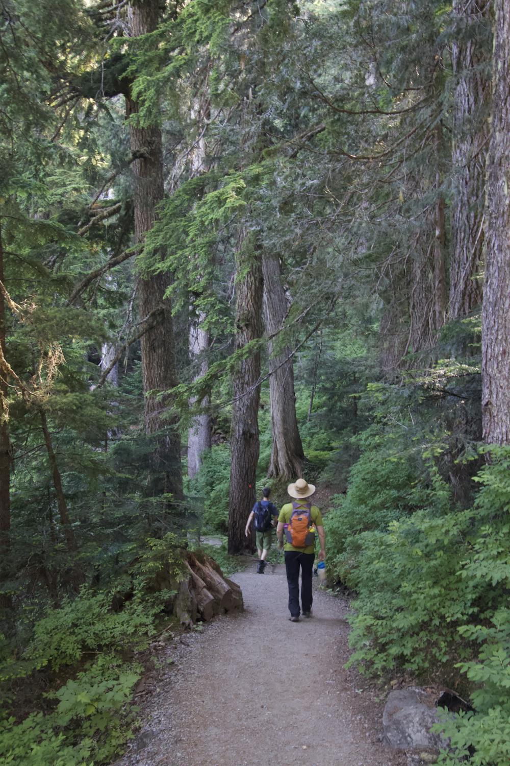
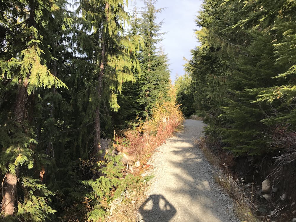
The hike begin sin the maze of trails at the Cypress Ski resort. Most intersections will have a sign post.
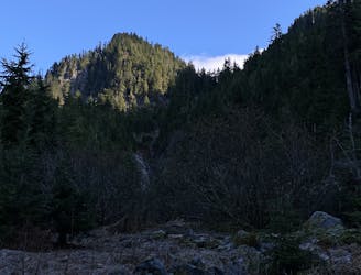
In winter the northern edge of this section is at risk of avalanches. The open area beneath Christmas Gulley is of particularly high risk. The Howe Sound Crest trail continues on from here down a steep rockey heavily treed ridge. Without a clear plan it's not recomended to keep going along.
The return route follows the same trail back. At the threeway junction you can opt to take a different route back to the Cypress Parking lot.
As of 2022 there are no camping facilities, but wild camping is allowed. Campfires are not. This is likely to change if people continue to damage bushes putting up tents, have campfires, and leave trash. Be a good steward and politely remind others who may be unaware if you see violations. Visit https://bcparks.ca/cypress-park/ for more info.
This route remain popular in winter, but is much more dangerous. Parking is also more difficult as the resort keeps altering the rules on where to park. The route takes much longer in winter and days are shorter, so bring appropriate Ten Essentials. Also be mindful that the trail is no longer visible. Several people have died following false trails. Be sure to look for orange diamond markers on the trees, and never lose sight of at least one.
Moderate
Hiking along trails with some uneven terrain and small hills. Small rocks and roots may be present.

The path is on completely flat land and potential injury is limited to falling over.

Away from help but easily accessed.
210 m away
Local classic to take in a beautiful Howe Sound sunset
Moderate Hiking
1.9 km away
A moderate hike with excellent view over Vancouver and the Salish Sea
Moderate Hiking
2 km away
Challenging North Shore Hike
Difficult Hiking
8.7 km away
Beautiful Howe Sound sunset with a sneaky peak of Tantalus
Moderate Hiking
9.1 km away
The safe and legal option for hiking Tunnel Bluffs.
Easy Hiking
9.1 km away
A steep hike, with an easy scramble to the summit
Severe Hiking
9.1 km away
A steep climb with an short, but thrilling narrow exposed ridge to a beautiful summit.
Extreme Hiking

7 routes · Hiking · Trail Running

6 routes · Hiking

3 routes · Hiking