5.7 km away
Middle Needle Peak
Follow a heavily forested ridge to one of Vancouver's lesser known peaks
Moderate Hiking
- Distance
- 20 km
- Ascent
- 1.5 km
- Descent
- 1.5 km
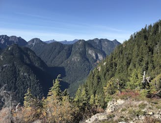
A scrambly hike to the summit of Mt. Seymour
Hiking Difficult

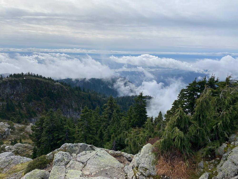
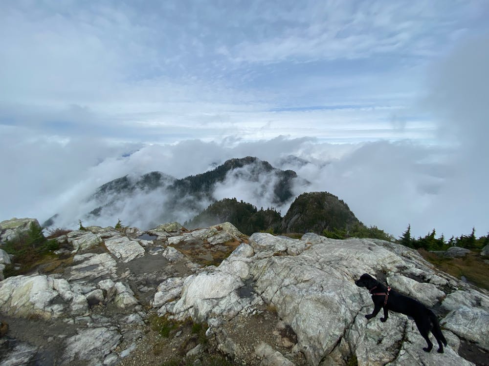
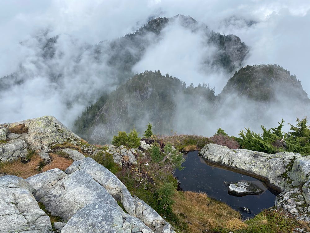
The hike to the summit of Mt Seymour is a pleasurable hike, but is much harder than it's proximity to town suggests. While the trail is mostly straight forward, the ground is very rough, with eroded rocks and slippery roots being more frequent than mud and dirt of most North Shore trails. Some sections get a bit scrambly and the trail can be hard to find. This makes it an excellent trail for those curious about scrambling to get a low risk taste. Proper hiking footwear is strongly recommended. Route finding is also challenging, especially if it gets dark so make sure to bring the ten essentials, or at least a map and headlamp.
The trail leaves from the northwest corner of the parking lot, just to the left of the Mystery Chair. The steepest path heads through the woods, along rocky trail. Keep an eye out for trail markers as there are numerous options to head towards Dog Mountain, or Suicide Bluff. The Seymour Trail becomes meadowy as you near Brockton. Head down and eastward along the flank f Pump peak, before turning back up into a small alpine valley. Here the trail becomes quite rocky and the trail becomes faint or disappears amongst the rocks. Small orange diamonds mark the best trail from here. The route descends briefly, before climbing back upwards on marginal trail to the summit of Tim Jones peak. The opposite side descends through a very interesting root system, and then it is a short scrambly section gains the summit.
Difficult
Hiking trails where obstacles such as rocks or roots are prevalent. Some obstacles can require care to step over or around. At times, the trail can be worn and eroded. The grade of the trail is generally quite steep, and can often lead to strenuous hiking.

The trail contains some obstacles such as outcroppings and rock which could cause injury.

Close to help in case of emergency.
5.7 km away
Follow a heavily forested ridge to one of Vancouver's lesser known peaks
Moderate Hiking
6.3 km away
Short distance, low elevation, great views
Easy Hiking

7 routes · Hiking · Trail Running

6 routes · Hiking

3 routes · Hiking