19 m away
Nub Peak
A beautiful alpine loop along the glorious Nub Peak.
Difficult Hiking
- Distance
- 9.8 km
- Ascent
- 649 m
- Descent
- 649 m
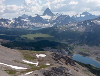
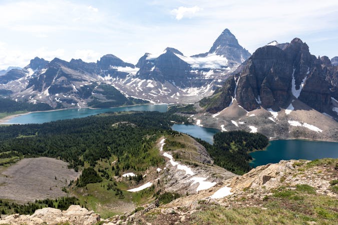
A short but very fun scramble with outstanding 360 views of Mt Assiniboine Provincial Park
Hiking Extreme

Sunburst Peak is very much a scramble as opposed to a routine hike. This is a fun route but can be challenging to navigate, you will need all of your route-finding experience on this one.
Follow the GPX track closely, it's the easiest and safest way up. Deviating from this route will lead to some very challenging and exposed scrambling.
This route starts at Lake Magog Campground. You follow the trail to the creek which is where this becomes more of a route than a trail.
Find your way through the trees before arriving at a large boulder field. Personally, I found the boulder field really fun to go through, but there's plenty of hazards here, so you need to be careful not to fall.
Once you get close to the alpine bowl, you will see a large drainage gully to climbers right. You want to go up here, it's very loose in the middle so you may want to keep to the sides where there's more traction.
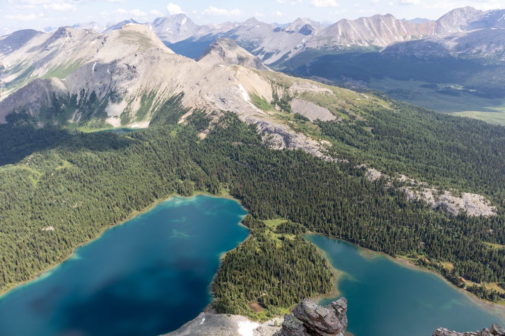
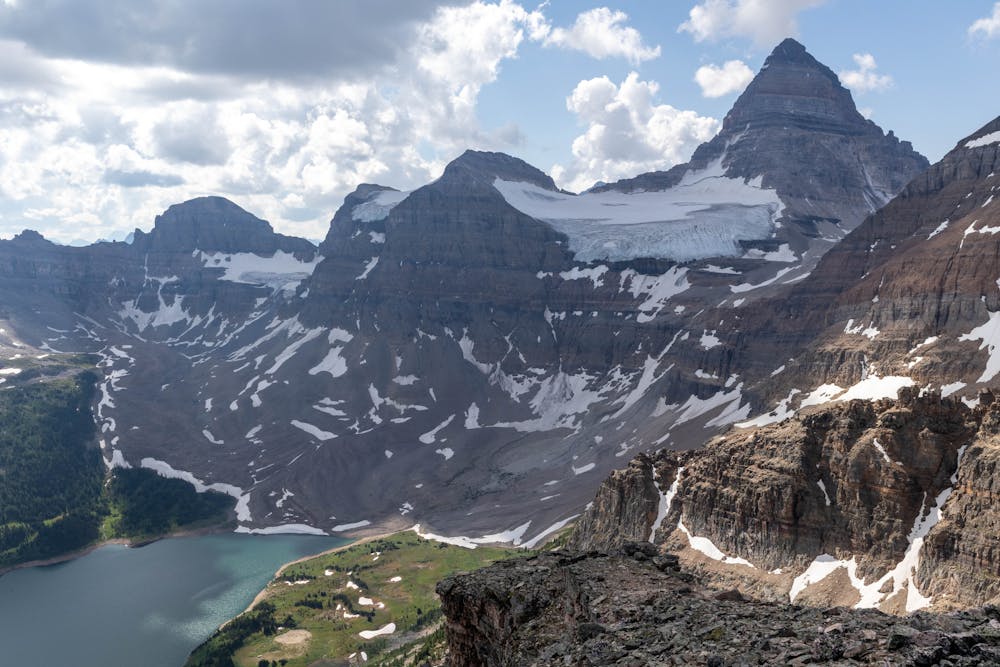
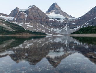
As you head up this gully the views really start to open up, you get fantastic views of Mt Assiniboine and Lake Magog from here, which totally make up for the difficult scree slope you find yourself on.
The route mapped here will easily get you to the top of the drainage gully, but GPS is not an ideal way to navigate this type of terrain. The cliff bands are too close together to really know if you are properly on track.
From the top of the drainage gully you will see some Rock Cairns to climbers left. The Cairns, combined with the GPX track and your own route-finding skills, should be enough to get you to the top.
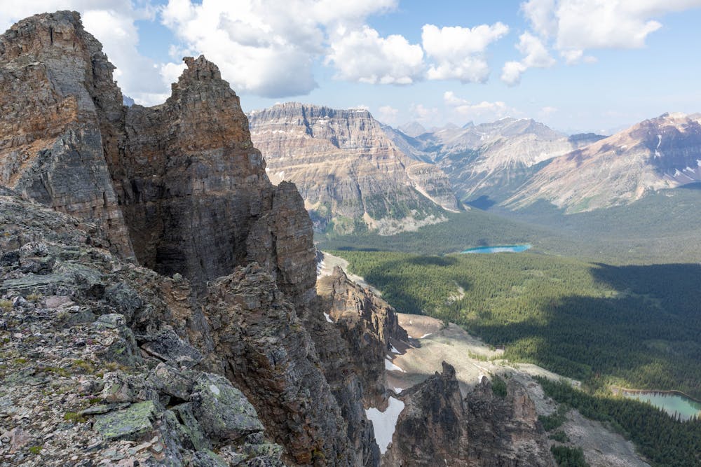
The views from the top are outstanding, you have a stunning 360 degree panorama of Mt Assiniboine Provincial Park. Considering this is actually a pretty short climb, in terms of effort to reward value this one is hard to beat.
For the descent, follow the same way you came up. The scrambling is pretty straight forward if you follow this route, but can get very challenging if you go off it.
Rock fall is a huge hazard here, it's very loose and no matter how careful you are, you will send rocks flying down the mountain. A helmet should be considered mandatory here if you are hiking in a group.
Extreme
Scrambling up mountains and along technical trails with moderate fall exposure. Handholds are necessary to navigate the trail in its entirety, although they are not necessary at all times. Some obstacles can be very large and difficult to navigate, and the grades can often be near-vertical. The challenge of the trail and the steepness of the grade results in very strenuous hiking. Hikes of this difficulty blur the lines between "hiking" and "climbing".

Some trail sections are extremely exposed where falling will almost certainly result in serious injury or death.

Little chance of being seen or helped in case of an accident.
19 m away
A beautiful alpine loop along the glorious Nub Peak.
Difficult Hiking
22 m away
A fantastic day hike with views you will be reminiscing about for a long time.
Difficult Hiking
30 m away
A long hike out via a magnificent viewpoint that you will be talking about for years to come.
Difficult Hiking
6 routes · Hiking