30 m away
Sunburst Peak
A short but very fun scramble with outstanding 360 views of Mt Assiniboine Provincial Park
Extreme Hiking
- Distance
- 3.7 km
- Ascent
- 547 m
- Descent
- 547 m
A long hike out via a magnificent viewpoint that you will be talking about for years to come.
Also in Alberta, Canada
Hiking Difficult

There's no hiding the fact that this is a long day. If you are not comfortable completing this distance in a day, there are campgrounds on route to make this a two day trip.
It's actually very common for people to hike out from Lake Magog to Mt Shark in a single day. The trail after Wonder Pass is mostly downhill and on an ATV road for large parts of it. As a result it's a lot of distance, it's actually pretty quick & easy hiking.
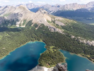
The trail starts by traversing around Lake Magog, this will give you one final chance to take in the superb views of the picturesque lake.
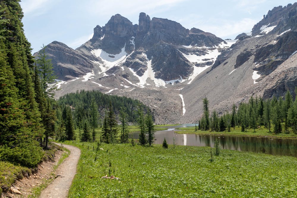
After following the trail past the lodge you start to make your way up to Gog Lake. This is another beautiful alpine lake nestled at the base of Naiset Point, which towers overhead.
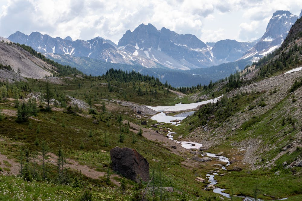
It won't be long before you find yourself at the top of Wonder Pass. This is a magnificent viewpoint with stunning views in every direction.
For most people, this is also the high point of the day. Although I said it's common for people to hike out in a single day, the majority of people don't visit the Wonder Pass viewpoint.
If you have to get up before sunrise, or do this trail over two days, you will want to visit this viewpoint, it's epic!
Just after you start to descend Wonder Pass you will see the trail fork off to the left and head towards a small ridge. There is a defined trail up the ridge but it can be hard to spot.
From the top of the ridge continue to some open rocky ledges at the end of the ridge, this is the viewpoint.
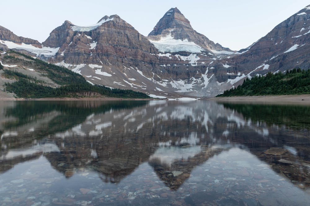
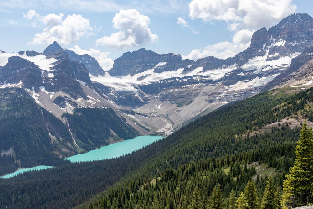
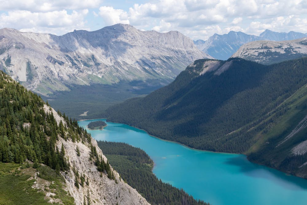
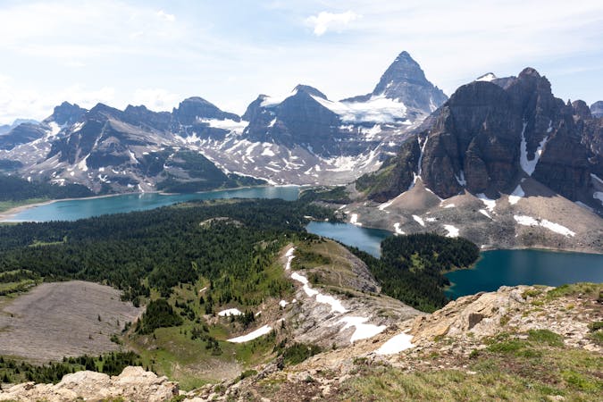
The view from here is spectacular, in my opinion this is the best viewpoint in the entire area. The glaciers on the backside of Mt Assiniboine are magnificent and when mixed with the turquoise waters of Lake Gloria below, it's a sight to behold.
Just in case that view didn't leave you speechless enough, you then turn your head to the left and see the fabulous Marvel Lake nestled in the valley below.
When you are finished admiring the magnificence of the surrounding landscape, you head back down to continue the long hike out.
The trail is mostly downhill from here and once you get back into the treeline, it's a long but speedy hike back to the Mt Shark Parking lot.
I'd recommend starting early and catching sunrise over Lake Magog, that will also then give you plenty of time to finish before dark. Expect it to take 10-12 hours to complete.
Difficult
Hiking trails where obstacles such as rocks or roots are prevalent. Some obstacles can require care to step over or around. At times, the trail can be worn and eroded. The grade of the trail is generally quite steep, and can often lead to strenuous hiking.

The trail contains some obstacles such as outcroppings and rock which could cause injury.

Little chance of being seen or helped in case of an accident.
30 m away
A short but very fun scramble with outstanding 360 views of Mt Assiniboine Provincial Park
Extreme Hiking
34 m away
A beautiful alpine loop along the glorious Nub Peak.
Difficult Hiking
44 m away
A fantastic day hike with views you will be reminiscing about for a long time.
Difficult Hiking
6 routes · Hiking