22 m away
Sunburst Peak
A short but very fun scramble with outstanding 360 views of Mt Assiniboine Provincial Park
Extreme Hiking
- Distance
- 3.7 km
- Ascent
- 547 m
- Descent
- 547 m
A fantastic day hike with views you will be reminiscing about for a long time.
Hiking Difficult

Windy Ridge is a great day hike, but it's significantly longer than most other day hikes in this area. This trail is for those looking for a fun day out who don't mind doing some extra kilometres.
Quite often in Canada, on longer trails, you find yourself hiking for hours without much reward, but thankfully that's not the case here.
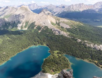
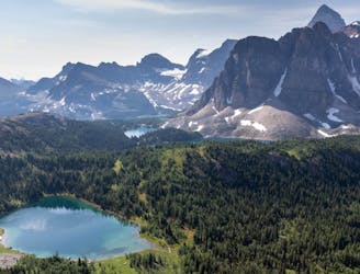
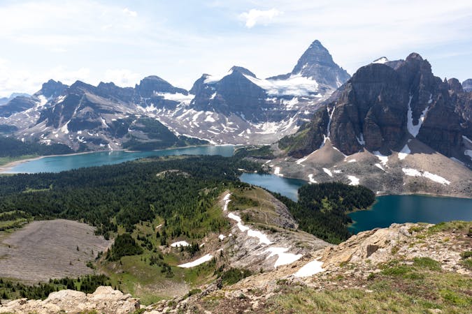
As soon as you begin the trail you already have spectacular views of the surrounding peaks. Most of this trail travels through open meadows, giving you great views along the way.
Unfortunately these meadows are filled with insects. They don't all bite, but they do fly into your face which is pretty annoying. Wearing a bug net here will make your hike significantly more enjoyable.
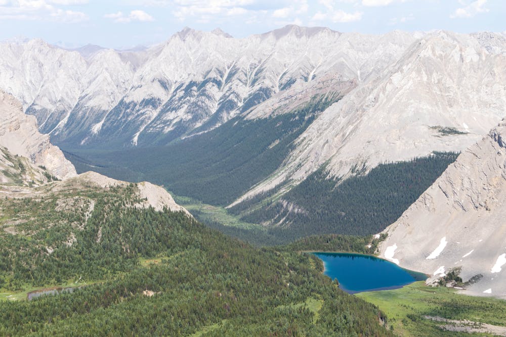
Although this is a long trail, half of that distance is hiking along the flat open meadows, which makes for some quick and easy hiking.
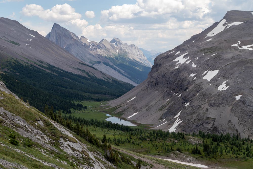
Once you hit the tree line the trail starts to gradually gain elevation on a nice mellow incline. This is also one of the few places on trail you can refill water.
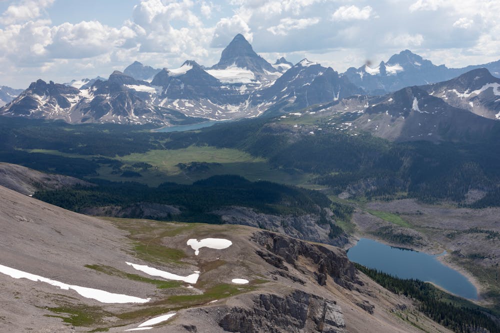
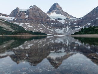
The tree line is very short and it's a quick hike up to the alpine where you are treated with some outstanding views looking back towards Mt Assiniboine.
The final push to the saddle is relatively straightforward and the views from here are spectacular. Many people don't go past the saddle as you already have stunning views and the trail to the actual summit is more technical. The summit does look like it's quite far away from the saddle, in reality, it's only a 5-10 minute scramble up to the top.
The panoramic views from the summit are incredible and make it well worth the extra effort. You can even see all the way into Kootney National Park on a clear day.
You descend back down the same way, with the unbelievable views of Mt Assiniboine to keep you distracted the entire way back.
Difficult
Hiking trails where obstacles such as rocks or roots are prevalent. Some obstacles can require care to step over or around. At times, the trail can be worn and eroded. The grade of the trail is generally quite steep, and can often lead to strenuous hiking.

The trail contains some obstacles such as outcroppings and rock which could cause injury.

Little chance of being seen or helped in case of an accident.
22 m away
A short but very fun scramble with outstanding 360 views of Mt Assiniboine Provincial Park
Extreme Hiking
41 m away
A beautiful alpine loop along the glorious Nub Peak.
Difficult Hiking
44 m away
A long hike out via a magnificent viewpoint that you will be talking about for years to come.
Difficult Hiking
6 routes · Hiking